– Lat/Long: 35.40° N 133.96° E
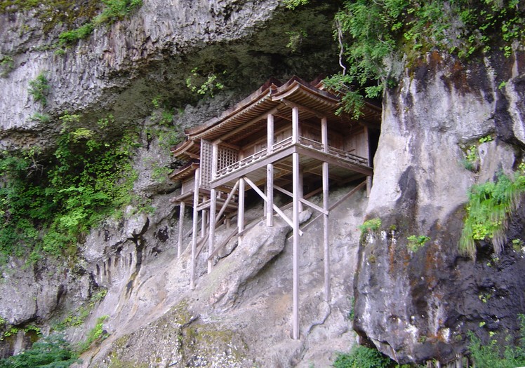
 Mount Mitoku
Weather Forecast, JapanIssued: 8 pm Mon 03 Aug Local TimeUpdates in: hr min sUpdate imminent
Issued: 8 pm Mon 03 Aug Local Time
Updates in:
Update imminent hr min s

Issued: 8 pm Mon 03 Aug Local Time
Updates in:
Update imminent hr min s
Days 1–4 Weather SummaryLight rain (total 3mm), mostly falling on Tue afternoon. Warm (max 26°C on Thu morning, min 22°C on Mon night). Winds increasing (calm on Mon night, fresh winds from the ESE by Thu afternoon). | Days 5–7 Weather SummaryLight rain (total 2mm), mostly falling on Sat afternoon. Warm (max 26°C on Fri afternoon, min 22°C on Thu night). Winds decreasing (strong winds from the ESE on Thu night, moderate winds from the SE by Sat night). | |||||||||||||||
Tuesday 4 | Wednesday 5 | Thursday 6 | Friday 7 | Saturday 8 | ||||||||||||
night | AM | PM | night | AM | PM | night | AM | PM | night | AM | PM | night | AM | PM | night | |
clear | rain shwrs | risk tstorm | rain shwrs | rain shwrs | clear | clear | clear | clear | clear | clear | clear | risk tstorm | clear | risk tstorm | risk tstorm | |
Cloud base (m) | 400 | 950 | 1600 | 2200 | 1600 | 6000 | ||||||||||
km/h | ||||||||||||||||
 |  |  |  |  |  | |||||||||||
— | — | — | — | — | — | — | — | — | — | — | — | — | — | — | — | |
mm | — | 0.1 | 1.1 | 1.1 | 0.6 | — | — | — | — | — | — | — | 0.1 | — | 1.4 | 0.9 |
max °C | 24 | 25 | 24 | 22 | 25 | 25 | 23 | 26 | 26 | 24 | 25 | 26 | 23 | 24 | 24 | 22 |
min °C | 22 | 23 | 23 | 22 | 23 | 24 | 22 | 23 | 25 | 22 | 23 | 24 | 22 | 23 | 22 | 22 |
chill °C | 22 | 23 | 23 | 22 | 23 | 24 | 22 | 23 | 25 | 22 | 23 | 24 | 22 | 23 | 22 | 22 |
Freezing level m | 5700 | 5650 | 5650 | 5600 | 5450 | 5550 | 5500 | 5350 | 5400 | 5450 | 5350 | 5300 | 5350 | 5200 | 5200 | 5150 |
— | 5:13 | — | — | 5:15 | — | — | 5:16 | — | — | 5:16 | — | — | 5:16 | — | — | |
— | — | 7:05 | — | — | 7:04 | — | — | 7:02 | — | — | 7:01 | — | — | 7:00 | — | |
Loading...
Mount Mitoku Weather (Days 0-3):
The weather forecast for Mount Mitoku is: Light rain (total 3mm), mostly falling on Tue afternoon. Warm (max 26°C on Thu morning, min 22°C on Mon night). Winds increasing (calm on Mon night, fresh winds from the ESE by Thu afternoon).
Mount Mitoku Weather (Days 3-6):
Light rain (total 2mm), mostly falling on Sat afternoon. Warm (max 26°C on Fri afternoon, min 22°C on Thu night). Winds decreasing (strong winds from the ESE on Thu night, moderate winds from the SE by Sat night).
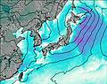
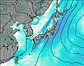
This table gives the weather forecast for Mount Mitoku at the specific elevation of 900 m. Our advanced weather models allow us to provide distinct weather forecasts for several elevations of Mount Mitoku. To see the weather forecasts for the other elevations, use the tab navigation above the table. For a wider overview of the weather, consult the Weather Map of Japan.
| Weather Station | Temp. | Weather | Wind | Gusts | Cloud / Visibility |
|---|---|---|---|---|---|
Miho Airport | |||||
Izumo Airport | |||||
lightning 10km SE of Takamatsu | |||||
* NOTE: not all weather observatories update at the same frequency which is the reason why some locations may show data from stations that are further away than known closer ones.
Mount Mitoku Photos
View all
Chūgoku Mountains photos (3) |
Japanese Archipelago photos (294) |
photos from mountains in Japan (376) |
all photos
 Upload new photo
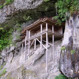
Mount Mitoku