– Lat/Long: 35.65° N 83.44° W
 Mount LeConte
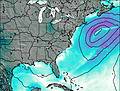
Weather Forecast, United StatesIssued: 7 am Mon 03 Aug Local TimeUpdates in: hr min sUpdate imminent
Issued: 7 am Mon 03 Aug Local Time
Updates in:
Update imminent hr min s

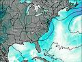
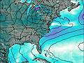
Issued: 7 am Mon 03 Aug Local Time
Updates in:
Update imminent hr min s
Days 1–3 Weather SummaryModerate rain (total 18mm), heaviest on Mon afternoon. Very mild (max 16°C on Tue afternoon, min 13°C on Mon morning). Wind will be generally light. | Days 4–6 Weather SummaryHeavy rain (total 23mm), heaviest during Thu afternoon. Very mild (max 17°C on Fri night, min 15°C on Thu morning). Wind will be generally light. | |||||||||||||||||
Monday 3 | Tuesday 4 | Wednesday 5 | Thursday 6 | Friday 7 | Saturday 8 | |||||||||||||
AM | PM | night | AM | PM | night | AM | PM | night | AM | PM | night | AM | PM | night | AM | PM | night | |
rain shwrs | risk tstorm | risk tstorm | rain shwrs | risk tstorm | risk tstorm | rain shwrs | risk tstorm | risk tstorm | rain shwrs | risk tstorm | risk tstorm | rain shwrs | risk tstorm | risk tstorm | rain shwrs | risk tstorm | risk tstorm | |
Cloud base (m) | 1550 | 1650 | 2750 | 2550 | 2050 | 5600 | 2400 | 5600 | 6200 | 2450 | 5300 | 6000 | ||||||
km/h | ||||||||||||||||||
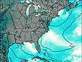 | 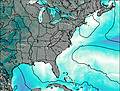 | 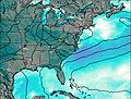 |  |  |  | |||||||||||||
— | — | — | — | — | — | — | — | — | — | — | — | — | — | — | — | — | — | |
mm | 0.7 | 4 | 3 | 0.1 | 1.5 | 2 | 1.7 | 4 | 1.7 | 0.3 | 8 | 3 | 1.7 | 3 | 2 | 0.6 | 4 | 1 |
max °C | 13 | 15 | 15 | 15 | 16 | 16 | 15 | 16 | 16 | 15 | 16 | 16 | 16 | 16 | 17 | 16 | 16 | 17 |
min °C | 13 | 14 | 15 | 15 | 16 | 15 | 14 | 15 | 15 | 15 | 15 | 16 | 15 | 16 | 16 | 16 | 16 | 16 |
chill °C | 13 | 14 | 15 | 15 | 16 | 15 | 14 | 15 | 14 | 14 | 14 | 16 | 14 | 16 | 16 | 16 | 16 | 15 |
Freezing level m | 4500 | 4600 | 4500 | 4450 | 4500 | 4550 | 4550 | 4600 | 4700 | 4650 | 4650 | 4750 | 4600 | 4600 | 4700 | 4600 | 4700 | 4650 |
6:43 | — | — | 6:43 | — | — | 6:43 | — | — | 6:45 | — | — | 6:46 | — | — | 6:46 | — | — | |
— | — | 8:36 | — | — | 8:35 | — | — | 8:34 | — | — | 8:32 | — | — | 8:31 | — | — | 8:30 | |
Loading...
Mount LeConte Weather (Days 0-3):
The weather forecast for Mount LeConte is: Moderate rain (total 18mm), heaviest on Mon afternoon. Very mild (max 16°C on Tue afternoon, min 13°C on Mon morning). Wind will be generally light.
Mount LeConte Weather (Days 3-6):
Heavy rain (total 23mm), heaviest during Thu afternoon. Very mild (max 17°C on Fri night, min 15°C on Thu morning). Wind will be generally light.
This table gives the weather forecast for Mount LeConte at the specific elevation of 2010 m. Our advanced weather models allow us to provide distinct weather forecasts for several elevations of Mount LeConte. To see the weather forecasts for the other elevations, use the tab navigation above the table. For a wider overview of the weather, consult the Weather Map of Tennessee.
| Weather Station | Temp. | Weather | Wind | Gusts | Cloud / Visibility |
|---|---|---|---|---|---|
Gatlinburg Pigeon Forge Airport Sevierville (Tennessee) | |||||
* NOTE: not all weather observatories update at the same frequency which is the reason why some locations may show data from stations that are further away than known closer ones.
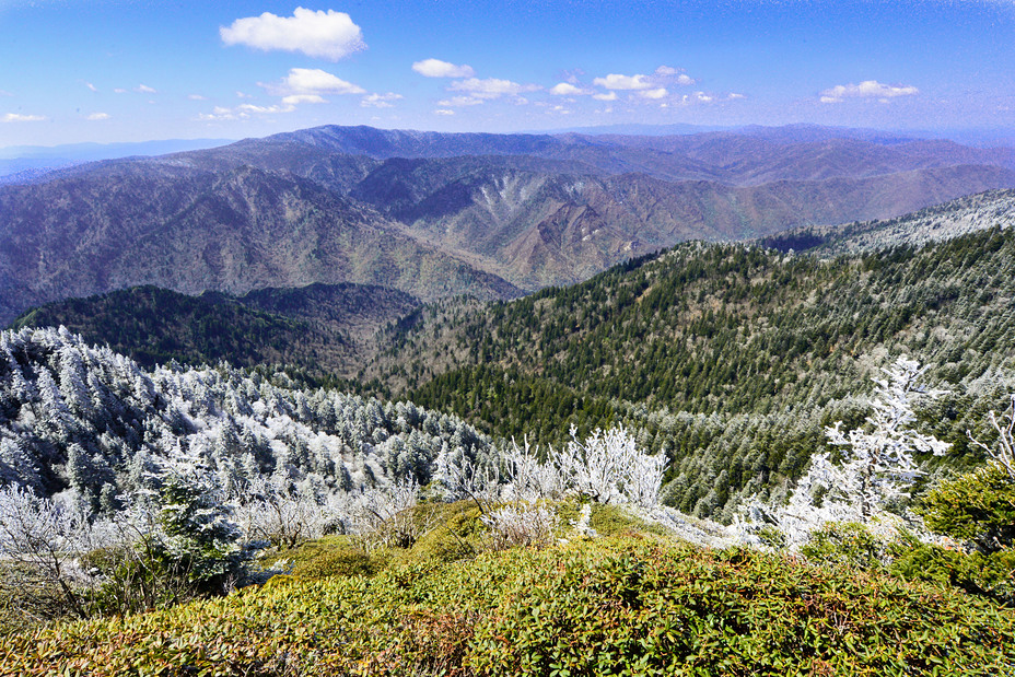
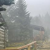
Mount LeConte Photos
View all
Great Smoky Mountains photos (57) |
Appalachians photos (910) |
photos from mountains in United States (3056) |
all photos
 Upload new photo
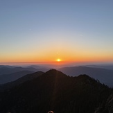
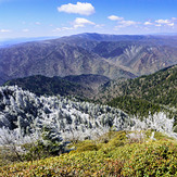
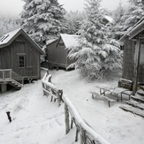

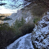
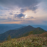
 See 26 more Mount LeConte photos
Mt. LeConte Sunset
Frosty Spring Day at Cliff Tops
LeConte Sunset
Mt Leconte Lodge