– Lat/Long: 56.97° N 2.90° W
 Mount Keen
Weather Forecast, United KingdomIssued: 12 am Mon 03 Aug Local TimeUpdates in: hr min sUpdate imminent
Issued: 12 am Mon 03 Aug Local Time
Updates in:
Update imminent hr min s

Issued: 12 am Mon 03 Aug Local Time
Updates in:
Update imminent hr min s
Days 1–4 Weather SummaryHeavy rain (total 29mm), heaviest during Wed afternoon. Very mild (max 12°C on Tue afternoon, min 8°C on Sun night). Winds decreasing (strong winds from the SE on Mon night, light winds from the WSW by Wed afternoon). | Days 5–7 Weather SummaryModerate rain (total 11mm), heaviest on Wed night. Very mild (max 10°C on Fri afternoon, min 6°C on Wed night). Winds increasing (light winds from the WSW on Thu night, gales from the SW by Fri night). | ||||||||||||||||||
Monday 3 | Tuesday 4 | Wednesday 5 | Thursday 6 | Friday 7 | Saturday 8 | ||||||||||||||
night | AM | PM | night | AM | PM | night | AM | PM | night | AM | PM | night | AM | PM | night | AM | PM | night | |
some clouds | light rain | light rain | heavy rain | light rain | light rain | rain shwrs | rain shwrs | heavy rain | mod. rain | clear | light rain | rain shwrs | cloudy | some clouds | light rain | rain shwrs | clear | rain shwrs | |
Cloud base (m) | 2400 | 2150 | 300 | 1600 | 300 | 400 | 300 | 1500 | 450 | 300 | 1500 | 1700 | 2150 | 850 | 450 | 300 | 1700 | 800 | |
km/h | |||||||||||||||||||
 |  |  |  |  |  |  | |||||||||||||
— | — | — | — | — | — | — | — | — | — | — | — | — | — | — | — | — | — | — | |
mm | — | 0.5 | 2 | 10 | 2 | 0.9 | 0.4 | 1.7 | 10 | 7 | — | 0.1 | 0.1 | — | — | 1.4 | 3 | — | 0.1 |
max °C | 9 | 10 | 9 | 10 | 10 | 12 | 11 | 11 | 11 | 9 | 8 | 9 | 7 | 9 | 10 | 10 | 10 | 9 | 8 |
min °C | 8 | 9 | 9 | 9 | 9 | 11 | 11 | 11 | 10 | 6 | 6 | 8 | 6 | 9 | 9 | 9 | 9 | 9 | 6 |
chill °C | 6 | 7 | 7 | 5 | 5 | 9 | 8 | 9 | 7 | 1 | 1 | 6 | 3 | 6 | 4 | 4 | 5 | 5 | 1 |
Freezing level m | 2300 | 2500 | 2550 | 3050 | 3300 | 3350 | 3300 | 2850 | 2800 | 2600 | 2100 | 2300 | 2300 | 2200 | 2350 | 2750 | 2550 | 2650 | 2700 |
— | 5:13 | — | — | 5:15 | — | — | 5:16 | — | — | 5:18 | — | — | 5:20 | — | — | 5:22 | — | — | |
— | — | 9:20 | — | — | 9:17 | — | — | 9:15 | — | — | 9:14 | — | — | 9:12 | — | — | 9:08 | — | |
Loading...
Mount Keen Weather (Days 0-3):
The weather forecast for Mount Keen is: Heavy rain (total 29mm), heaviest during Wed afternoon. Very mild (max 12°C on Tue afternoon, min 8°C on Sun night). Winds decreasing (strong winds from the SE on Mon night, light winds from the WSW by Wed afternoon).
Mount Keen Weather (Days 3-6):
Moderate rain (total 11mm), heaviest on Wed night. Very mild (max 10°C on Fri afternoon, min 6°C on Wed night). Winds increasing (light winds from the WSW on Thu night, gales from the SW by Fri night).
This table gives the weather forecast for Mount Keen at the specific elevation of 939 m. Our advanced weather models allow us to provide distinct weather forecasts for several elevations of Mount Keen. To see the weather forecasts for the other elevations, use the tab navigation above the table. For a wider overview of the weather, consult the Weather Map of United Kingdom.
| Weather Station | Temp. | Weather | Wind | Gusts | Cloud / Visibility |
|---|---|---|---|---|---|
Dyce | |||||
SEPA Arbroath wave rider | |||||
Leuchars Royal Air Force Airport |
* NOTE: not all weather observatories update at the same frequency which is the reason why some locations may show data from stations that are further away than known closer ones.
Mount Keen Photos
View all
Grampians photos (167) |
Scottish Highlands photos (301) |
photos from mountains in United Kingdom (2125) |
all photos
 Upload new photo
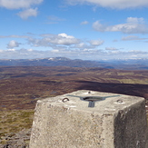
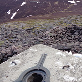
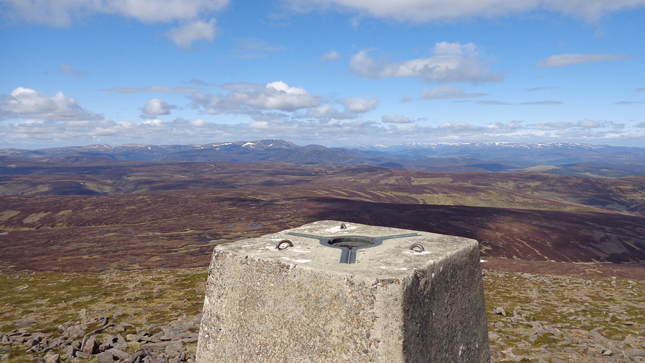
Mount Keen Summit Trig Point
Mount Keen Summit