
– Lat/Long: 42.69° N 142.76° E
 Mount Esaoman-Tottabetsu
Weather Forecast, JapanIssued: 2 am Fri 24 Jul Local TimeUpdates in: hr min sUpdate imminent
Issued: 2 am Fri 24 Jul Local Time
Updates in:
Update imminent hr min s

Issued: 2 am Fri 24 Jul Local Time
Updates in:
Update imminent hr min s
Days 1–3 Weather SummaryLight rain (total 4mm), mostly falling on Fri morning. Very mild (max 12°C on Fri morning, min 9°C on Sun afternoon). Wind will be generally light. | Days 4–6 Weather SummaryLight rain (total 8mm), mostly falling on Tue afternoon. Very mild (max 12°C on Wed night, min 10°C on Mon morning). Wind will be generally light. | |||||||||||||||||
Friday 24 | Saturday 25 | Sunday 26 | Monday 27 | Tuesday 28 | Wednesday 29 | |||||||||||||
AM | PM | night | AM | PM | night | AM | PM | night | AM | PM | night | AM | PM | night | AM | PM | night | |
light rain | light rain | light rain | light rain | light rain | rain shwrs | rain shwrs | light rain | rain shwrs | rain shwrs | rain shwrs | rain shwrs | rain shwrs | rain shwrs | rain shwrs | rain shwrs | rain shwrs | rain shwrs | |
Cloud base (m) | 1900 | 700 | 700 | 800 | 750 | 850 | 900 | 750 | 750 | 950 | 800 | 850 | 750 | 1550 | 1500 | 800 | 750 | 700 |
km/h | ||||||||||||||||||
 |  |  |  |  |  | |||||||||||||
— | — | — | — | — | — | — | — | — | — | — | — | — | — | — | — | — | — | |
mm | 1.1 | 0.8 | 0.4 | 0.2 | 0.3 | 0.2 | 0.3 | 0.3 | 0.1 | 0.3 | 1.2 | 0.6 | 1.4 | 2 | 0.2 | 0.7 | 1.6 | 0.1 |
max °C | 12 | 12 | 11 | 10 | 10 | 10 | 10 | 10 | 10 | 10 | 11 | 11 | 10 | 11 | 10 | 11 | 11 | 12 |
min °C | 12 | 11 | 10 | 10 | 10 | 10 | 10 | 9 | 10 | 10 | 10 | 10 | 10 | 10 | 10 | 10 | 11 | 11 |
chill °C | 11 | 10 | 8 | 9 | 8 | 9 | 10 | 9 | 10 | 10 | 9 | 9 | 10 | 10 | 10 | 10 | 11 | 11 |
Freezing level m | 4200 | 4250 | 4100 | 3950 | 3950 | 4200 | 4250 | 4100 | 4050 | 3950 | 4000 | 4100 | 4000 | 4000 | 4000 | 4100 | 4100 | 4500 |
4:11 | — | — | 4:13 | — | — | 4:13 | — | — | 4:13 | — | — | 4:15 | — | — | 4:16 | — | — | |
— | 6:58 | — | — | 6:57 | — | — | 6:55 | — | — | 6:54 | — | — | 6:53 | — | — | 6:52 | — | |
Loading...
Mount Esaoman-Tottabetsu Weather (Days 0-3):
The weather forecast for Mount Esaoman-Tottabetsu is: Light rain (total 4mm), mostly falling on Fri morning. Very mild (max 12°C on Fri morning, min 9°C on Sun afternoon). Wind will be generally light.
Mount Esaoman-Tottabetsu Weather (Days 3-6):
Light rain (total 8mm), mostly falling on Tue afternoon. Very mild (max 12°C on Wed night, min 10°C on Mon morning). Wind will be generally light.
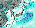
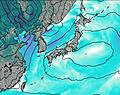
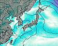
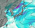
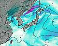
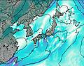
This table gives the weather forecast for Mount Esaoman-Tottabetsu at the specific elevation of 1902 m. Our advanced weather models allow us to provide distinct weather forecasts for several elevations of Mount Esaoman-Tottabetsu. To see the weather forecasts for the other elevations, use the tab navigation above the table. For a wider overview of the weather, consult the Weather Map of Japan.
| Weather Station | Temp. | Weather | Wind | Gusts | Cloud / Visibility |
|---|---|---|---|---|---|
Chitose Airport | |||||
Asahikawa Airport | |||||
Kushiro Airport | |||||
Sapporo Airport | |||||
Hakodate Airport | |||||
Misawa Airport | |||||
* NOTE: not all weather observatories update at the same frequency which is the reason why some locations may show data from stations that are further away than known closer ones.