– Lat/Long: 36.10° N 138.20° E
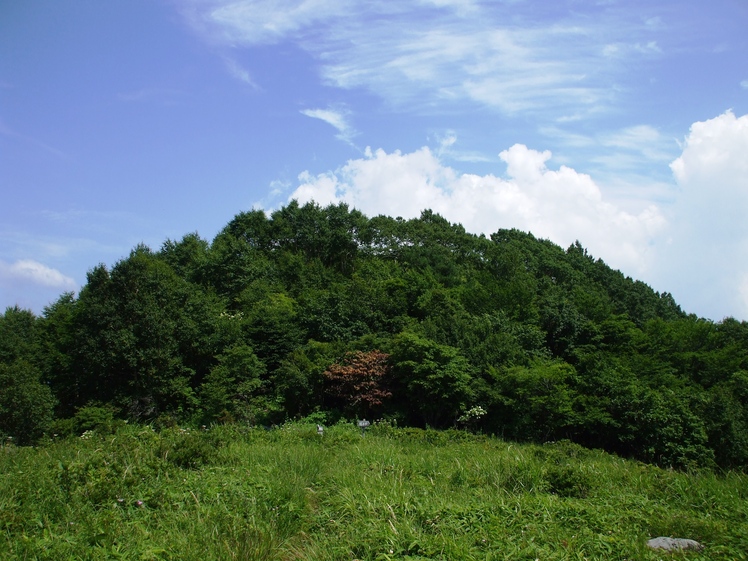
 Mount Denjō (Mount Denjo)
Weather Forecast, JapanIssued: 2 am Tue 04 Aug Local TimeUpdates in: hr min sUpdate imminent
Issued: 2 am Tue 04 Aug Local Time
Updates in:
Update imminent hr min s

Issued: 2 am Tue 04 Aug Local Time
Updates in:
Update imminent hr min s
Days 1–3 Weather SummaryMostly dry. Warm (max 21°C on Wed morning, min 15°C on Tue morning). Wind will be generally light. | Days 4–6 Weather SummaryLight rain (total 5mm), mostly falling on Sat afternoon. Warm (max 20°C on Fri morning, min 14°C on Sun night). Wind will be generally light. | |||||||||||||||||
Tuesday 4 | Wednesday 5 | Thursday 6 | Friday 7 | Saturday 8 | Sunday 9 | |||||||||||||
AM | PM | night | AM | PM | night | AM | PM | night | AM | PM | night | AM | PM | night | AM | PM | night | |
some clouds | clear | clear | clear | clear | clear | clear | risk tstorm | rain shwrs | clear | rain shwrs | rain shwrs | rain shwrs | risk tstorm | rain shwrs | clear | cloudy | cloudy | |
Cloud base (m) | 1650 | 1800 | 3000 | 850 | 2950 | 1700 | 1550 | 2400 | 1650 | 9150 | 2500 | |||||||
km/h | ||||||||||||||||||
 |  |  |  |  |  | |||||||||||||
— | — | — | — | — | — | — | — | — | — | — | — | — | — | — | — | — | — | |
mm | — | — | — | — | — | — | — | 0.8 | 0.1 | — | 0.8 | 0.2 | 0.5 | 4 | 0.2 | — | — | — |
max °C | 19 | 20 | 16 | 21 | 21 | 17 | 21 | 21 | 18 | 20 | 20 | 16 | 20 | 19 | 16 | 19 | 20 | 16 |
min °C | 15 | 18 | 15 | 17 | 19 | 16 | 18 | 19 | 16 | 18 | 17 | 15 | 17 | 17 | 15 | 16 | 18 | 14 |
chill °C | 15 | 18 | 15 | 17 | 19 | 16 | 18 | 19 | 16 | 18 | 16 | 15 | 17 | 17 | 15 | 16 | 18 | 13 |
Freezing level m | 5450 | 5350 | 5600 | 5600 | 5400 | 5550 | 5450 | 5300 | 5250 | 5300 | 5150 | 5100 | 5150 | 5100 | 5100 | 5150 | 4950 | 5300 |
4:56 | — | — | 4:56 | — | — | 4:56 | — | — | 4:58 | — | — | 4:58 | — | — | 5:00 | — | — | |
— | 6:49 | — | — | 6:47 | — | — | 6:46 | — | — | 6:45 | — | — | 6:45 | — | — | 6:44 | — | |
Loading...
Mount Denjō Weather (Days 0-3):
The weather forecast for Mount Denjō is: Mostly dry. Warm (max 21°C on Wed morning, min 15°C on Tue morning). Wind will be generally light.
Mount Denjō Weather (Days 3-6):
Light rain (total 5mm), mostly falling on Sat afternoon. Warm (max 20°C on Fri morning, min 14°C on Sun night). Wind will be generally light.
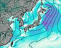
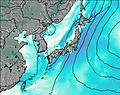
This table gives the weather forecast for Mount Denjō at the specific elevation of 1800 m. Our advanced weather models allow us to provide distinct weather forecasts for several elevations of Mount Denjō. To see the weather forecasts for the other elevations, use the tab navigation above the table. For a wider overview of the weather, consult the Weather Map of Japan.
Mount Denjō Photos
View all
Japanese Archipelago photos (294) |
photos from mountains in Japan (376) |
all photos
 Upload new photo
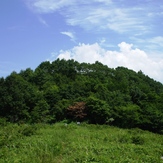
Mount Denjō