
– Lat/Long: 18.36° S 146.27° E
 Mount Bowen (Queensland)
Weather Forecast, AustraliaIssued: 3 pm Mon 03 Aug Local TimeUpdates in: hr min sUpdate imminent
Issued: 3 pm Mon 03 Aug Local Time
Updates in:
Update imminent hr min s

Issued: 3 pm Mon 03 Aug Local Time
Updates in:
Update imminent hr min s
Days 1–4 Weather SummaryLight rain (total 10mm), mostly falling on Tue night. Very mild (max 13°C on Tue afternoon, min 12°C on Mon afternoon). Mainly fresh winds. | Days 5–7 Weather SummaryMostly dry. Very mild (max 15°C on Sat afternoon, min 12°C on Fri night). Wind will be generally light. | ||||||||||||||||
Mon 3 | Tuesday 4 | Wednesday 5 | Thursday 6 | Friday 7 | Saturday 8 | ||||||||||||
PM | night | AM | PM | night | AM | PM | night | AM | PM | night | AM | PM | night | AM | PM | night | |
rain shwrs | rain shwrs | rain shwrs | rain shwrs | rain shwrs | rain shwrs | rain shwrs | rain shwrs | rain shwrs | some clouds | some clouds | clear | clear | some clouds | clear | clear | rain shwrs | |
Cloud base (m) | 800 | 550 | 950 | 650 | 300 | 650 | 550 | 700 | 1600 | 1550 | 550 | 600 | |||||
km/h | |||||||||||||||||
 |  |  |  |  |  | ||||||||||||
— | — | — | — | — | — | — | — | — | — | — | — | — | — | — | — | — | |
mm | 0.4 | 3 | 0.3 | 0.1 | 3 | 2 | 0.1 | 0.7 | 0.3 | — | — | — | — | — | — | — | 0.1 |
max °C | 12 | 12 | 12 | 13 | 12 | 13 | 13 | 13 | 13 | 13 | 13 | 14 | 14 | 14 | 14 | 15 | 14 |
min °C | 12 | 12 | 12 | 12 | 12 | 12 | 13 | 12 | 13 | 13 | 13 | 13 | 14 | 12 | 13 | 15 | 13 |
chill °C | 9 | 9 | 10 | 10 | 10 | 9 | 11 | 10 | 11 | 11 | 11 | 11 | 13 | 9 | 11 | 14 | 12 |
Freezing level m | 4650 | 5000 | 5000 | 4800 | 4600 | 4850 | 4650 | 4700 | 4750 | 4450 | 4150 | 4450 | 4350 | 4250 | 4550 | 4450 | 4500 |
— | — | 6:41 | — | — | 6:39 | — | — | 6:39 | — | — | 6:39 | — | — | 6:39 | — | — | |
6:00 | — | — | 6:00 | — | — | 6:00 | — | — | 6:00 | — | — | 6:00 | — | — | 6:01 | — | |
Loading...
Mount Bowen (Queensland) Weather (Days 0-3):
The weather forecast for Mount Bowen (Queensland) is: Light rain (total 10mm), mostly falling on Tue night. Very mild (max 13°C on Tue afternoon, min 12°C on Mon afternoon). Mainly fresh winds.
Mount Bowen (Queensland) Weather (Days 3-6):
Mostly dry. Very mild (max 15°C on Sat afternoon, min 12°C on Fri night). Wind will be generally light.
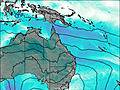
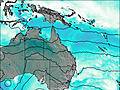
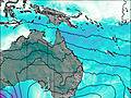
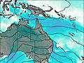
This table gives the weather forecast for Mount Bowen (Queensland) at the specific elevation of 1121 m. Our advanced weather models allow us to provide distinct weather forecasts for several elevations of Mount Bowen (Queensland). To see the weather forecasts for the other elevations, use the tab navigation above the table. For a wider overview of the weather, consult the Weather Map of Queensland.
| Weather Station | Temp. | Weather | Wind | Gusts | Cloud / Visibility |
|---|---|---|---|---|---|
Lucinda Point | |||||
Innisfail Aerodrome | |||||
Townsville - Air Weapons Range (Defence) | |||||
Townsville Aero | |||||
Mount Stuart (Defence) | |||||
Cape Ferguson Ntc Aws | |||||
Townsville - Fanning River (Defence) |
* NOTE: not all weather observatories update at the same frequency which is the reason why some locations may show data from stations that are further away than known closer ones.