– Lat/Long: 52.18° N 117.22° W
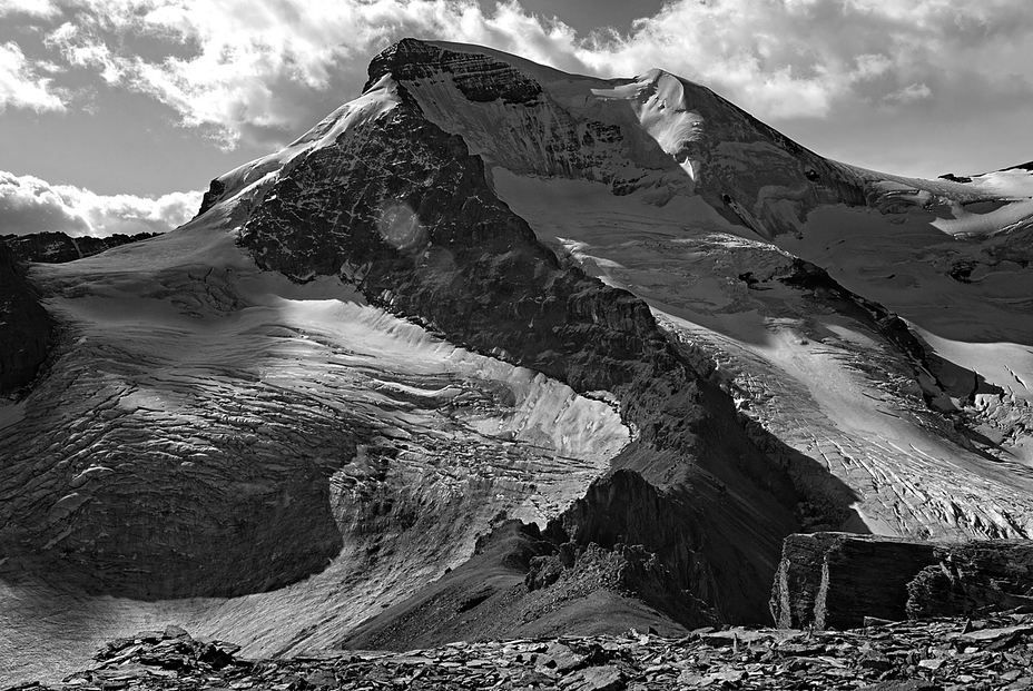
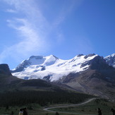
 Mount Athabasca
Weather Forecast, CanadaIssued: 5 am Sun 02 Aug Local TimeUpdates in: hr min sUpdate imminent
Issued: 5 am Sun 02 Aug Local Time
Updates in:
Update imminent hr min s

Issued: 5 am Sun 02 Aug Local Time
Updates in:
Update imminent hr min s
Days 1–3 Weather SummaryA dusting of new snow. Freeze-thaw conditions (max 2°C on Tue afternoon, min -8°C on Sun morning). Wind will be generally light. | Days 4–6 Weather SummaryLight rain (total 5mm) at first, then becoming colder with a dusting of snow on Fri night. Mild temperatures (max 8°C on Thu afternoon, min 1°C on Wed morning). Wind will be generally light. | |||||||||||||||||
Sunday 2 | Monday 3 | Tuesday 4 | Wednesday 5 | Thursday 6 | Friday 7 | |||||||||||||
AM | PM | night | AM | PM | night | AM | PM | night | AM | PM | night | AM | PM | night | AM | PM | night | |
some clouds | cloudy | snow shwrs | some clouds | cloudy | some clouds | clear | some clouds | some clouds | clear | clear | clear | clear | clear | clear | rain shwrs | risk tstorm | snow shwrs | |
Cloud base (m) | 2400 | 2700 | 2500 | 2550 | 3250 | 3400 | 5800 | 3900 | 4600 | 4450 | 4350 | 4700 | 2450 | |||||
km/h | ||||||||||||||||||
 |  |  |  |  |  | |||||||||||||
— | — | 1 | — | — | — | — | — | — | — | — | — | — | — | — | — | — | 2 | |
mm | — | — | — | — | — | — | — | — | — | — | — | — | — | — | — | 0.1 | 3 | 1.9 |
max °C | -7 | -5 | -5 | -5 | -2 | -2 | -1 | 2 | 2 | 2 | 5 | 5 | 5 | 8 | 7 | 6 | 6 | 3 |
min °C | -8 | -6 | -6 | -6 | -3 | -3 | -3 | 1 | 1 | 1 | 4 | 4 | 5 | 7 | 6 | 6 | 5 | 1 |
chill °C | -14 | -11 | -13 | -12 | -7 | -6 | -6 | -1 | -2 | -2 | 2 | 1 | 2 | 4 | 3 | 3 | 3 | -1 |
Freezing level m | 2400 | 2700 | 2550 | 2550 | 3100 | 3150 | 3100 | 3600 | 3800 | 3750 | 4200 | 4300 | 4250 | 4400 | 4400 | 4300 | 4300 | 3900 |
6:09 | — | — | 6:11 | — | — | 6:13 | — | — | 6:15 | — | — | 6:16 | — | — | 6:18 | — | — | |
— | — | 9:37 | — | — | 9:36 | — | — | 9:34 | — | — | 9:31 | — | — | 9:30 | — | — | 9:29 | |
Loading...
Mount Athabasca Weather (Days 0-3):
The weather forecast for Mount Athabasca is: A dusting of new snow. Freeze-thaw conditions (max 2°C on Tue afternoon, min -8°C on Sun morning). Wind will be generally light.
Mount Athabasca Weather (Days 3-6):
Light rain (total 5mm) at first, then becoming colder with a dusting of snow on Fri night. Mild temperatures (max 8°C on Thu afternoon, min 1°C on Wed morning). Wind will be generally light.
This table gives the weather forecast for Mount Athabasca at the specific elevation of 3491 m. Our advanced weather models allow us to provide distinct weather forecasts for several elevations of Mount Athabasca. To see the weather forecasts for the other elevations, use the tab navigation above the table. For a wider overview of the weather, consult the Weather Map of Alberta.
| Weather Station | Temp. | Weather | Wind | Gusts | Cloud / Visibility |
|---|---|---|---|---|---|
Nordegg Cs- Alta | |||||
Jasper Warden- Alta | |||||
Golden Airport | |||||
Yoho Park- BC | |||||
Mount 7 | |||||
Jasper Warden Airport | |||||
Blue River Airport | |||||
Blue River Cs- BC | |||||
Revelstoke Airport |
* NOTE: not all weather observatories update at the same frequency which is the reason why some locations may show data from stations that are further away than known closer ones.
Mount Athabasca Photos
View all
Sir Winston Churchill Range photos (7) |
Canadian Rockies photos (92) |
photos from mountains in Canada (457) |
all photos
 Upload new photo
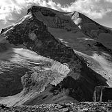
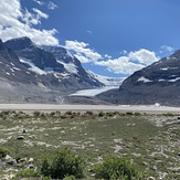
Mount Athabasca
From RV parking lot
Mount Athabasca