
– Lat/Long: 41.89° S 145.23° E
 Mount Agnew
Weather Forecast, AustraliaIssued: 9 pm Sun 02 Aug Local TimeUpdates in: hr min sUpdate imminent
Issued: 9 pm Sun 02 Aug Local Time
Updates in:
Update imminent hr min s

Issued: 9 pm Sun 02 Aug Local Time
Updates in:
Update imminent hr min s
Days 1–4 Weather SummaryModerate rain (total 18mm), heaviest on Sun night. Mild temperatures (max 6°C on Wed morning, min 3°C on Sun night). Winds decreasing (strong winds from the N on Sun night, calm by Mon night). | Days 5–7 Weather SummaryLight rain (total 2mm), mostly falling on Wed night. Mild temperatures (max 7°C on Sat morning, min 3°C on Wed night). Winds increasing (light winds from the SW on Wed night, strong winds from the N by Sat morning). | ||||||||||||||||||
Monday 3 | Tuesday 4 | Wednesday 5 | Thursday 6 | Friday 7 | Saturday 8 | ||||||||||||||
night | AM | PM | night | AM | PM | night | AM | PM | night | AM | PM | night | AM | PM | night | AM | PM | night | |
rain shwrs | risk tstorm | risk tstorm | rain shwrs | rain shwrs | rain shwrs | clear | clear | clear | rain shwrs | light rain | rain shwrs | rain shwrs | rain shwrs | rain shwrs | some clouds | cloudy | some clouds | mod. rain | |
Cloud base (m) | 900 | 150 | 600 | 500 | 700 | 850 | 250 | 650 | 300 | 350 | 400 | 400 | 950 | 1550 | 2200 | 400 | |||
km/h | |||||||||||||||||||
 |  |  |  |  |  |  | |||||||||||||
— | — | — | — | — | — | — | — | — | — | — | — | — | — | — | — | — | — | — | |
mm | 5 | 4 | 4 | 4 | 0.2 | 0.4 | — | — | — | 0.9 | 0.2 | 0.6 | 0.3 | 0.1 | 0.2 | — | — | — | 5 |
max °C | 4 | 4 | 4 | 3 | 5 | 5 | 3 | 6 | 5 | 4 | 5 | 5 | 5 | 6 | 5 | 5 | 7 | 7 | 5 |
min °C | 3 | 4 | 3 | 3 | 4 | 4 | 3 | 5 | 4 | 3 | 4 | 5 | 5 | 5 | 5 | 4 | 7 | 6 | 4 |
chill °C | -3 | -1 | 0 | 0 | 4 | 3 | 1 | 4 | 1 | 0 | 0 | 1 | 1 | 2 | 2 | 0 | 2 | 0 | -3 |
Freezing level m | 1600 | 1350 | 1350 | 1250 | 1400 | 1500 | 1600 | 1850 | 1750 | 1400 | 1350 | 1800 | 1850 | 1800 | 1750 | 1950 | 1950 | 1800 | 1600 |
— | 7:26 | — | — | 7:24 | — | — | 7:24 | — | — | 7:22 | — | — | 7:22 | — | — | 7:20 | — | — | |
— | — | 5:23 | — | — | 5:24 | — | — | 5:25 | — | — | 5:27 | — | — | 5:27 | — | — | 5:28 | — | |
Loading...
Mount Agnew Weather (Days 0-3):
The weather forecast for Mount Agnew is: Moderate rain (total 18mm), heaviest on Sun night. Mild temperatures (max 6°C on Wed morning, min 3°C on Sun night). Winds decreasing (strong winds from the N on Sun night, calm by Mon night).
Mount Agnew Weather (Days 3-6):
Light rain (total 2mm), mostly falling on Wed night. Mild temperatures (max 7°C on Sat morning, min 3°C on Wed night). Winds increasing (light winds from the SW on Wed night, strong winds from the N by Sat morning).
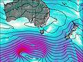
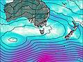
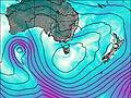
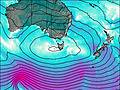
This table gives the weather forecast for Mount Agnew at the specific elevation of 846 m. Our advanced weather models allow us to provide distinct weather forecasts for several elevations of Mount Agnew. To see the weather forecasts for the other elevations, use the tab navigation above the table. For a wider overview of the weather, consult the Weather Map of Tasmania.
| Weather Station | Temp. | Weather | Wind | Gusts | Cloud / Visibility |
|---|---|---|---|---|---|
Mount Read | |||||
Strahan Aerodrome | |||||
Cape Sorell | |||||
lightning 101km W of Rosebery | |||||
Luncheon Hill (Forestry) | |||||
Sheffield School Farm | |||||
Burnie Ntc Aws |
* NOTE: not all weather observatories update at the same frequency which is the reason why some locations may show data from stations that are further away than known closer ones.