
– Lat/Long: 46.60° S 73.35° W
 Monte San Valentin
Weather Forecast, ChileIssued: 1 pm Sun 19 Jul Local TimeUpdates in: hr min sUpdate imminent
Issued: 1 pm Sun 19 Jul Local Time
Updates in:
Update imminent hr min s

Issued: 1 pm Sun 19 Jul Local Time
Updates in:
Update imminent hr min s
Days 1–4 Weather SummaryMostly dry. Extremely cold (max -15°C on Tue night, min -21°C on Sun afternoon). Winds decreasing (fresh winds from the SSW on Sun night, light winds from the SW by Tue afternoon). | Days 5–7 Weather SummaryA heavy fall of snow, heaviest during Thu afternoon. Extremely cold (max -12°C on Thu morning, min -17°C on Thu night). Winds increasing (moderate winds from the NW on Wed night, gales from the NW by Fri afternoon). | ||||||||||||||||
Sun 19 | Monday 20 | Tuesday 21 | Wednesday 22 | Thursday 23 | Friday 24 | ||||||||||||
PM | night | AM | PM | night | AM | PM | night | AM | PM | night | AM | PM | night | AM | PM | night | |
some clouds | clear | clear | clear | clear | clear | clear | some clouds | cloudy | some clouds | light snow | mod. snow | mod. snow | heavy snow | snow shwrs | snow shwrs | heavy snow | |
Cloud base (m) | 550 | 400 | 400 | 450 | 700 | 600 | 650 | 5850 | 5300 | 1850 | 550 | 550 | 550 | 550 | 550 | 550 | |
km/h | |||||||||||||||||
 |  |  |  |  |  | ||||||||||||
— | — | — | — | — | — | — | — | — | — | 1 | 8 | 10 | 16 | 6 | 8 | 11 | |
mm | — | — | — | — | — | — | — | — | — | — | — | — | — | — | — | — | — |
max °C | -21 | -20 | -20 | -20 | -18 | -17 | -16 | -15 | -15 | -15 | -13 | -12 | -13 | -14 | -17 | -17 | -16 |
min °C | -21 | -21 | -20 | -21 | -21 | -17 | -16 | -15 | -15 | -15 | -15 | -12 | -13 | -17 | -17 | -17 | -16 |
chill °C | -32 | -34 | -34 | -34 | -33 | -26 | -22 | -24 | -24 | -25 | -24 | -24 | -27 | -32 | -32 | -33 | -32 |
Freezing level m | 0 | 0 | 0 | 0 | 0 | 0 | 0 | 0 | 950 | 600 | 250 | 0 | 100 | 650 | 900 | 950 | 1000 |
— | — | 8:27 | — | — | 8:26 | — | — | 8:26 | — | — | 8:25 | — | — | 8:23 | — | — | |
5:30 | — | — | 5:30 | — | — | 5:31 | — | — | 5:32 | — | — | 5:34 | — | — | 5:35 | — | |
Loading...
Monte San Valentin Weather (Days 0-3):
The weather forecast for Monte San Valentin is: Mostly dry. Extremely cold (max -15°C on Tue night, min -21°C on Sun afternoon). Winds decreasing (fresh winds from the SSW on Sun night, light winds from the SW by Tue afternoon).
Monte San Valentin Weather (Days 3-6):
A heavy fall of snow, heaviest during Thu afternoon. Extremely cold (max -12°C on Thu morning, min -17°C on Thu night). Winds increasing (moderate winds from the NW on Wed night, gales from the NW by Fri afternoon).
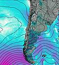
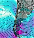
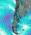
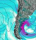
This table gives the weather forecast for Monte San Valentin at the specific elevation of 3500 m. Our advanced weather models allow us to provide distinct weather forecasts for several elevations of Monte San Valentin. To see the weather forecasts for the other elevations, use the tab navigation above the table. For a wider overview of the weather, consult the Weather Map of Chile.
* NOTE: not all weather observatories update at the same frequency which is the reason why some locations may show data from stations that are further away than known closer ones.
Monte San Valentin Photos
View all
Patagonia photos (162) |
Andes photos (1029) |
photos from mountains in Chile (480) |
all photos
 Upload new photo
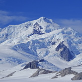
san valentin