
– Lat/Long: 17.84° N 8.72° E
 Mont Idoukal-n-Taghès (Mont Idoukal-n-Taghes)
Weather Forecast, NigerIssued: 12 am Mon 03 Aug Local TimeUpdates in: hr min sUpdate imminent
Issued: 12 am Mon 03 Aug Local Time
Updates in:
Update imminent hr min s

Issued: 12 am Mon 03 Aug Local Time
Updates in:
Update imminent hr min s
Days 1–4 Weather SummarySome drizzle, heaviest during Tue afternoon. Warm (max 32°C on Wed afternoon, min 23°C on Sun night). Winds increasing (calm on Mon morning, strong winds from the NE by Wed afternoon). | Days 5–7 Weather SummaryLight rain (total 3mm), mostly falling on Sat afternoon. Warm (max 31°C on Thu afternoon, min 20°C on Sat afternoon). Winds decreasing (fresh winds from the NE on Wed night, light winds from the NNW by Thu night). | ||||||||||||||||||
Monday 3 | Tuesday 4 | Wednesday 5 | Thursday 6 | Friday 7 | Saturday 8 | ||||||||||||||
night | AM | PM | night | AM | PM | night | AM | PM | night | AM | PM | night | AM | PM | night | AM | PM | night | |
rain shwrs | some clouds | light rain | clear | some clouds | risk tstorm | some clouds | clear | clear | clear | clear | clear | clear | clear | some clouds | some clouds | some clouds | risk tstorm | rain shwrs | |
Cloud base (m) | 2700 | 4200 | 4900 | 3400 | 4600 | 3950 | 5000 | 5250 | 4850 | 5100 | 4600 | 5450 | |||||||
km/h | |||||||||||||||||||
 |  |  |  |  |  |  | |||||||||||||
— | — | — | — | — | — | — | — | — | — | — | — | — | — | — | — | — | — | — | |
mm | 0.8 | — | 0.1 | — | — | 1 | — | — | — | — | — | — | — | — | — | — | — | 3 | 1.3 |
max °C | 25 | 27 | 28 | 26 | 28 | 26 | 27 | 30 | 32 | 29 | 29 | 31 | 29 | 29 | 30 | 30 | 28 | 26 | 27 |
min °C | 23 | 25 | 26 | 24 | 25 | 26 | 27 | 27 | 31 | 26 | 27 | 31 | 25 | 26 | 30 | 23 | 25 | 20 | 22 |
chill °C | 23 | 25 | 26 | 24 | 25 | 26 | 27 | 27 | 31 | 26 | 27 | 31 | 25 | 26 | 30 | 23 | 25 | 20 | 22 |
Freezing level m | 5000 | 5000 | 5200 | 5150 | 5200 | 5100 | 5200 | 5150 | 5400 | 5350 | 5250 | 5350 | 5300 | 5150 | 5350 | 5300 | 5200 | 5100 | 5250 |
— | 6:03 | — | — | 6:03 | — | — | 6:03 | — | — | 6:05 | — | — | 6:05 | — | — | 6:05 | — | — | |
— | — | 6:58 | — | — | 6:57 | — | — | 6:57 | — | — | 6:55 | — | — | 6:55 | — | — | 6:54 | — | |
Loading...
Mont Idoukal-n-Taghès Weather (Days 0-3):
The weather forecast for Mont Idoukal-n-Taghès is: Some drizzle, heaviest during Tue afternoon. Warm (max 32°C on Wed afternoon, min 23°C on Sun night). Winds increasing (calm on Mon morning, strong winds from the NE by Wed afternoon).
Mont Idoukal-n-Taghès Weather (Days 3-6):
Light rain (total 3mm), mostly falling on Sat afternoon. Warm (max 31°C on Thu afternoon, min 20°C on Sat afternoon). Winds decreasing (fresh winds from the NE on Wed night, light winds from the NNW by Thu night).
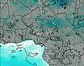
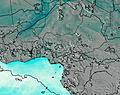
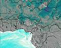
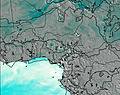
This table gives the weather forecast for Mont Idoukal-n-Taghès at the specific elevation of 1500 m. Our advanced weather models allow us to provide distinct weather forecasts for several elevations of Mont Idoukal-n-Taghès. To see the weather forecasts for the other elevations, use the tab navigation above the table. For a wider overview of the weather, consult the Weather Map of Niger.
| Weather Station | Temp. | Weather | Wind | Gusts | Cloud / Visibility |
|---|---|---|---|---|---|
Agadez | |||||
lightning 232km S of Tamanrasset | |||||
Tadante | |||||
lightning 235km NE of Kidal | |||||
Tintarabine | |||||
Tin Zaouatene | |||||
IN Azzane |
* NOTE: not all weather observatories update at the same frequency which is the reason why some locations may show data from stations that are further away than known closer ones.