– Lat/Long: 53.00° N 4.14° W
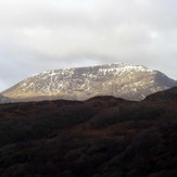
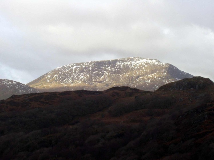
 Moel Hebog
Weather Forecast, United KingdomIssued: 12 am Sun 21 Jun Local TimeUpdates in: hr min sUpdate imminent
Issued: 12 am Sun 21 Jun Local Time
Updates in:
Update imminent hr min s

Issued: 12 am Sun 21 Jun Local Time
Updates in:
Update imminent hr min s
Days 1–4 Weather SummaryMostly dry. Warm (max 21°C on Tue morning, min 10°C on Sat night). Wind will be generally light. | Days 5–7 Weather SummaryMostly dry. Warm (max 26°C on Thu afternoon, min 15°C on Thu night). Winds increasing (calm on Tue night, strong winds from the SSE by Thu night). | ||||||||||||||||||
Sunday 21 | Monday 22 | Tuesday 23 | Wednesday 24 | Thursday 25 | Friday 26 | ||||||||||||||
night | AM | PM | night | AM | PM | night | AM | PM | night | AM | PM | night | AM | PM | night | AM | PM | night | |
clear | some clouds | clear | some clouds | some clouds | clear | rain shwrs | clear | clear | clear | clear | clear | risk tstorm | some clouds | clear | some clouds | clear | some clouds | light rain | |
km/h | |||||||||||||||||||
 |  |  |  |  |  |  | |||||||||||||
— | — | — | — | — | — | — | — | — | — | — | — | — | — | — | — | — | — | — | |
mm | — | — | — | — | — | — | 0.1 | — | — | — | — | — | 0.4 | — | — | — | — | — | 0.9 |
max °C | 11 | 15 | 16 | 16 | 19 | 20 | 19 | 21 | 21 | 20 | 23 | 23 | 22 | 25 | 26 | 25 | 17 | 16 | 15 |
min °C | 10 | 13 | 15 | 14 | 18 | 20 | 18 | 20 | 21 | 19 | 22 | 22 | 21 | 24 | 26 | 15 | 15 | 16 | 12 |
chill °C | 10 | 13 | 15 | 14 | 18 | 20 | 18 | 20 | 21 | 19 | 22 | 22 | 21 | 24 | 26 | 13 | 13 | 14 | 9 |
Freezing level m | 3550 | 3550 | 3850 | 4000 | 4000 | 4000 | 4250 | 4350 | 4450 | 4350 | 4450 | 4500 | 4500 | 4250 | 4450 | 4400 | 4100 | 3700 | 3350 |
Cloud base (m) | 3450 | 800 | 6000 | 800 | 4250 | 5500 | 5800 | 5400 | 4750 | 150 | 150 | 700 | |||||||
— | 4:50 | — | — | 4:50 | — | — | 4:50 | — | — | 4:50 | — | — | 4:50 | — | — | 4:50 | — | — | |
— | — | 9:45 | — | — | 9:45 | — | — | 9:45 | — | — | 9:45 | — | — | 9:45 | — | — | 9:45 | — | |
Loading...
Moel Hebog Weather (Days 0-3):
The weather forecast for Moel Hebog is: Mostly dry. Warm (max 21°C on Tue morning, min 10°C on Sat night). Wind will be generally light.
Moel Hebog Weather (Days 3-6):
Mostly dry. Warm (max 26°C on Thu afternoon, min 15°C on Thu night). Winds increasing (calm on Tue night, strong winds from the SSE by Thu night).
This table gives the weather forecast for Moel Hebog at the specific elevation of 783 m. Our advanced weather models allow us to provide distinct weather forecasts for several elevations of Moel Hebog. To see the weather forecasts for the other elevations, use the tab navigation above the table. For a wider overview of the weather, consult the Weather Map of United Kingdom.
| Weather Station | Temp. | Weather | Wind | Gusts | Cloud / Visibility |
|---|---|---|---|---|---|
Caernarfon Airport | |||||
Valley RAF Airport | |||||
BARCIAL | |||||
HORNACHOS IM2 | |||||
SHIP1302 |
* NOTE: not all weather observatories update at the same frequency which is the reason why some locations may show data from stations that are further away than known closer ones.