
– Lat/Long: 37.51° N 121.88° W
 Mission Peak
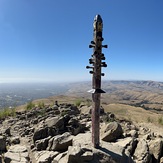
Weather Forecast, United StatesIssued: 4 am Tue 28 Jul Local TimeUpdates in: hr min sUpdate imminent
Issued: 4 am Tue 28 Jul Local Time
Updates in:
Update imminent hr min s

Issued: 4 am Tue 28 Jul Local Time
Updates in:
Update imminent hr min s
Days 1–3 Weather SummaryMostly dry. Warm (max 27°C on Thu afternoon, min 19°C on Tue morning). Wind will be generally light. | Days 4–6 Weather SummaryMostly dry. Warm (max 29°C on Fri afternoon, min 21°C on Sat night). Wind will be generally light. | |||||||||||||||||
Tuesday 28 | Wednesday 29 | Thursday 30 | Friday 31 | Saturday 1 | Sunday 2 | |||||||||||||
AM | PM | night | AM | PM | night | AM | PM | night | AM | PM | night | AM | PM | night | AM | PM | night | |
clear | clear | clear | clear | clear | clear | clear | clear | clear | clear | clear | clear | clear | clear | clear | clear | clear | clear | |
Cloud base (m) | 9450 | 8900 | ||||||||||||||||
km/h | ||||||||||||||||||
 |  |  |  |  |  | |||||||||||||
— | — | — | — | — | — | — | — | — | — | — | — | — | — | — | — | — | — | |
mm | — | — | — | — | — | — | — | — | — | — | — | — | — | — | — | — | — | — |
max °C | 22 | 25 | 22 | 24 | 26 | 22 | 24 | 27 | 23 | 26 | 29 | 24 | 27 | 29 | 25 | 27 | 29 | 24 |
min °C | 19 | 24 | 19 | 21 | 25 | 20 | 21 | 26 | 21 | 22 | 28 | 22 | 23 | 28 | 21 | 23 | 28 | 22 |
chill °C | 19 | 24 | 19 | 21 | 25 | 20 | 21 | 26 | 21 | 22 | 28 | 22 | 23 | 28 | 21 | 23 | 28 | 22 |
Freezing level m | 4850 | 4750 | 4750 | 4900 | 5000 | 5150 | 5200 | 5300 | 5500 | 5550 | 5550 | 5500 | 5500 | 5550 | 5500 | 5400 | 5400 | 5450 |
6:07 | — | — | 6:07 | — | — | 6:09 | — | — | 6:09 | — | — | 6:11 | — | — | 6:11 | — | — | |
— | — | 8:19 | — | — | 8:17 | — | — | 8:16 | — | — | 8:15 | — | — | 8:15 | — | — | 8:14 | |
Loading...
Mission Peak Weather (Days 0-3):
The weather forecast for Mission Peak is: Mostly dry. Warm (max 27°C on Thu afternoon, min 19°C on Tue morning). Wind will be generally light.
Mission Peak Weather (Days 3-6):
Mostly dry. Warm (max 29°C on Fri afternoon, min 21°C on Sat night). Wind will be generally light.
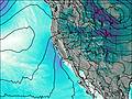
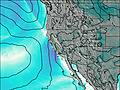
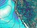
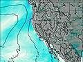
This table gives the weather forecast for Mission Peak at the specific elevation of 767 m. Our advanced weather models allow us to provide distinct weather forecasts for several elevations of Mission Peak. To see the weather forecasts for the other elevations, use the tab navigation above the table. For a wider overview of the weather, consult the Weather Map of California.
| Weather Station | Temp. | Weather | Wind | Gusts | Cloud / Visibility |
|---|---|---|---|---|---|
San Jose Airport | |||||
Moffett Federal Airfield Airport | |||||
* NOTE: not all weather observatories update at the same frequency which is the reason why some locations may show data from stations that are further away than known closer ones.
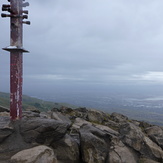
Mission Peak Photos
View all
Diablo Range photos (7) |
Pacific Coast Ranges photos (1060) |
photos from mountains in United States (3056) |
all photos
 Upload new photo
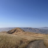
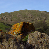
Mission Peak
Mission Peak
Mission Peak
Mission Peak