– Lat/Long: 36.34° N 115.73° W
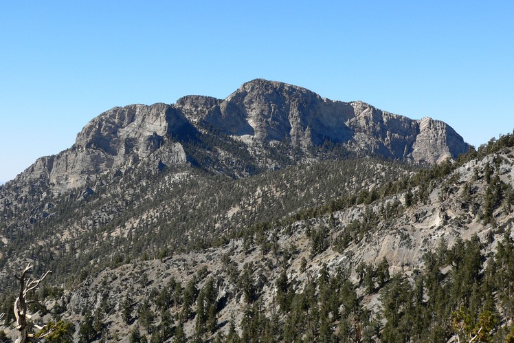
 McFarland Peak
Weather Forecast, United StatesIssued: 10 pm Wed 15 Jul Local TimeUpdates in: hr min sUpdate imminent
Issued: 10 pm Wed 15 Jul Local Time
Updates in:
Update imminent hr min s

Issued: 10 pm Wed 15 Jul Local Time
Updates in:
Update imminent hr min s
Days 1–4 Weather SummaryLight rain (total 6mm), mostly falling on Fri afternoon. Very mild (max 15°C on Wed night, min 11°C on Thu night). Wind will be generally light. | Days 5–7 Weather SummaryMostly dry. Very mild (max 15°C on Mon afternoon, min 13°C on Sat night). Wind will be generally light. | ||||||||||||||||||
Thursday 16 | Friday 17 | Saturday 18 | Sunday 19 | Monday 20 | Tuesday 21 | ||||||||||||||
night | AM | PM | night | AM | PM | night | AM | PM | night | AM | PM | night | AM | PM | night | AM | PM | night | |
rain shwrs | some clouds | clear | rain shwrs | rain shwrs | risk tstorm | risk tstorm | rain shwrs | rain shwrs | clear | some clouds | rain shwrs | clear | some clouds | some clouds | clear | rain shwrs | rain shwrs | clear | |
km/h | |||||||||||||||||||
 |  |  |  |  |  |  | |||||||||||||
— | — | — | — | — | — | — | — | — | — | — | — | — | — | — | — | — | — | — | |
mm | 0.1 | — | — | 0.2 | 0.2 | 3 | 1.2 | 0.1 | 0.7 | — | — | 0.1 | — | — | — | — | 0.4 | 0.4 | — |
max °C | 15 | 13 | 15 | 15 | 12 | 12 | 12 | 11 | 13 | 14 | 13 | 14 | 14 | 14 | 15 | 15 | 13 | 15 | 15 |
min °C | 14 | 13 | 14 | 11 | 11 | 11 | 11 | 11 | 12 | 13 | 13 | 13 | 14 | 13 | 14 | 13 | 13 | 15 | 14 |
chill °C | 14 | 12 | 13 | 10 | 11 | 11 | 11 | 11 | 12 | 13 | 13 | 13 | 14 | 13 | 14 | 13 | 13 | 15 | 14 |
Freezing level m | 5350 | 5250 | 5450 | 5300 | 5100 | 5200 | 5050 | 5150 | 5350 | 5350 | 5400 | 5450 | 5400 | 5300 | 5450 | 5350 | 5250 | 5450 | 5350 |
Cloud base (m) | 5000 | 4950 | 6400 | 4950 | 2650 | 4250 | 4250 | 5400 | 4450 | 4750 | |||||||||
— | 5:37 | — | — | 5:37 | — | — | 5:37 | — | — | 5:39 | — | — | 5:39 | — | — | 5:39 | — | — | |
— | — | — | 8:00 | — | 7:59 | — | — | 7:59 | — | — | 7:58 | — | — | 7:58 | — | — | 7:57 | — | |
Loading...
McFarland Peak Weather (Days 0-3):
The weather forecast for McFarland Peak is: Light rain (total 6mm), mostly falling on Fri afternoon. Very mild (max 15°C on Wed night, min 11°C on Thu night). Wind will be generally light.
McFarland Peak Weather (Days 3-6):
Mostly dry. Very mild (max 15°C on Mon afternoon, min 13°C on Sat night). Wind will be generally light.
This table gives the weather forecast for McFarland Peak at the specific elevation of 3275 m. Our advanced weather models allow us to provide distinct weather forecasts for several elevations of McFarland Peak. To see the weather forecasts for the other elevations, use the tab navigation above the table. For a wider overview of the weather, consult the Weather Map of Nevada.
| Weather Station | Temp. | Weather | Wind | Gusts | Cloud / Visibility |
|---|---|---|---|---|---|
Indian Springs Airport | |||||
North Las Vegas Airport | |||||
Las Vegas Airport | |||||
Boulder City Municipal Airport | |||||
Bullhead City Airport | |||||
* NOTE: not all weather observatories update at the same frequency which is the reason why some locations may show data from stations that are further away than known closer ones.
McFarland Peak Photos
View all
Great Basin Ranges photos (64) |
Intermountain West photos (151) |
photos from mountains in United States (3055) |
all photos
 Upload new photo
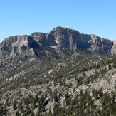
McFarland Peak