– Lat/Long: 45.50° N 6.69° E
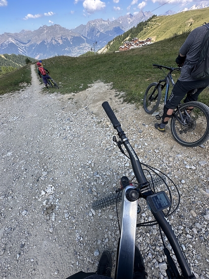
 La Plagne Bike Park Guide & Trail information

La Plagne Bike Park Guide
- Bike trails: 10
- E-bike trails: 5
- Highest trailhead: 2469m
- Total vertical: 536m
- Total distance: 16km
- Total descent distance: 12km
- Total descent: 1518m
- Detailed page: https://www.trailforks.com/region/la-plagne-bike-park-41275
La Plagne Bike Park riders NotesBe the first to submit your riders note! Please submit any useful information about climbing La Plagne Bike Park that may be useful to other climbers. Consider things such as access and accommodation at the base of La Plagne Bike Park, as well as the logistics of climbing to the summit. |

10 other mountain peaks closest to La Plagne Bike Park:
| 1. | Refuge du Mont Jovet (2348 m) | 4.5 km |
| 2. | Bellecôte (3417 m) | 7.4 km |
| 3. | Dôme des Pichères (3319 m) | 8.6 km |
| 4. | Refuge de Rosuel (1556 m) | 9.2 km |
| 5. | Grand Bec (3398 m) | 9.9 km |
| 6. | Refuge du Grand Bec (2405 m) | 10.0 km |
| 7. | Pointe du Vallonnet (3372 m) | 10.9 km |
| 8. | Aiguille de la Vanoise (2796 m) | 13.7 km |
| 9. | Dôme des Platières (3473 m) | 13.7 km |
| 10. | Aiguille Rouge (3226 m) | 13.8 km |