– Lat/Long: 33.08° N 131.25° E
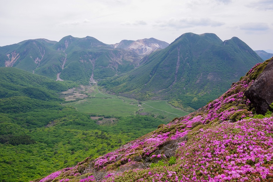
 Kuju Group
Weather Forecast, JapanIssued: 8 am Mon 03 Aug Local TimeUpdates in: hr min sUpdate imminent
Issued: 8 am Mon 03 Aug Local Time
Updates in:
Update imminent hr min s

Issued: 8 am Mon 03 Aug Local Time
Updates in:
Update imminent hr min s
Days 1–3 Weather SummaryLight rain (total 6mm), mostly falling on Tue afternoon. Warm (max 26°C on Mon morning, min 20°C on Wed night). Winds increasing (light winds from the ESE on Mon night, strong winds from the E by Wed night). | Days 4–6 Weather SummaryHeavy rain (total 35mm), heaviest during Fri afternoon. Warm (max 23°C on Thu morning, min 20°C on Thu night). Winds increasing (strong winds from the E on Thu morning, gales from the E by Fri morning). | |||||||||||||||||
Monday 3 | Tuesday 4 | Wednesday 5 | Thursday 6 | Friday 7 | Saturday 8 | |||||||||||||
AM | PM | night | AM | PM | night | AM | PM | night | AM | PM | night | AM | PM | night | AM | PM | night | |
risk tstorm | risk tstorm | risk tstorm | risk tstorm | risk tstorm | clear | clear | clear | clear | rain shwrs | some clouds | rain shwrs | light rain | mod. rain | mod. rain | light rain | mod. rain | mod. rain | |
Cloud base (m) | 1950 | 1650 | 750 | 450 | 2050 | 550 | 1600 | 700 | 450 | 400 | 400 | 400 | 400 | 400 | ||||
km/h | ||||||||||||||||||
 |  |  |  |  |  | |||||||||||||
— | — | — | — | — | — | — | — | — | — | — | — | — | — | — | — | — | — | |
mm | 0.4 | 0.2 | 0.6 | 2 | 3 | — | — | — | — | 0.1 | — | 0.8 | 2 | 6 | 10 | 3 | 5 | 8 |
max °C | 26 | 26 | 23 | 23 | 24 | 22 | 24 | 24 | 21 | 23 | 23 | 21 | 21 | 21 | 21 | 21 | 21 | 21 |
min °C | 25 | 25 | 22 | 23 | 23 | 21 | 22 | 23 | 20 | 21 | 22 | 20 | 20 | 21 | 20 | 20 | 21 | 20 |
chill °C | 25 | 25 | 22 | 23 | 23 | 21 | 22 | 23 | 19 | 21 | 22 | 19 | 19 | 20 | 19 | 19 | 20 | 19 |
Freezing level m | 5500 | 5550 | 5450 | 5500 | 5550 | 5550 | 5400 | 5450 | 5550 | 5500 | 5350 | 5450 | 5400 | 5350 | 5350 | 5350 | 5350 | 5350 |
5:28 | — | — | 5:28 | — | — | 5:30 | — | — | 5:31 | — | — | 5:31 | — | — | 5:31 | — | — | |
— | 7:12 | — | — | 7:10 | — | — | 7:09 | — | — | 7:09 | — | — | 7:08 | — | — | 7:07 | — | |
Loading...
Kuju Group Weather (Days 0-3):
The weather forecast for Kuju Group is: Light rain (total 6mm), mostly falling on Tue afternoon. Warm (max 26°C on Mon morning, min 20°C on Wed night). Winds increasing (light winds from the ESE on Mon night, strong winds from the E by Wed night).
Kuju Group Weather (Days 3-6):
Heavy rain (total 35mm), heaviest during Fri afternoon. Warm (max 23°C on Thu morning, min 20°C on Thu night). Winds increasing (strong winds from the E on Thu morning, gales from the E by Fri morning).
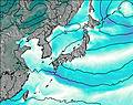
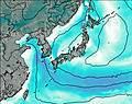
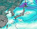
This table gives the weather forecast for Kuju Group at the specific elevation of 1000 m. Our advanced weather models allow us to provide distinct weather forecasts for several elevations of Kuju Group. To see the weather forecasts for the other elevations, use the tab navigation above the table. For a wider overview of the weather, consult the Weather Map of Japan.
| Weather Station | Temp. | Weather | Wind | Gusts | Cloud / Visibility |
|---|---|---|---|---|---|
Oita Airport | |||||
Kitakyushu Airport | |||||
Saga Airport | |||||
Fukuok / tazuke Airport | |||||
* NOTE: not all weather observatories update at the same frequency which is the reason why some locations may show data from stations that are further away than known closer ones.
Kuju Group Photos
View all
photos (19) |
Japanese Archipelago photos (294) |
photos from mountains in Japan (376) |
all photos
 Upload new photo
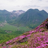
Kuju mountains & Kyushu Azalea