– Lat/Long: 34.42° N 47.24° E
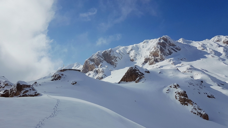
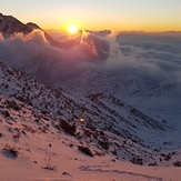
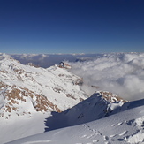
 Parâw (Kuh e Parau)
Weather Forecast, IranIssued: 2 am Mon 03 Aug Local TimeUpdates in: hr min sUpdate imminent
Issued: 2 am Mon 03 Aug Local Time
Updates in:
Update imminent hr min s

Issued: 2 am Mon 03 Aug Local Time
Updates in:
Update imminent hr min s
Days 1–3 Weather SummaryMostly dry. Very mild (max 18°C on Tue afternoon, min 15°C on Mon morning). Winds decreasing (fresh winds from the E on Mon night, calm by Tue night). | Days 4–6 Weather SummaryMostly dry. Very mild (max 19°C on Thu afternoon, min 16°C on Thu morning). Wind will be generally light. | |||||||||||||||||
Monday 3 | Tuesday 4 | Wednesday 5 | Thursday 6 | Friday 7 | Saturday 8 | |||||||||||||
AM | PM | night | AM | PM | night | AM | PM | night | AM | PM | night | AM | PM | night | AM | PM | night | |
some clouds | some clouds | clear | clear | some clouds | clear | some clouds | some clouds | clear | some clouds | some clouds | some clouds | some clouds | some clouds | clear | clear | some clouds | clear | |
Cloud base (m) | 5500 | 5550 | 5400 | 5400 | 5700 | 5550 | 5450 | 5650 | 5700 | 5650 | 5800 | 5600 | 5800 | 5900 | 6050 | 6100 | ||
km/h | ||||||||||||||||||
 |  |  |  |  |  | |||||||||||||
— | — | — | — | — | — | — | — | — | — | — | — | — | — | — | — | — | — | |
mm | — | — | — | — | — | — | — | — | — | — | — | — | — | — | — | — | — | — |
max °C | 16 | 17 | 16 | 16 | 18 | 17 | 17 | 18 | 17 | 17 | 19 | 18 | 17 | 19 | 18 | 17 | 19 | 17 |
min °C | 15 | 17 | 15 | 15 | 18 | 16 | 16 | 18 | 16 | 16 | 19 | 16 | 16 | 18 | 17 | 16 | 18 | 16 |
chill °C | 14 | 17 | 13 | 14 | 18 | 16 | 16 | 18 | 16 | 16 | 19 | 14 | 15 | 18 | 17 | 16 | 18 | 16 |
Freezing level m | 5800 | 5800 | 5650 | 5550 | 5850 | 5850 | 5800 | 5950 | 5900 | 6100 | 6100 | 6150 | 5900 | 5950 | 5800 | 5950 | 5950 | 5800 |
5:31 | — | — | 5:33 | — | — | 5:33 | — | — | 5:35 | — | — | 5:35 | — | — | 5:35 | — | — | |
— | 7:21 | — | — | 7:20 | — | — | 7:19 | — | — | 7:17 | — | — | 7:16 | — | — | 7:15 | — | |
Loading...
Parâw Weather (Days 0-3):
The weather forecast for Parâw is: Mostly dry. Very mild (max 18°C on Tue afternoon, min 15°C on Mon morning). Winds decreasing (fresh winds from the E on Mon night, calm by Tue night).
Parâw Weather (Days 3-6):
Mostly dry. Very mild (max 19°C on Thu afternoon, min 16°C on Thu morning). Wind will be generally light.
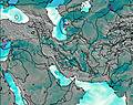
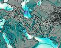
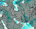
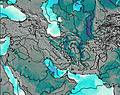
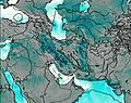
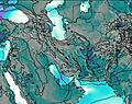
This table gives the weather forecast for Parâw at the specific elevation of 3415 m. Our advanced weather models allow us to provide distinct weather forecasts for several elevations of Parâw. To see the weather forecasts for the other elevations, use the tab navigation above the table. For a wider overview of the weather, consult the Weather Map of Iran.
| Weather Station | Temp. | Weather | Wind | Gusts | Cloud / Visibility |
|---|---|---|---|---|---|
Kermanshah | |||||
Kermansha / hahid Ashrafi Esfahani Airport | |||||
Sanandaj Airport | |||||
Ilam Airport | |||||
Hamadan Airport | |||||
Malayer Airport | |||||
Khoram Abad Airport | |||||
Borujerd | |||||
Zanjan Airport | |||||
Baghdad International Airport |
* NOTE: not all weather observatories update at the same frequency which is the reason why some locations may show data from stations that are further away than known closer ones.
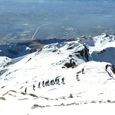
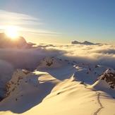
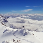
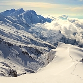
Parâw Photos
View all
Kermanshah photos (57) |
Iranian Plateau photos (1935) |
photos from mountains in Iran (11849) |
all photos
 Upload new photo
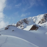
 See 29 more Parâw photos
the mountain
paraw mountain
Parâw
Sekal view
Paraw mount