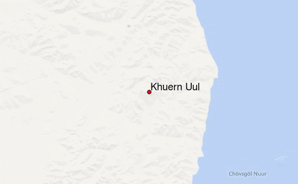
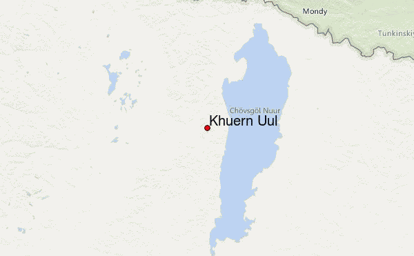
– Lat/Long: 51.10° N 100.14° E
 Khuern Uul – Climbing, Hiking & Mountaineering information

Khuern Uul Guide
- Elevation: 3020
- Difficulty: -
- Best months to climb: -
- Convenient center: -
Khuern Uul climbers NotesBe the first to submit your climbers note! Please submit any useful information about climbing Khuern Uul that may be useful to other climbers. Consider things such as access and accommodation at the base of Khuern Uul, as well as the logistics of climbing to the summit. |
| Select a
mountain summit from the menu |
||
|
Select a Mountain Summit
|
||
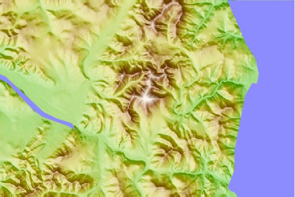
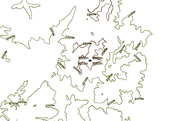
Use this relief map to navigate to mountain peaks in the area of Khuern Uul.
10 other mountain peaks closest to Khuern Uul:
| 1. | Munkhu Sardyk (3491 m) | 37.4 km |
| 2. | Ikh Uul (2961 m) | 44.2 km |
| 3. | Delgerkhaan Uul (3093 m) | 54.0 km |
| 4. | Khandjit Khad (Ханджит Хан) (3077 m) | 63.9 km |
| 5. | Monkh Saridag (3491 m) | 76.6 km |
| 6. | Munku-Sardyk (3491 m) | 76.6 km |
| 7. | Tunkin Depression (1200 m) | 170.4 km |
| 8. | Ulug-arginsky (1800 m) | 201.2 km |
| 9. | Dgida Basin (1500 m) | 228.2 km |
| 10. | Taryatu-chulutu (2400 m) | 327.5 km |