
– Lat/Long: 32.78° N 49.32° E
 Keyno
Keyno
Weather Forecast, IranIssued: 2 pm Fri 03 Jul Local TimeUpdates in: hr min sUpdate imminent
Issued: 2 pm Fri 03 Jul Local Time
Updates in:
Update imminent hr min s

Issued: 2 pm Fri 03 Jul Local Time
Updates in:
Update imminent hr min s
Days 1–4 Weather SummaryMostly dry. Very mild (max 15°C on Mon morning, min 9°C on Sat night). Wind will be generally light. | Days 5–7 Weather SummaryMostly dry. Very mild (max 18°C on Tue afternoon, min 15°C on Mon afternoon). Wind will be generally light. | ||||||||||||||||
Fri 3 | Saturday 4 | Sunday 5 | Monday 6 | Tuesday 7 | Wednesday 8 | ||||||||||||
PM | night | AM | PM | night | AM | PM | night | AM | PM | night | AM | PM | night | AM | PM | night | |
clear | clear | clear | clear | clear | clear | clear | clear | clear | clear | clear | clear | clear | clear | clear | clear | clear | |
km/h | |||||||||||||||||
 |  |  |  |  |  | ||||||||||||
— | — | — | — | — | — | — | — | — | — | — | — | — | — | — | — | — | |
mm | — | — | — | — | — | — | — | — | — | — | — | — | — | — | — | — | — |
max °C | 14 | 13 | 12 | 12 | 10 | 12 | 13 | 12 | 15 | 16 | 15 | 17 | 18 | 17 | 17 | 17 | 17 |
min °C | 14 | 11 | 11 | 11 | 9 | 10 | 13 | 12 | 13 | 15 | 15 | 15 | 17 | 16 | 16 | 17 | 16 |
chill °C | 13 | 9 | 9 | 9 | 7 | 9 | 12 | 11 | 13 | 14 | 15 | 15 | 17 | 16 | 15 | 16 | 16 |
Freezing level m | 5750 | 5650 | 5500 | 5650 | 5450 | 5500 | 5800 | 5700 | 5750 | 5950 | 5950 | 6000 | 6100 | 6050 | 5950 | 6000 | 5950 |
Cloud base (m) | |||||||||||||||||
— | — | 5:09 | — | — | 5:09 | — | — | 5:09 | — | — | 5:09 | — | — | 5:11 | — | — | |
7:23 | — | — | 7:23 | — | — | 7:23 | — | — | 7:23 | — | — | 7:23 | — | — | 7:22 | — | |
Loading...
Keyno Weather (Days 0-3):
The weather forecast for Keyno is: Mostly dry. Very mild (max 15°C on Mon morning, min 9°C on Sat night). Wind will be generally light.
Keyno Weather (Days 3-6):
Mostly dry. Very mild (max 18°C on Tue afternoon, min 15°C on Mon afternoon). Wind will be generally light.
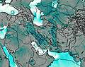
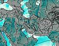
This table gives the weather forecast for Keyno at the specific elevation of 3701 m. Our advanced weather models allow us to provide distinct weather forecasts for several elevations of Keyno. To see the weather forecasts for the other elevations, use the tab navigation above the table. For a wider overview of the weather, consult the Weather Map of Iran.
| Weather Station | Temp. | Weather | Wind | Gusts | Cloud / Visibility |
|---|---|---|---|---|---|
Masjed-Soleyman Airport | |||||
Khoram Abad Airport | |||||
Borujerd | |||||
Shahre-Kord Airport | |||||
Malayer Airport | |||||
Ahwaz Airport | |||||
Esfahan Airport | |||||
Agha Jari Airport | |||||
Kashan Airport | |||||
Hamadan Airport |
* NOTE: not all weather observatories update at the same frequency which is the reason why some locations may show data from stations that are further away than known closer ones.
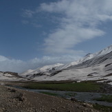
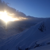
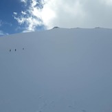
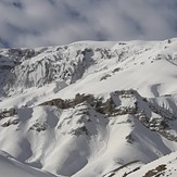
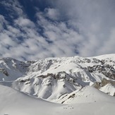
Keyno Photos
View all
photos (498) |
Iranian Plateau photos (1925) |
photos from mountains in Iran (11830) |
all photos
 Upload new photo
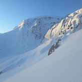
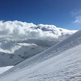
 See 13 more Keyno photos
Keyno
Keyno
keyno
Keyno
Keyno
Sadegh salehi
Sadegh salehi