– Lat/Long: 30.81° N 79.08° E
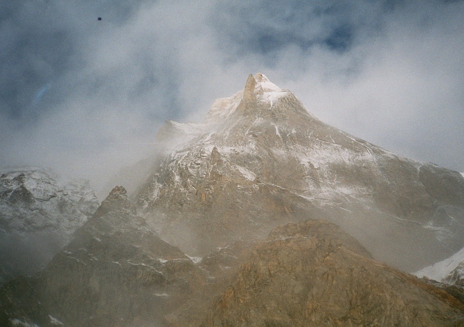
 Kedarnarth Dome
Weather Forecast, IndiaIssued: 10 pm Sun 12 Jul Local TimeUpdates in: hr min sUpdate imminent
Issued: 10 pm Sun 12 Jul Local Time
Updates in:
Update imminent hr min s

Issued: 10 pm Sun 12 Jul Local Time
Updates in:
Update imminent hr min s
Days 1–4 Weather SummaryA light covering of new snow mostly falling on Mon afternoon. Temperatures will be below freezing (max -4°C on Sun night, min -6°C on Tue night). Winds decreasing (fresh winds from the WSW on Mon afternoon, light winds from the WNW by Wed afternoon). | Days 5–7 Weather SummaryA light covering of new snow mostly falling on Thu afternoon. Temperatures will be below freezing (max -3°C on Thu night, min -5°C on Wed night). Wind will be generally light. | ||||||||||||||||||
Monday 13 | Tuesday 14 | Wednesday 15 | Thursday 16 | Friday 17 | Saturday 18 | ||||||||||||||
night | AM | PM | night | AM | PM | night | AM | PM | night | AM | PM | night | AM | PM | night | AM | PM | night | |
clear | some clouds | light snow | some clouds | some clouds | light snow | some clouds | some clouds | light snow | some clouds | some clouds | snow shwrs | snow shwrs | some clouds | light snow | snow shwrs | some clouds | cloudy | some clouds | |
km/h | |||||||||||||||||||
 |  |  |  |  |  |  | |||||||||||||
— | — | 2 | — | — | 2 | — | — | 2 | — | — | 2 | 2 | — | 2 | 2 | — | — | — | |
mm | — | — | — | — | — | — | — | — | — | — | — | — | — | — | — | — | — | — | — |
max °C | -4 | -4 | -4 | -4 | -4 | -5 | -5 | -5 | -5 | -5 | -4 | -4 | -3 | -3 | -3 | -4 | -3 | -3 | -4 |
min °C | -5 | -5 | -5 | -5 | -5 | -5 | -6 | -6 | -5 | -5 | -5 | -4 | -5 | -4 | -3 | -4 | -3 | -4 | -4 |
chill °C | -13 | -13 | -14 | -12 | -12 | -12 | -12 | -12 | -10 | -5 | -5 | -7 | -9 | -8 | -7 | -11 | -6 | -9 | -10 |
Freezing level m | 5850 | 6000 | 6000 | 5800 | 6000 | 5900 | 5750 | 5900 | 5900 | 5900 | 6100 | 6200 | 6050 | 6400 | 6300 | 6100 | 6300 | 6250 | 6100 |
Cloud base (m) | 4850 | 4650 | 4650 | 4900 | 4600 | 4600 | 5450 | ||||||||||||
— | 5:18 | — | — | 5:20 | — | — | 5:20 | — | — | 5:20 | — | — | 5:20 | — | — | 5:22 | — | — | |
— | — | 7:17 | — | — | 7:17 | — | — | 7:17 | — | — | 7:16 | — | — | 7:16 | — | — | 7:16 | — | |
Loading...
Kedarnarth Dome Weather (Days 0-3):
The weather forecast for Kedarnarth Dome is: A light covering of new snow mostly falling on Mon afternoon. Temperatures will be below freezing (max -4°C on Sun night, min -6°C on Tue night). Winds decreasing (fresh winds from the WSW on Mon afternoon, light winds from the WNW by Wed afternoon).
Kedarnarth Dome Weather (Days 3-6):
A light covering of new snow mostly falling on Thu afternoon. Temperatures will be below freezing (max -3°C on Thu night, min -5°C on Wed night). Wind will be generally light.
This table gives the weather forecast for Kedarnarth Dome at the specific elevation of 6831 m. Our advanced weather models allow us to provide distinct weather forecasts for several elevations of Kedarnarth Dome. To see the weather forecasts for the other elevations, use the tab navigation above the table. For a wider overview of the weather, consult the Weather Map of India.
| Weather Station | Temp. | Weather | Wind | Gusts | Cloud / Visibility |
|---|---|---|---|---|---|
Chandigarh | |||||
Leh K B Rimpoche | |||||
Amritsar Airport | |||||
Agra (in-afb) | |||||
Jammu | |||||
Lahore Airport | |||||
Lahore City |
* NOTE: not all weather observatories update at the same frequency which is the reason why some locations may show data from stations that are further away than known closer ones.
Kedarnarth Dome Photos
View all
Garhwal Himalaya photos (21) |
Greater Himalaya photos (378) |
photos from mountains in India (87) |
all photos
 Upload new photo
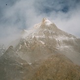
Kedarnath Done - the wall of fear