
– Lat/Long: 47.33° N 10.20° E
 Kanzelwand
Weather Forecast, AustriaIssued: 1 pm Mon 03 Aug Local TimeUpdates in: hr min sUpdate imminent
Issued: 1 pm Mon 03 Aug Local Time
Updates in:
Update imminent hr min s

Issued: 1 pm Mon 03 Aug Local Time
Updates in:
Update imminent hr min s
Days 1–4 Weather SummaryModerate rain (total 18mm), heaviest on Wed night. Warm (max 20°C on Mon afternoon, min 13°C on Tue night). Wind will be generally light. | Days 5–7 Weather SummaryHeavy rain (total 41mm), heaviest during Thu night. Very mild (max 16°C on Thu afternoon, min 10°C on Thu night). Wind will be generally light. | ||||||||||||||||
Mon 3 | Tuesday 4 | Wednesday 5 | Thursday 6 | Friday 7 | Saturday 8 | ||||||||||||
PM | night | AM | PM | night | AM | PM | night | AM | PM | night | AM | PM | night | AM | PM | night | |
some clouds | rain shwrs | clear | some clouds | risk tstorm | rain shwrs | risk tstorm | risk tstorm | rain shwrs | risk tstorm | rain shwrs | rain shwrs | risk tstorm | rain shwrs | some clouds | rain shwrs | rain shwrs | |
Cloud base (m) | 3600 | 4600 | 4600 | 3550 | 2750 | 3000 | 4300 | 7950 | 2800 | 1850 | 2350 | 2200 | 2750 | 2400 | 2800 | ||
km/h | |||||||||||||||||
 |  |  |  |  |  | ||||||||||||
— | — | — | — | — | — | — | — | — | — | — | — | — | — | — | — | — | |
mm | — | 0.5 | — | — | 2 | 0.1 | 4 | 10 | 1.6 | 7 | 32 | 0.1 | 1 | 0.4 | — | 0.4 | 0.1 |
max °C | 20 | 18 | 18 | 20 | 18 | 16 | 17 | 15 | 15 | 16 | 11 | 12 | 12 | 11 | 13 | 13 | 13 |
min °C | 19 | 16 | 17 | 19 | 13 | 14 | 17 | 14 | 15 | 15 | 10 | 10 | 11 | 11 | 11 | 13 | 13 |
chill °C | 19 | 16 | 17 | 19 | 13 | 14 | 17 | 14 | 15 | 15 | 9 | 10 | 11 | 11 | 11 | 13 | 13 |
Freezing level m | 4550 | 4500 | 4450 | 4600 | 4450 | 4350 | 4500 | 4250 | 4250 | 4300 | 3800 | 3900 | 3950 | 4050 | 4000 | 4000 | 4350 |
— | — | 6:00 | — | — | 6:01 | — | — | 6:01 | — | — | 6:03 | — | — | 6:05 | — | — | |
— | 8:50 | — | — | 8:49 | — | — | 8:47 | — | — | 8:45 | — | — | 8:44 | — | — | 8:43 | |
Loading...
Kanzelwand Weather (Days 0-3):
The weather forecast for Kanzelwand is: Moderate rain (total 18mm), heaviest on Wed night. Warm (max 20°C on Mon afternoon, min 13°C on Tue night). Wind will be generally light.
Kanzelwand Weather (Days 3-6):
Heavy rain (total 41mm), heaviest during Thu night. Very mild (max 16°C on Thu afternoon, min 10°C on Thu night). Wind will be generally light.
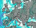
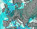
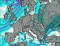
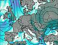
This table gives the weather forecast for Kanzelwand at the specific elevation of 2058 m. Our advanced weather models allow us to provide distinct weather forecasts for several elevations of Kanzelwand. To see the weather forecasts for the other elevations, use the tab navigation above the table. For a wider overview of the weather, consult the Weather Map of Austria.
| Weather Station | Temp. | Weather | Wind | Gusts | Cloud / Visibility |
|---|---|---|---|---|---|
lightning 7km SE of Mittelberg | |||||
Oberstdorf Schanze | |||||
lightning 4km NE of Lech | |||||
Nebelhorn 1930m | |||||
Hörnerbahn Mitte | |||||
Grüner Weg | |||||
Jöchelspitze Süd | |||||
Arlberg (Rüfikopf) |
* NOTE: not all weather observatories update at the same frequency which is the reason why some locations may show data from stations that are further away than known closer ones.