– Lat/Long: 40.65° N 140.88° E
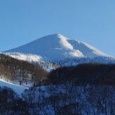
 Hakkoda Group
Weather Forecast, JapanIssued: 8 pm Mon 03 Aug Local TimeUpdates in: hr min sUpdate imminent
Issued: 8 pm Mon 03 Aug Local Time
Updates in:
Update imminent hr min s

Issued: 8 pm Mon 03 Aug Local Time
Updates in:
Update imminent hr min s
Days 1–4 Weather SummaryMostly dry. Warm (max 21°C on Tue night, min 18°C on Mon night). Wind will be generally light. | Days 5–7 Weather SummaryModerate rain (total 11mm), heaviest on Sat afternoon. Warm (max 20°C on Thu night, min 16°C on Sun morning). Wind will be generally light. | Days 8–10 Weather SummaryHeavy rain (total 24mm), heaviest during Tue night. Very mild (max 16°C on Sun night, min 11°C on Mon night). Winds increasing (fresh winds from the ESE on Sun night, stormy winds from the ESE by Wed morning). | Days 11–13 Weather SummaryMostly dry. Warm (max 21°C on Sat morning, min 15°C on Wed night). Winds decreasing (gales from the SSE on Wed night, calm by Fri night). | Days 14–17 Weather SummaryLight rain (total 3mm), mostly falling on Wed afternoon. Warm (max 23°C on Sat night, min 18°C on Mon afternoon). Wind will be generally light. | |||||||||||||||||||||||||||||||||||||||||||
Tuesday 4 | Wednesday 5 | Thursday 6 | Friday 7 | Saturday 8 | Sunday 9 | Monday 10 | Tuesday 11 | Wednesday 12 | Thursday 13 | Friday 14 | Saturday 15 | Sunday 16 | Monday 17 | Tuesday 18 | Wed 19 | ||||||||||||||||||||||||||||||||
night | AM | PM | night | AM | PM | night | AM | PM | night | AM | PM | night | AM | PM | night | AM | PM | night | AM | PM | night | AM | PM | night | AM | PM | night | AM | PM | night | AM | PM | night | AM | PM | night | AM | PM | night | AM | PM | night | AM | PM | night | AM | |
clear | clear | clear | clear | clear | clear | clear | clear | clear | clear | some clouds | clear | clear | risk tstorm | risk tstorm | rain shwrs | rain shwrs | rain shwrs | rain shwrs | rain shwrs | rain shwrs | rain shwrs | cloudy | light rain | heavy rain | light rain | rain shwrs | rain shwrs | rain shwrs | rain shwrs | clear | rain shwrs | rain shwrs | some clouds | clear | clear | some clouds | some clouds | cloudy | cloudy | cloudy | rain shwrs | rain shwrs | rain shwrs | risk tstorm | clear | rain shwrs | |
Cloud base (m) | 350 | 9100 | 1700 | 700 | 350 | 350 | 350 | 350 | 350 | 350 | 300 | 400 | 500 | 250 | 250 | 300 | 450 | 300 | 500 | 300 | 300 | 500 | 9150 | 800 | 5150 | 6100 | 300 | 300 | 850 | 450 | 300 | 400 | 300 | 450 | |||||||||||||
km/h | |||||||||||||||||||||||||||||||||||||||||||||||
 |  |  |  |  |  |  |  |  |  |  |  |  |  |  |  |  | |||||||||||||||||||||||||||||||
— | — | — | — | — | — | — | — | — | — | — | — | — | — | — | — | — | — | — | — | — | — | — | — | — | — | — | — | — | — | — | — | — | — | — | — | — | — | — | — | — | — | — | — | — | — | — | |
mm | — | — | — | — | — | — | — | — | — | — | — | — | — | 2 | 6 | 2 | 0.3 | 0.4 | 1.2 | 0.3 | 0.3 | 0.5 | — | 3 | 16 | 2 | 0.3 | 0.1 | 0.1 | 0.2 | — | 0.1 | 0.1 | — | — | — | — | — | — | — | — | 0.4 | 0.3 | 0.2 | 1 | — | 0.2 |
max °C | 19 | 19 | 19 | 21 | 21 | 20 | 20 | 20 | 20 | 20 | 20 | 20 | 20 | 18 | 19 | 18 | 18 | 16 | 16 | 13 | 13 | 13 | 12 | 13 | 14 | 15 | 15 | 19 | 18 | 20 | 20 | 20 | 20 | 20 | 21 | 21 | 23 | 23 | 21 | 20 | 19 | 19 | 19 | 19 | 18 | 19 | 19 |
min °C | 18 | 19 | 19 | 19 | 20 | 19 | 20 | 19 | 19 | 20 | 20 | 20 | 19 | 18 | 18 | 18 | 16 | 16 | 13 | 13 | 13 | 11 | 12 | 13 | 13 | 14 | 14 | 15 | 17 | 18 | 20 | 19 | 19 | 20 | 20 | 20 | 21 | 20 | 20 | 20 | 19 | 18 | 19 | 18 | 18 | 18 | 18 |
chill °C | 17 | 19 | 19 | 19 | 20 | 19 | 20 | 19 | 19 | 20 | 20 | 20 | 19 | 18 | 18 | 18 | 15 | 15 | 10 | 9 | 10 | 6 | 8 | 10 | 8 | 10 | 10 | 12 | 16 | 17 | 20 | 19 | 19 | 20 | 20 | 20 | 21 | 20 | 20 | 20 | 19 | 18 | 19 | 18 | 18 | 18 | 18 |
Freezing level m | 5350 | 5450 | 5550 | 5650 | 5650 | 5700 | 5600 | 5550 | 5550 | 5450 | 5300 | 5350 | 5250 | 5100 | 5050 | 4900 | 4850 | 4800 | 4700 | 4650 | 4700 | 4750 | 4400 | 4650 | 5200 | 4600 | 4800 | 4500 | 4950 | 5250 | 5450 | 5500 | 5550 | 5450 | 5500 | 5500 | 5350 | 5500 | 5600 | 5450 | 5300 | 5350 | 5150 | 5150 | 5200 | 5200 | 5250 |
— | 4:35 | — | — | 4:35 | — | — | 4:37 | — | — | 4:37 | — | — | 4:39 | — | — | 4:39 | — | — | 4:41 | — | — | 4:41 | — | — | 4:43 | — | — | 4:43 | — | — | 4:45 | — | — | 4:46 | — | — | 4:47 | — | — | 4:48 | — | — | 4:48 | — | — | 4:50 | |
— | — | 6:49 | — | — | 6:46 | — | — | 6:45 | — | — | 6:45 | — | — | 6:44 | — | — | 6:43 | — | — | 6:40 | — | — | 6:39 | — | — | 6:38 | — | — | 6:37 | — | — | 6:36 | — | — | 6:35 | — | — | 6:32 | — | — | 6:31 | — | — | 6:30 | — | — | |
Hakkoda Group Weather (Days 0-3):
The weather forecast for Hakkoda Group is: Mostly dry. Warm (max 21°C on Tue night, min 18°C on Mon night). Wind will be generally light.
Hakkoda Group Weather (Days 3-6):
Moderate rain (total 11mm), heaviest on Sat afternoon. Warm (max 20°C on Thu night, min 16°C on Sun morning). Wind will be generally light.
Hakkoda Group Weather (Days 6-9):
Heavy rain (total 24mm), heaviest during Tue night. Very mild (max 16°C on Sun night, min 11°C on Mon night). Winds increasing (fresh winds from the ESE on Sun night, stormy winds from the ESE by Wed morning).
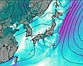
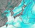
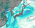
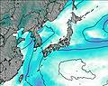
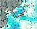
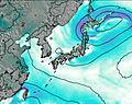
This table gives the weather forecast for Hakkoda Group at the specific elevation of 1585 m. Our advanced weather models allow us to provide distinct weather forecasts for several elevations of Hakkoda Group. To see the weather forecasts for the other elevations, use the tab navigation above the table. For a wider overview of the weather, consult the Weather Map of Japan.
| Weather Station | Temp. | Weather | Wind | Gusts | Cloud / Visibility |
|---|---|---|---|---|---|
Misawa Airport | |||||
Hakodate Airport | |||||
Shonai Airport | |||||
Chitose Airport |
* NOTE: not all weather observatories update at the same frequency which is the reason why some locations may show data from stations that are further away than known closer ones.
Hakkoda Group Photos
View all
Honshu photos (153) |
Japanese Archipelago photos (294) |
photos from mountains in Japan (376) |
all photos
 Upload new photo
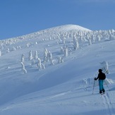
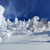
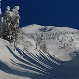
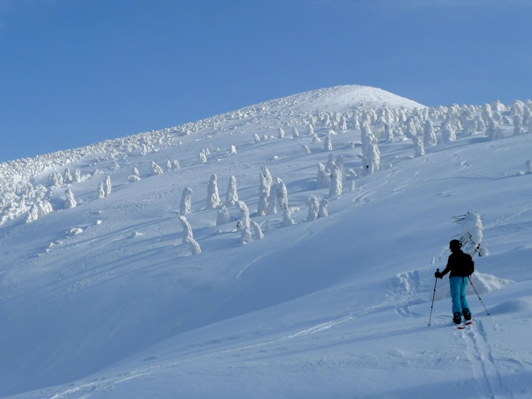
The Snow Monsters of Hakkoda
Otake (Hakkoda)
Otake (Hakkoda)
Otake (Hakkoda)