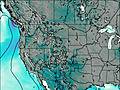
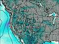
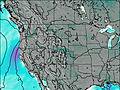
– Lat/Long: 43.74° N 110.80° W
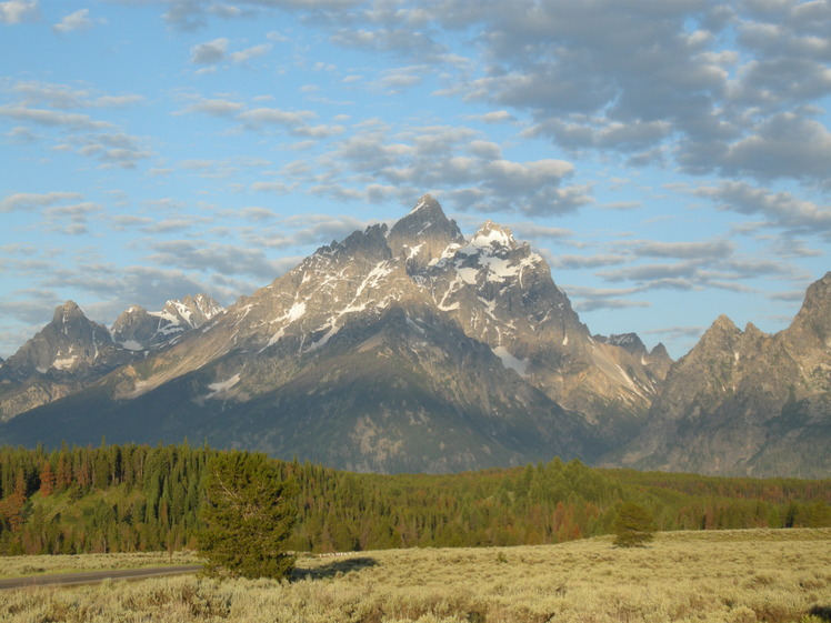
 Grand Teton
Weather Forecast, United StatesIssued: 5 am Mon 03 Aug Local TimeUpdates in: hr min sUpdate imminent
Issued: 5 am Mon 03 Aug Local Time
Updates in:
Update imminent hr min s

Issued: 5 am Mon 03 Aug Local Time
Updates in:
Update imminent hr min s
Days 1–3 Weather SummaryMostly dry. Mild temperatures (max 7°C on Wed afternoon, min 1°C on Mon morning). Mainly strong winds. | Days 4–6 Weather SummaryMostly dry. Very mild (max 11°C on Fri afternoon, min 6°C on Thu morning). Winds increasing (light winds from the W on Thu night, gales from the W by Fri night). | |||||||||||||||||
Monday 3 | Tuesday 4 | Wednesday 5 | Thursday 6 | Friday 7 | Saturday 8 | |||||||||||||
AM | PM | night | AM | PM | night | AM | PM | night | AM | PM | night | AM | PM | night | AM | PM | night | |
clear | clear | clear | clear | clear | clear | clear | clear | clear | clear | clear | clear | clear | clear | clear | clear | clear | clear | |
Cloud base (m) | 9700 | 6350 | ||||||||||||||||
km/h | ||||||||||||||||||
 |  |  |  |  |  | |||||||||||||
— | — | — | — | — | — | — | — | — | — | — | — | — | — | — | — | — | — | |
mm | — | — | — | — | — | — | — | — | — | — | — | — | — | — | — | — | — | — |
max °C | 2 | 4 | 3 | 2 | 5 | 5 | 4 | 7 | 7 | 7 | 10 | 10 | 10 | 11 | 10 | 9 | 10 | 10 |
min °C | 1 | 3 | 1 | 1 | 4 | 3 | 3 | 6 | 6 | 6 | 9 | 9 | 9 | 11 | 7 | 8 | 10 | 7 |
chill °C | -6 | -3 | -5 | -5 | -2 | -2 | -2 | 1 | 2 | 2 | 5 | 6 | 5 | 7 | 3 | 4 | 6 | 2 |
Freezing level m | 4350 | 4700 | 4600 | 4300 | 4750 | 4750 | 4650 | 5000 | 5150 | 4950 | 5300 | 5450 | 5250 | 5400 | 5400 | 5200 | 5350 | 5300 |
6:13 | — | — | 6:13 | — | — | 6:16 | — | — | 6:16 | — | — | 6:18 | — | — | 6:18 | — | — | |
— | 8:44 | — | — | 8:43 | — | — | 8:40 | — | — | 8:39 | — | — | 8:38 | — | — | 8:37 | — | |
Loading...
Grand Teton Weather (Days 0-3):
The weather forecast for Grand Teton is: Mostly dry. Mild temperatures (max 7°C on Wed afternoon, min 1°C on Mon morning). Mainly strong winds.
Grand Teton Weather (Days 3-6):
Mostly dry. Very mild (max 11°C on Fri afternoon, min 6°C on Thu morning). Winds increasing (light winds from the W on Thu night, gales from the W by Fri night).
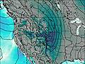
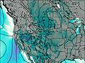
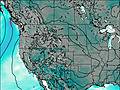
This table gives the weather forecast for Grand Teton at the specific elevation of 4197 m. Our advanced weather models allow us to provide distinct weather forecasts for several elevations of Grand Teton. To see the weather forecasts for the other elevations, use the tab navigation above the table. For a wider overview of the weather, consult the Weather Map of Wyoming.
| Weather Station | Temp. | Weather | Wind | Gusts | Cloud / Visibility |
|---|---|---|---|---|---|
Jackson Airport | |||||
Rexburg Airport |
* NOTE: not all weather observatories update at the same frequency which is the reason why some locations may show data from stations that are further away than known closer ones.
Grand Teton Photos
View all
Teton Range photos (33) |
Rocky Mountains (USA) photos (298) |
photos from mountains in United States (3056) |
all photos
 Upload new photo
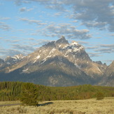

 See 21 more Grand Teton photos
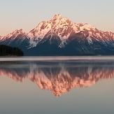
The Grand Teton
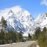
Grand Teton in the spring
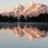
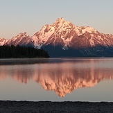
Reflections at the Tetons
Teton Calmness
Early morning reflections
Early Spring in the Teton's
Grand Teton