– Lat/Long: 38.62° N 22.27° E
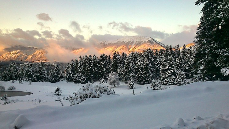
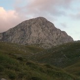
 Ghiona
Weather Forecast, GreeceIssued: 8 am Mon 03 Aug Local TimeUpdates in: hr min sUpdate imminent
Issued: 8 am Mon 03 Aug Local Time
Updates in:
Update imminent hr min s

Issued: 8 am Mon 03 Aug Local Time
Updates in:
Update imminent hr min s
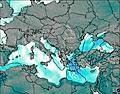
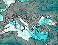
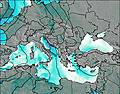
Days 1–3 Weather SummaryMostly dry. Warm (max 28°C on Wed afternoon, min 21°C on Mon morning). Wind will be generally light. | Days 4–6 Weather SummaryMostly dry. Warm (max 30°C on Sat afternoon, min 24°C on Thu morning). Wind will be generally light. | |||||||||||||||||
Monday 3 | Tuesday 4 | Wednesday 5 | Thursday 6 | Friday 7 | Saturday 8 | |||||||||||||
AM | PM | night | AM | PM | night | AM | PM | night | AM | PM | night | AM | PM | night | AM | PM | night | |
clear | clear | clear | clear | some clouds | clear | clear | cloudy | clear | clear | cloudy | clear | some clouds | cloudy | clear | clear | some clouds | clear | |
Cloud base (m) | 4050 | 3700 | 3900 | 4600 | 4300 | 4350 | 4700 | |||||||||||
km/h | ||||||||||||||||||
 |  |  |  |  |  | |||||||||||||
— | — | — | — | — | — | — | — | — | — | — | — | — | — | — | — | — | — | |
mm | — | — | — | — | — | — | — | — | — | — | — | — | — | — | — | — | — | — |
max °C | 24 | 26 | 23 | 26 | 27 | 25 | 27 | 28 | 25 | 26 | 27 | 25 | 26 | 27 | 25 | 28 | 30 | 27 |
min °C | 21 | 26 | 22 | 24 | 27 | 24 | 25 | 27 | 24 | 24 | 26 | 24 | 25 | 26 | 25 | 26 | 29 | 26 |
chill °C | 21 | 26 | 22 | 24 | 27 | 24 | 25 | 27 | 24 | 24 | 26 | 24 | 25 | 26 | 25 | 26 | 29 | 26 |
Freezing level m | 4200 | 4250 | 4400 | 4300 | 4400 | 4300 | 4350 | 4550 | 4450 | 4250 | 4400 | 4350 | 4400 | 4550 | 4700 | 4550 | 4700 | 4700 |
6:33 | — | — | 6:33 | — | — | 6:35 | — | — | 6:35 | — | — | 6:37 | — | — | 6:37 | — | — | |
— | 8:39 | — | — | 8:38 | — | — | 8:37 | — | — | 8:36 | — | — | 8:35 | — | — | 8:34 | — | |
Loading...
Ghiona Weather (Days 0-3):
The weather forecast for Ghiona is: Mostly dry. Warm (max 28°C on Wed afternoon, min 21°C on Mon morning). Wind will be generally light.
Ghiona Weather (Days 3-6):
Mostly dry. Warm (max 30°C on Sat afternoon, min 24°C on Thu morning). Wind will be generally light.
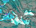
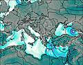
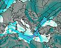
This table gives the weather forecast for Ghiona at the specific elevation of 1000 m. Our advanced weather models allow us to provide distinct weather forecasts for several elevations of Ghiona. To see the weather forecasts for the other elevations, use the tab navigation above the table. For a wider overview of the weather, consult the Weather Map of Greece.
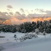
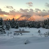
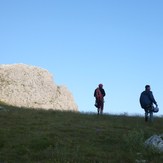
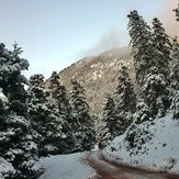
Ghiona Photos
View all
Greek-Albanian Ranges photos (460) |
Balkan Peninsula photos (1075) |
photos from mountains in Greece (690) |
all photos
 Upload new photo
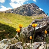
Γκιώνα
Location Sila
Sila
giona climbing
Location Sila
pyramida giona 2510m