– Lat/Long: 56.84° N 4.50° W
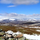
 Geal-Chàrn (Geal-Charn)
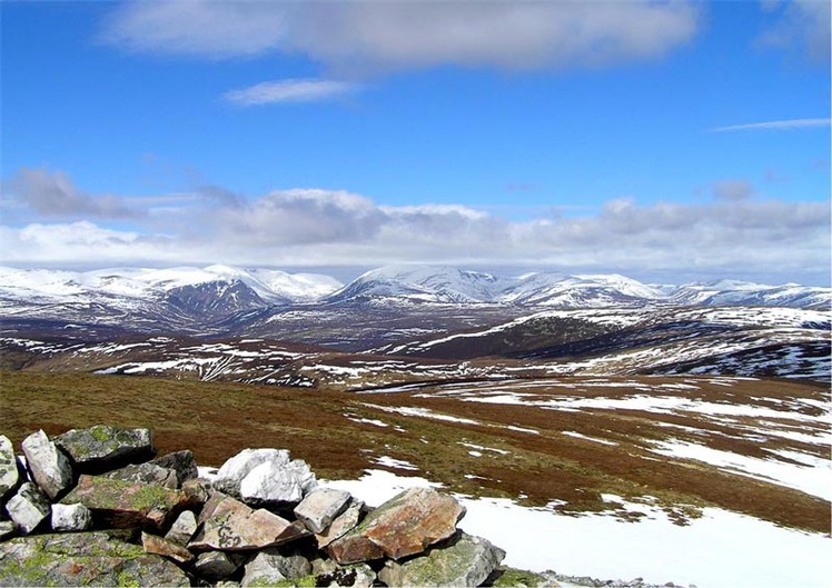
Weather Forecast, United KingdomIssued: 6 am Mon 03 Aug Local TimeUpdates in: hr min sUpdate imminent
Issued: 6 am Mon 03 Aug Local Time
Updates in:
Update imminent hr min s

Issued: 6 am Mon 03 Aug Local Time
Updates in:
Update imminent hr min s
Days 1–3 Weather SummaryHeavy rain (total 25mm), heaviest during Mon night. Very mild (max 15°C on Wed morning, min 10°C on Wed night). Wind will be generally light. | Days 4–6 Weather SummaryLight rain (total 9mm), mostly falling on Fri night. Very mild (max 14°C on Thu morning, min 10°C on Thu night). Wind will be generally light. | |||||||||||||||||
Monday 3 | Tuesday 4 | Wednesday 5 | Thursday 6 | Friday 7 | Saturday 8 | |||||||||||||
AM | PM | night | AM | PM | night | AM | PM | night | AM | PM | night | AM | PM | night | AM | PM | night | |
light rain | light rain | mod. rain | light rain | light rain | light rain | light rain | light rain | rain shwrs | rain shwrs | some clouds | light rain | light rain | light rain | mod. rain | light rain | rain shwrs | light rain | |
Cloud base (m) | 1550 | 400 | 550 | 350 | 350 | 350 | 350 | 450 | 400 | 1500 | 950 | 800 | 450 | 400 | 350 | 800 | 700 | 750 |
km/h | ||||||||||||||||||
 |  |  |  |  |  | |||||||||||||
— | — | — | — | — | — | — | — | — | — | — | — | — | — | — | — | — | — | |
mm | 0.9 | 0.7 | 9 | 1.8 | 2 | 2 | 3 | 4 | 1.6 | 0.2 | — | 0.1 | 0.6 | 1.9 | 6 | 0.3 | 0.4 | 0.4 |
max °C | 13 | 14 | 13 | 13 | 14 | 14 | 15 | 15 | 11 | 14 | 14 | 11 | 11 | 12 | 13 | 13 | 13 | 13 |
min °C | 13 | 13 | 12 | 13 | 14 | 14 | 14 | 13 | 10 | 12 | 13 | 10 | 11 | 12 | 12 | 13 | 12 | 11 |
chill °C | 12 | 13 | 11 | 12 | 14 | 14 | 14 | 12 | 10 | 11 | 12 | 9 | 10 | 10 | 10 | 11 | 10 | 9 |
Freezing level m | 2450 | 2600 | 3050 | 3200 | 3200 | 3050 | 2800 | 2750 | 2300 | 1950 | 2250 | 2250 | 2150 | 2300 | 2600 | 2850 | 2750 | 2550 |
5:20 | — | — | 5:22 | — | — | 5:24 | — | — | 5:26 | — | — | 5:28 | — | — | 5:30 | — | — | |
— | 9:25 | — | — | 9:23 | — | — | 9:22 | — | — | 9:20 | — | — | 9:16 | — | — | 9:15 | — | |
Loading...
Geal-Chàrn Weather (Days 0-3):
The weather forecast for Geal-Chàrn is: Heavy rain (total 25mm), heaviest during Mon night. Very mild (max 15°C on Wed morning, min 10°C on Wed night). Wind will be generally light.
Geal-Chàrn Weather (Days 3-6):
Light rain (total 9mm), mostly falling on Fri night. Very mild (max 14°C on Thu morning, min 10°C on Thu night). Wind will be generally light.
This table gives the weather forecast for Geal-Chàrn at the specific elevation of 248 m. Our advanced weather models allow us to provide distinct weather forecasts for several elevations of Geal-Chàrn. To see the weather forecasts for the other elevations, use the tab navigation above the table. For a wider overview of the weather, consult the Weather Map of United Kingdom.