– Lat/Long: 57.04° N 5.26° W
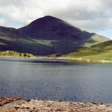
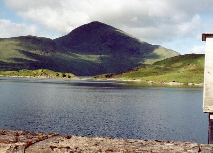
 Gairich
Weather Forecast, United KingdomIssued: 12 am Mon 03 Aug Local TimeUpdates in: hr min sUpdate imminent
Issued: 12 am Mon 03 Aug Local Time
Updates in:
Update imminent hr min s

Issued: 12 am Mon 03 Aug Local Time
Updates in:
Update imminent hr min s
Days 1–4 Weather SummaryHeavy rain (total 23mm), heaviest during Wed afternoon. Very mild (max 12°C on Tue afternoon, min 8°C on Sun night). Winds increasing (light winds from the SSW on Sun night, strong winds from the SE by Mon night). | Days 5–7 Weather SummaryHeavy rain (total 63mm), heaviest during Fri night. Mild temperatures (max 9°C on Wed night, min 5°C on Wed night). Winds increasing (light winds from the WNW on Thu morning, strong winds from the W by Sat afternoon). | ||||||||||||||||||
Monday 3 | Tuesday 4 | Wednesday 5 | Thursday 6 | Friday 7 | Saturday 8 | ||||||||||||||
night | AM | PM | night | AM | PM | night | AM | PM | night | AM | PM | night | AM | PM | night | AM | PM | night | |
some clouds | light rain | light rain | light rain | light rain | light rain | light rain | light rain | mod. rain | light rain | rain shwrs | rain shwrs | light rain | mod. rain | light rain | heavy rain | rain shwrs | rain shwrs | rain shwrs | |
Cloud base (m) | 1850 | 2150 | 300 | 1650 | 300 | 300 | 350 | 400 | 250 | 450 | 600 | 800 | 900 | 300 | 300 | 250 | 300 | 750 | 550 |
km/h | |||||||||||||||||||
 |  |  |  |  |  |  | |||||||||||||
— | — | — | — | — | — | — | — | — | — | — | — | — | — | — | — | — | — | — | |
mm | — | 0.3 | 0.8 | 4 | 0.4 | 0.8 | 2 | 5 | 10 | 0.5 | 0.2 | 0.1 | 0.9 | 6 | 4 | 49 | 1.5 | 1.3 | 1.8 |
max °C | 8 | 10 | 10 | 10 | 11 | 12 | 11 | 10 | 9 | 9 | 6 | 6 | 7 | 7 | 8 | 9 | 7 | 7 | 7 |
min °C | 8 | 9 | 9 | 8 | 10 | 11 | 10 | 9 | 9 | 5 | 5 | 6 | 6 | 7 | 8 | 8 | 7 | 7 | 6 |
chill °C | 7 | 7 | 6 | 3 | 6 | 9 | 8 | 8 | 7 | 1 | 2 | 3 | 2 | 3 | 4 | 3 | 2 | 2 | 3 |
Freezing level m | 2450 | 2500 | 2600 | 2950 | 3150 | 3200 | 2950 | 2700 | 2700 | 2350 | 1750 | 2000 | 2250 | 2150 | 2250 | 2700 | 2700 | 2350 | 2600 |
— | 5:22 | — | — | 5:24 | — | — | 5:26 | — | — | 5:28 | — | — | 5:30 | — | — | 5:31 | — | — | |
— | — | 9:30 | — | — | 9:28 | — | — | 9:25 | — | — | 9:23 | — | — | 9:21 | — | — | 9:19 | — | |
Loading...
Gairich Weather (Days 0-3):
The weather forecast for Gairich is: Heavy rain (total 23mm), heaviest during Wed afternoon. Very mild (max 12°C on Tue afternoon, min 8°C on Sun night). Winds increasing (light winds from the SSW on Sun night, strong winds from the SE by Mon night).
Gairich Weather (Days 3-6):
Heavy rain (total 63mm), heaviest during Fri night. Mild temperatures (max 9°C on Wed night, min 5°C on Wed night). Winds increasing (light winds from the WNW on Thu morning, strong winds from the W by Sat afternoon).
This table gives the weather forecast for Gairich at the specific elevation of 919 m. Our advanced weather models allow us to provide distinct weather forecasts for several elevations of Gairich. To see the weather forecasts for the other elevations, use the tab navigation above the table. For a wider overview of the weather, consult the Weather Map of United Kingdom.