– Lat/Long: 41.94° S 146.05° E
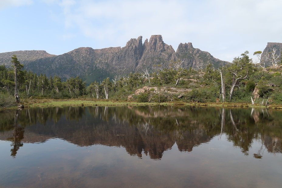
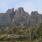
 Du Cane Range
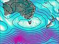
Weather Forecast, AustraliaIssued: 9 pm Sun 02 Aug Local TimeUpdates in: hr min sUpdate imminent
Issued: 9 pm Sun 02 Aug Local Time
Updates in:
Update imminent hr min s

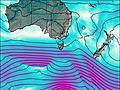
Issued: 9 pm Sun 02 Aug Local Time
Updates in:
Update imminent hr min s
Days 1–4 Weather SummaryA dusting of snow on Mon morning. Freezing level rising with drizzle on Mon afternoon. Mild temperatures (max 6°C on Wed morning, min 1°C on Mon night). Winds decreasing (strong winds from the N on Sun night, calm by Mon night). | Days 5–7 Weather SummaryMostly dry. Mild temperatures (max 7°C on Fri morning, min 1°C on Wed night). Winds increasing (light winds from the NW on Fri afternoon, fresh winds from the N by Sat afternoon). | ||||||||||||||||||
Monday 3 | Tuesday 4 | Wednesday 5 | Thursday 6 | Friday 7 | Saturday 8 | ||||||||||||||
night | AM | PM | night | AM | PM | night | AM | PM | night | AM | PM | night | AM | PM | night | AM | PM | night | |
rain shwrs | light snow | light rain | cloudy | rain shwrs | rain shwrs | clear | clear | clear | some clouds | light rain | cloudy | some clouds | some clouds | rain shwrs | some clouds | light rain | light rain | light rain | |
Cloud base (m) | 750 | 600 | 600 | 750 | 850 | 900 | 1750 | 850 | 750 | 700 | 650 | 900 | 1550 | 700 | 850 | 750 | 750 | ||
km/h | |||||||||||||||||||
 |  |  |  |  |  |  | |||||||||||||
— | 2 | — | — | — | — | — | — | — | — | — | — | — | — | — | — | — | — | — | |
mm | 0.5 | 0.3 | 0.7 | — | 0.1 | 0.1 | — | — | — | — | 0.1 | — | — | — | 0.2 | — | 0.1 | 0.1 | 2 |
max °C | 3 | 2 | 2 | 1 | 3 | 4 | 3 | 6 | 5 | 2 | 3 | 4 | 4 | 7 | 6 | 4 | 5 | 4 | 4 |
min °C | 2 | 2 | 2 | 1 | 2 | 3 | 2 | 5 | 3 | 1 | 2 | 3 | 3 | 5 | 5 | 3 | 4 | 4 | 3 |
chill °C | -4 | -3 | -2 | -2 | 2 | 0 | 0 | 4 | 0 | -3 | -2 | -2 | -1 | 2 | 2 | 0 | -1 | -2 | -4 |
Freezing level m | 1500 | 1250 | 1300 | 1200 | 1300 | 1500 | 1500 | 1800 | 1750 | 1250 | 1300 | 1550 | 1550 | 1700 | 2250 | 2000 | 1850 | 1650 | 1650 |
— | 7:22 | — | — | 7:22 | — | — | 7:20 | — | — | 7:20 | — | — | 7:18 | — | — | 7:16 | — | — | |
— | — | 5:20 | — | — | 5:21 | — | — | 5:22 | — | — | 5:22 | — | — | 5:23 | — | — | 5:24 | — | |
Loading...
Du Cane Range Weather (Days 0-3):
The weather forecast for Du Cane Range is: A dusting of snow on Mon morning. Freezing level rising with drizzle on Mon afternoon. Mild temperatures (max 6°C on Wed morning, min 1°C on Mon night). Winds decreasing (strong winds from the N on Sun night, calm by Mon night).
Du Cane Range Weather (Days 3-6):
Mostly dry. Mild temperatures (max 7°C on Fri morning, min 1°C on Wed night). Winds increasing (light winds from the NW on Fri afternoon, fresh winds from the N by Sat afternoon).
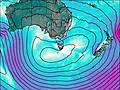
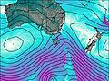
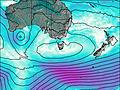
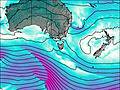
This table gives the weather forecast for Du Cane Range at the specific elevation of 1000 m. Our advanced weather models allow us to provide distinct weather forecasts for several elevations of Du Cane Range. To see the weather forecasts for the other elevations, use the tab navigation above the table. For a wider overview of the weather, consult the Weather Map of Tasmania.
Du Cane Range Photos
View all
Central Highlands (Tasmania) photos (32) |
Other ranges of Australia photos (85) |
photos from mountains in Australia (242) |
all photos
 Upload new photo
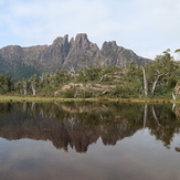
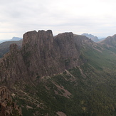
Mount Geryon
Mount Geryon
Mount Geryon