
– Lat/Long: 39.25° N 119.92° W
 Diamond Peak Ski Resort Bike Park
Weather Forecast, United StatesIssued: 4 pm Sun 24 May Local TimeUpdates in: hr min sUpdate imminent
Issued: 4 pm Sun 24 May Local Time
Updates in:
Update imminent hr min s

Issued: 4 pm Sun 24 May Local Time
Updates in:
Update imminent hr min s
Days 1–4 Weather SummaryMostly dry. Freeze-thaw conditions (max 13°C on Sun afternoon, min -4°C on Tue night). Winds increasing (light winds from the SW on Sun afternoon, severe gales from the SW by Mon night). | Days 5–7 Weather SummaryA light covering of new snow mostly falling on Wed afternoon. Freeze-thaw conditions (max 7°C on Fri afternoon, min -1°C on Wed night). Wind will be generally light. | ||||||||||||||||
Sun 24 | Monday 25 | Tuesday 26 | Wednesday 27 | Thursday 28 | Friday 29 | ||||||||||||
PM | night | AM | PM | night | AM | PM | night | AM | PM | night | AM | PM | night | AM | PM | night | |
some clouds | some clouds | clear | clear | clear | some clouds | some clouds | some clouds | some clouds | snow shwrs | snow shwrs | some clouds | some clouds | light snow | some clouds | cloudy | some clouds | |
km/h | |||||||||||||||||
 |  |  |  |  |  | ||||||||||||
— | — | — | — | — | — | — | — | — | 2 | 1 | — | — | 2 | — | — | — | |
— | — | — | — | — | — | — | — | — | — | — | — | — | — | — | — | — | |
max °C | 13 | 11 | 10 | 11 | 7 | -1 | -1 | -2 | -1 | 2 | 2 | 1 | 2 | 1 | 4 | 7 | 6 |
min °C | 12 | 8 | 9 | 9 | 1 | -1 | -1 | -4 | -3 | 1 | -1 | -1 | 2 | 1 | 2 | 6 | 5 |
12 | 7 | 7 | 4 | -8 | -10 | -9 | -9 | -6 | -2 | -3 | -6 | -3 | -4 | -3 | 2 | 3 | |
4200 | 4000 | 3900 | 3800 | 3000 | 2500 | 2450 | 2100 | 2450 | 2800 | 2450 | 2700 | 2850 | 2750 | 3100 | 3550 | 3500 | |
Cloud base (m) | 4600 | 5750 | 8900 | 8900 | 3250 | 2150 | 2400 | 3000 | 2350 | 2500 | 2850 | 2250 | 2350 | 3150 | 5400 | ||
— | — | 5:37 | — | — | 5:37 | — | — | 5:37 | — | — | 5:35 | — | — | 5:35 | — | — | |
— | 8:14 | — | — | 8:15 | — | — | 8:15 | — | — | 8:15 | — | — | 8:16 | — | — | 8:17 | |
Loading...
Diamond Peak Ski Resort Weather (Days 0-3):
The weather forecast for Diamond Peak Ski Resort is: Mostly dry. Freeze-thaw conditions (max 13°C on Sun afternoon, min -4°C on Tue night). Winds increasing (light winds from the SW on Sun afternoon, severe gales from the SW by Mon night).
Diamond Peak Ski Resort Weather (Days 3-6):
A light covering of new snow mostly falling on Wed afternoon. Freeze-thaw conditions (max 7°C on Fri afternoon, min -1°C on Wed night). Wind will be generally light.
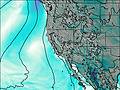
This table gives the weather forecast for Diamond Peak Ski Resort at the specific elevation of 2603 m. Our advanced weather models allow us to provide distinct weather forecasts for several elevations of Diamond Peak Ski Resort. To see the weather forecasts for the other elevations, use the tab navigation above the table. For a wider overview of the weather, consult the Weather Map of Nevada.
| Weather Station | Temp. | Weather | Wind | Gusts | Cloud / Visibility |
|---|---|---|---|---|---|
Carson City Airport | |||||
Truckee Tahoe Airport | |||||
Reno Airport | |||||
South Lake Tahoe Airport | |||||
Reno Stead Airport | |||||
Emigrant Gap Airport | |||||
Placerville Airport (California) | |||||
Nevada County Air Park -Grass Valley (California) |
* NOTE: not all weather observatories update at the same frequency which is the reason why some locations may show data from stations that are further away than known closer ones.