– Lat/Long: 53.42° N 1.70° W
 Derwent Edge
Weather Forecast, United KingdomIssued: 6 pm Mon 27 Jul Local TimeUpdates in: hr min sUpdate imminent
Issued: 6 pm Mon 27 Jul Local Time
Updates in:
Update imminent hr min s

Issued: 6 pm Mon 27 Jul Local Time
Updates in:
Update imminent hr min s
Days 1–4 Weather SummaryMostly dry. Warm (max 23°C on Tue afternoon, min 12°C on Wed night). Mainly fresh winds. | Days 5–7 Weather SummaryMostly dry. Very mild (max 16°C on Fri afternoon, min 8°C on Thu night). Mainly fresh winds. | ||||||||||||||||
Mon 27 | Tuesday 28 | Wednesday 29 | Thursday 30 | Friday 31 | Saturday 1 | ||||||||||||
PM | night | AM | PM | night | AM | PM | night | AM | PM | night | AM | PM | night | AM | PM | night | |
clear | some clouds | light rain | cloudy | clear | some clouds | some clouds | some clouds | clear | clear | clear | clear | clear | clear | clear | clear | clear | |
Cloud base (m) | 2850 | 600 | 300 | 950 | 4950 | 8500 | 450 | 2100 | 8250 | 2100 | 9250 | 8500 | |||||
km/h | |||||||||||||||||
 |  |  |  |  |  | ||||||||||||
— | — | — | — | — | — | — | — | — | — | — | — | — | — | — | — | — | |
mm | — | — | 0.1 | — | — | — | — | — | — | — | — | — | — | — | — | — | — |
max °C | 17 | 16 | 21 | 23 | 19 | 22 | 23 | 17 | 16 | 15 | 10 | 15 | 16 | 11 | 15 | 16 | 11 |
min °C | 17 | 15 | 18 | 22 | 16 | 19 | 21 | 12 | 14 | 13 | 8 | 13 | 14 | 9 | 12 | 14 | 9 |
chill °C | 16 | 13 | 17 | 22 | 15 | 18 | 21 | 10 | 12 | 10 | 6 | 11 | 12 | 6 | 10 | 12 | 6 |
Freezing level m | 3650 | 3750 | 3900 | 3850 | 3700 | 3700 | 3700 | 3400 | 3100 | 2850 | 2450 | 2400 | 2500 | 2600 | 2850 | 3100 | 3050 |
— | — | 5:15 | — | — | 5:16 | — | — | 5:18 | — | — | 5:20 | — | — | 5:20 | — | — | |
9:10 | — | — | 9:09 | — | — | 9:07 | — | — | 9:06 | — | — | 9:05 | — | — | 9:02 | — | |
Loading...
Derwent Edge Weather (Days 0-3):
The weather forecast for Derwent Edge is: Mostly dry. Warm (max 23°C on Tue afternoon, min 12°C on Wed night). Mainly fresh winds.
Derwent Edge Weather (Days 3-6):
Mostly dry. Very mild (max 16°C on Fri afternoon, min 8°C on Thu night). Mainly fresh winds.
This table gives the weather forecast for Derwent Edge at the specific elevation of 538 m. Our advanced weather models allow us to provide distinct weather forecasts for several elevations of Derwent Edge. To see the weather forecasts for the other elevations, use the tab navigation above the table. For a wider overview of the weather, consult the Weather Map of United Kingdom.
| Weather Station | Temp. | Weather | Wind | Gusts | Cloud / Visibility |
|---|---|---|---|---|---|
Humberside International Airport | |||||
Manchester International Airport | |||||
Leeds And Bradford Airport | |||||
East Midlands Airport | |||||
YDSC | |||||
Liverpool Airport | |||||
Shack int Dales | |||||
* NOTE: not all weather observatories update at the same frequency which is the reason why some locations may show data from stations that are further away than known closer ones.
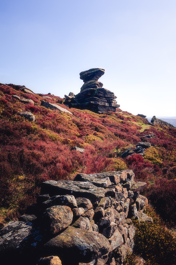
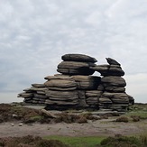
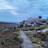
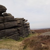
Derwent Edge Photos
View all
Peak District photos (120) |
Pennines photos (198) |
photos from mountains in United Kingdom (2125) |
all photos
 Upload new photo
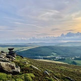
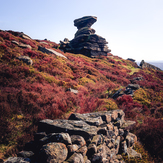
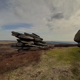
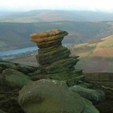
Salt cellar
The Salt Cellar
Back tor
Rocks at bac tor
Back tor
Derwent Edge