– Lat/Long: 50.04° N 123.25° W
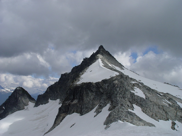
 Cypress Peak
Weather Forecast, CanadaIssued: 10 am Wed 22 Jul Local TimeUpdates in: hr min sUpdate imminent
Issued: 10 am Wed 22 Jul Local Time
Updates in:
Update imminent hr min s

Issued: 10 am Wed 22 Jul Local Time
Updates in:
Update imminent hr min s
Days 1–3 Weather SummaryMostly dry. Warm (max 28°C on Wed afternoon, min 13°C on Thu night). Wind will be generally light. | Days 4–6 Weather SummaryHeavy rain (total 33mm), heaviest during Sun night. Very mild (max 16°C on Sat morning, min 9°C on Sun night). Wind will be generally light. | |||||||||||||||||
Wednesday 22 | Thursday 23 | Friday 24 | Saturday 25 | Sunday 26 | Monday 27 | |||||||||||||
AM | PM | night | AM | PM | night | AM | PM | night | AM | PM | night | AM | PM | night | AM | PM | night | |
clear | clear | some clouds | some clouds | some clouds | risk tstorm | clear | rain shwrs | risk tstorm | rain shwrs | risk tstorm | light rain | light rain | mod. rain | heavy rain | rain shwrs | rain shwrs | some clouds | |
Cloud base (m) | 7000 | 9650 | 5900 | 6600 | 3000 | 700 | 1800 | 2350 | 2750 | 1900 | 700 | 750 | 700 | 750 | 800 | 2450 | 6150 | |
km/h | ||||||||||||||||||
 |  |  |  |  |  | |||||||||||||
— | — | — | — | — | — | — | — | — | — | — | — | — | — | — | — | — | — | |
mm | — | — | — | — | — | 0.1 | — | 0.1 | 0.8 | 0.2 | 7 | 3 | 3 | 8 | 12 | 0.3 | 0.1 | — |
max °C | 25 | 28 | 26 | 22 | 24 | 20 | 18 | 21 | 20 | 16 | 15 | 12 | 10 | 10 | 10 | 12 | 16 | 15 |
min °C | 21 | 27 | 20 | 20 | 23 | 13 | 14 | 21 | 14 | 14 | 13 | 11 | 10 | 10 | 9 | 9 | 15 | 10 |
chill °C | 21 | 27 | 20 | 20 | 23 | 13 | 14 | 21 | 14 | 13 | 11 | 10 | 8 | 8 | 7 | 8 | 15 | 9 |
Freezing level m | 4500 | 4450 | 4400 | 4150 | 4100 | 4200 | 4000 | 3850 | 3600 | 3150 | 3100 | 2850 | 2800 | 2750 | 2700 | 2850 | 2900 | 3050 |
5:28 | — | — | 5:28 | — | — | 5:30 | — | — | 5:31 | — | — | 5:33 | — | — | 5:33 | — | — | |
— | — | 9:08 | — | — | 9:07 | — | — | 9:07 | — | — | 9:05 | — | — | 9:04 | — | — | 9:02 | |
Loading...
Cypress Peak Weather (Days 0-3):
The weather forecast for Cypress Peak is: Mostly dry. Warm (max 28°C on Wed afternoon, min 13°C on Thu night). Wind will be generally light.
Cypress Peak Weather (Days 3-6):
Heavy rain (total 33mm), heaviest during Sun night. Very mild (max 16°C on Sat morning, min 9°C on Sun night). Wind will be generally light.
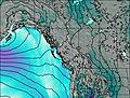
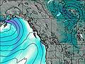
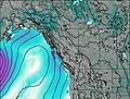
This table gives the weather forecast for Cypress Peak at the specific elevation of 1000 m. Our advanced weather models allow us to provide distinct weather forecasts for several elevations of Cypress Peak. To see the weather forecasts for the other elevations, use the tab navigation above the table. For a wider overview of the weather, consult the Weather Map of British-Columbia.
| Weather Station | Temp. | Weather | Wind | Gusts | Cloud / Visibility |
|---|---|---|---|---|---|
Whistler Airport | |||||
Squamish Airport | |||||
Port Mellon- BC | |||||
Sechelt- BC | |||||
West Vancouver Airport | |||||
West Vancouver Aut- BC |
* NOTE: not all weather observatories update at the same frequency which is the reason why some locations may show data from stations that are further away than known closer ones.
Cypress Peak Photos
View all
Cascade Range photos (451) |
Pacific Coast Ranges photos (1060) |
photos from mountains in Canada (457) |
all photos
 Upload new photo
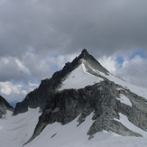
Cypress Peak