– Lat/Long: 51.88° N 3.44° W
 Corn Du
Weather Forecast, United KingdomIssued: 6 am Mon 03 Aug Local TimeUpdates in: hr min sUpdate imminent
Issued: 6 am Mon 03 Aug Local Time
Updates in:
Update imminent hr min s

Issued: 6 am Mon 03 Aug Local Time
Updates in:
Update imminent hr min s
Days 1–3 Weather SummarySome drizzle, heaviest during Tue morning. Warm (max 21°C on Mon afternoon, min 6°C on Wed night). Winds increasing (light winds from the SSW on Mon night, strong winds from the SW by Tue afternoon). | Days 4–6 Weather SummaryMostly dry. Very mild (max 14°C on Fri afternoon, min 8°C on Thu night). Wind will be generally light. | |||||||||||||||||
Monday 3 | Tuesday 4 | Wednesday 5 | Thursday 6 | Friday 7 | Saturday 8 | |||||||||||||
AM | PM | night | AM | PM | night | AM | PM | night | AM | PM | night | AM | PM | night | AM | PM | night | |
some clouds | some clouds | cloudy | light rain | rain shwrs | rain shwrs | rain shwrs | clear | some clouds | rain shwrs | rain shwrs | clear | rain shwrs | some clouds | clear | clear | some clouds | clear | |
Cloud base (m) | 4800 | 3050 | 3050 | 300 | 700 | 850 | 300 | 1750 | 1950 | 400 | 900 | 1800 | 9550 | 300 | 2800 | 3350 | ||
km/h | ||||||||||||||||||
 |  |  |  |  |  | |||||||||||||
— | — | — | — | — | — | — | — | — | — | — | — | — | — | — | — | — | — | |
mm | — | — | — | 0.6 | 0.1 | 0.5 | 0.1 | — | — | 0.4 | 0.1 | — | 0.1 | — | — | — | — | — |
max °C | 19 | 21 | 17 | 16 | 16 | 13 | 11 | 11 | 9 | 10 | 11 | 9 | 13 | 14 | 11 | 14 | 14 | 12 |
min °C | 17 | 20 | 14 | 14 | 14 | 9 | 9 | 11 | 6 | 9 | 11 | 8 | 11 | 13 | 10 | 13 | 14 | 11 |
chill °C | 16 | 20 | 12 | 12 | 11 | 5 | 5 | 7 | 2 | 6 | 9 | 6 | 10 | 11 | 8 | 11 | 12 | 10 |
Freezing level m | 3700 | 3650 | 3700 | 3750 | 3500 | 3750 | 3150 | 2800 | 2850 | 2550 | 2950 | 3300 | 3000 | 3100 | 3150 | 3250 | 3500 | 3400 |
5:37 | — | — | 5:39 | — | — | 5:41 | — | — | 5:41 | — | — | 5:43 | — | — | 5:45 | — | — | |
— | 9:00 | — | — | 8:59 | — | — | 8:57 | — | — | 8:54 | — | — | 8:52 | — | — | 8:51 | — | |
Loading...
Corn Du Weather (Days 0-3):
The weather forecast for Corn Du is: Some drizzle, heaviest during Tue morning. Warm (max 21°C on Mon afternoon, min 6°C on Wed night). Winds increasing (light winds from the SSW on Mon night, strong winds from the SW by Tue afternoon).
Corn Du Weather (Days 3-6):
Mostly dry. Very mild (max 14°C on Fri afternoon, min 8°C on Thu night). Wind will be generally light.
This table gives the weather forecast for Corn Du at the specific elevation of 873 m. Our advanced weather models allow us to provide distinct weather forecasts for several elevations of Corn Du. To see the weather forecasts for the other elevations, use the tab navigation above the table. For a wider overview of the weather, consult the Weather Map of United Kingdom.
| Weather Station | Temp. | Weather | Wind | Gusts | Cloud / Visibility |
|---|---|---|---|---|---|
Blorenge | |||||
Llantrithyd Park | |||||
Cardiff-Wales Airport | |||||
Llethryd Barns | |||||
Scarweather WaveNet Site | |||||
Weston Bay Waverider | |||||
* NOTE: not all weather observatories update at the same frequency which is the reason why some locations may show data from stations that are further away than known closer ones.
Corn Du Photos
View all
Brecon Beacons photos (99) |
Cambrian Mountains photos (384) |
photos from mountains in United Kingdom (2125) |
all photos
 Upload new photo
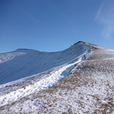

Corn Du from Pen-y-Fan
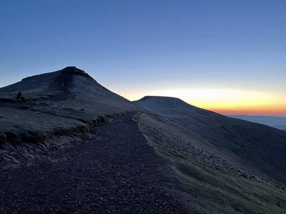
Pre-Dawn
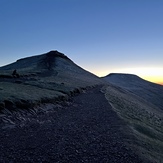
Contemplation