– Lat/Long: 46.60° S 73.33° W
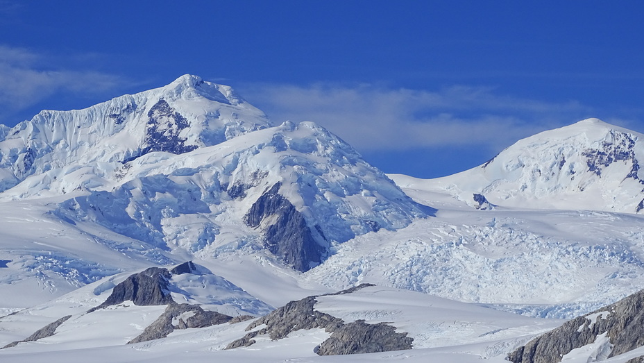
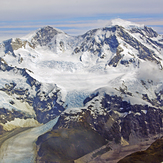
 Cerro San Valentin
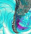
Weather Forecast, ChileIssued: 1 am Fri 24 Jul Local TimeUpdates in: hr min sUpdate imminent
Issued: 1 am Fri 24 Jul Local Time
Updates in:
Update imminent hr min s

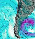
Issued: 1 am Fri 24 Jul Local Time
Updates in:
Update imminent hr min s
Days 1–3 Weather SummaryA heavy fall of snow, heaviest during Sat afternoon. Extremely cold (max -11°C on Sun afternoon, min -14°C on Fri night). Winds decreasing (fresh winds from the WNW on Fri afternoon, light winds from the NNW by Sun morning). | Days 4–6 Weather SummaryMostly dry. Extremely cold (max -12°C on Wed night, min -15°C on Mon afternoon). Wind will be generally light. | |||||||||||||||||
Friday 24 | Saturday 25 | Sunday 26 | Monday 27 | Tuesday 28 | Wednesday 29 | |||||||||||||
AM | PM | night | AM | PM | night | AM | PM | night | AM | PM | night | AM | PM | night | AM | PM | night | |
light snow | light snow | snow shwrs | some clouds | mod. snow | snow shwrs | clear | some clouds | some clouds | clear | some clouds | some clouds | clear | clear | clear | some clouds | clear | clear | |
Cloud base (m) | 550 | 550 | 550 | 550 | 550 | 600 | 550 | 550 | 550 | 550 | 1950 | 1700 | 500 | 800 | 600 | 600 | 600 | 600 |
km/h | ||||||||||||||||||
 |  |  |  |  |  | |||||||||||||
4 | 5 | 2 | — | 7 | 4 | — | — | — | — | — | — | — | — | — | — | — | — | |
mm | — | — | — | — | — | — | — | — | — | — | — | — | — | — | — | — | — | — |
max °C | -12 | -12 | -14 | -13 | -12 | -13 | -12 | -11 | -11 | -13 | -14 | -14 | -15 | -15 | -15 | -15 | -14 | -12 |
min °C | -13 | -13 | -14 | -14 | -12 | -14 | -13 | -12 | -12 | -14 | -15 | -15 | -15 | -15 | -15 | -15 | -14 | -13 |
chill °C | -23 | -24 | -25 | -23 | -22 | -23 | -18 | -16 | -18 | -18 | -20 | -19 | -22 | -22 | -20 | -20 | -18 | -17 |
Freezing level m | 700 | 650 | 250 | 450 | 650 | 150 | 150 | 0 | 0 | 0 | 0 | 0 | 0 | 0 | 0 | 0 | 0 | 0 |
8:23 | — | — | 8:22 | — | — | 8:22 | — | — | 8:21 | — | — | 8:18 | — | — | 8:18 | — | — | |
— | 5:35 | — | — | 5:36 | — | — | 5:37 | — | — | 5:38 | — | — | 5:39 | — | — | 5:40 | — | |
Loading...
Cerro San Valentin Weather (Days 0-3):
The weather forecast for Cerro San Valentin is: A heavy fall of snow, heaviest during Sat afternoon. Extremely cold (max -11°C on Sun afternoon, min -14°C on Fri night). Winds decreasing (fresh winds from the WNW on Fri afternoon, light winds from the NNW by Sun morning).
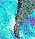
Cerro San Valentin Weather (Days 3-6):
Mostly dry. Extremely cold (max -12°C on Wed night, min -15°C on Mon afternoon). Wind will be generally light.
This table gives the weather forecast for Cerro San Valentin at the specific elevation of 2500 m. Our advanced weather models allow us to provide distinct weather forecasts for several elevations of Cerro San Valentin. To see the weather forecasts for the other elevations, use the tab navigation above the table. For a wider overview of the weather, consult the Weather Map of Chile.
| Weather Station | Temp. | Weather | Wind | Gusts | Cloud / Visibility |
|---|---|---|---|---|---|
Balmaceda Airport | |||||
Futaleufu Airport | |||||
Nuevo Chaitén Airport | |||||
Aeropuerto Internacional de El Calafate Airport | |||||
Esquel Airport | |||||
Enrique Moscon / omodoro Rivadavia Airport | |||||
Monopulli Airport | |||||
Rio Gallegos Airport |
* NOTE: not all weather observatories update at the same frequency which is the reason why some locations may show data from stations that are further away than known closer ones.
Cerro San Valentin Photos
View all
Patagonia photos (162) |
Andes photos (1029) |
photos from mountains in Chile (480) |
all photos
 Upload new photo
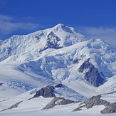
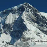
CARA OESTE
San Valentin, Cara Nor-Este
cara norte