– Lat/Long: 41.05° N 74.20° W
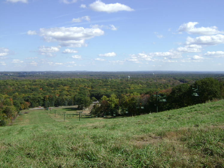
 Campgaw Mountain
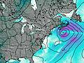
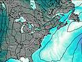
Weather Forecast, United StatesIssued: 7 pm Sun 02 Aug Local TimeUpdates in: hr min sUpdate imminent
Issued: 7 pm Sun 02 Aug Local Time
Updates in:
Update imminent hr min s

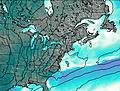
Issued: 7 pm Sun 02 Aug Local Time
Updates in:
Update imminent hr min s
Days 1–4 Weather SummaryHeavy rain (total 38mm), heaviest during Wed morning. Warm (max 23°C on Tue afternoon, min 16°C on Mon night). Winds decreasing (fresh winds from the SSW on Sun night, calm by Tue morning). | Days 5–7 Weather SummaryModerate rain (total 19mm), heaviest on Fri night. Warm (max 28°C on Fri afternoon, min 20°C on Wed night). Winds increasing (light winds from the WSW on Wed night, fresh winds from the W by Fri night). | ||||||||||||||||||
Monday 3 | Tuesday 4 | Wednesday 5 | Thursday 6 | Friday 7 | Saturday 8 | ||||||||||||||
night | AM | PM | night | AM | PM | night | AM | PM | night | AM | PM | night | AM | PM | night | AM | PM | night | |
light rain | risk tstorm | risk tstorm | rain shwrs | clear | clear | some clouds | heavy rain | mod. rain | rain shwrs | risk tstorm | risk tstorm | rain shwrs | clear | clear | rain shwrs | clear | light rain | risk tstorm | |
Cloud base (m) | 500 | 150 | 400 | 9250 | 9450 | 9000 | 650 | 200 | 200 | 6200 | 250 | 1600 | 2200 | 8650 | 1900 | 2400 | |||
km/h | |||||||||||||||||||
 |  |  |  |  |  |  | |||||||||||||
— | — | — | — | — | — | — | — | — | — | — | — | — | — | — | — | — | — | — | |
mm | 5 | 3 | 5 | 0.1 | — | — | — | 19 | 6 | 1.8 | 4 | 0.2 | 1.5 | — | — | 11 | — | 0.1 | 3 |
max °C | 21 | 20 | 21 | 19 | 20 | 23 | 21 | 19 | 20 | 20 | 23 | 26 | 24 | 26 | 28 | 20 | 24 | 26 | 24 |
min °C | 20 | 20 | 21 | 16 | 17 | 22 | 18 | 18 | 20 | 20 | 21 | 25 | 21 | 22 | 27 | 20 | 21 | 25 | 20 |
chill °C | 20 | 20 | 21 | 16 | 17 | 22 | 18 | 18 | 20 | 20 | 21 | 25 | 21 | 22 | 27 | 19 | 21 | 25 | 20 |
Freezing level m | 4650 | 4600 | 4450 | 4750 | 4900 | 4950 | 4750 | 4850 | 4950 | 4800 | 4800 | 4900 | 4750 | 4550 | 4650 | 4550 | 4550 | 4600 | 4550 |
— | 5:54 | — | — | 5:54 | — | — | 5:56 | — | — | 5:56 | — | — | 5:58 | — | — | 5:58 | — | — | |
— | — | — | 8:10 | — | — | 8:09 | — | — | 8:07 | — | — | 8:07 | — | — | 8:06 | — | — | 8:05 | |
Loading...
Campgaw Mountain Weather (Days 0-3):
The weather forecast for Campgaw Mountain is: Heavy rain (total 38mm), heaviest during Wed morning. Warm (max 23°C on Tue afternoon, min 16°C on Mon night). Winds decreasing (fresh winds from the SSW on Sun night, calm by Tue morning).
Campgaw Mountain Weather (Days 3-6):
Moderate rain (total 19mm), heaviest on Fri night. Warm (max 28°C on Fri afternoon, min 20°C on Wed night). Winds increasing (light winds from the WSW on Wed night, fresh winds from the W by Fri night).
This table gives the weather forecast for Campgaw Mountain at the specific elevation of 752 m. Our advanced weather models allow us to provide distinct weather forecasts for several elevations of Campgaw Mountain. To see the weather forecasts for the other elevations, use the tab navigation above the table. For a wider overview of the weather, consult the Weather Map of New-Jersey.
| Weather Station | Temp. | Weather | Wind | Gusts | Cloud / Visibility |
|---|---|---|---|---|---|
Caldwell Airport | |||||
Teterboro Airport | |||||
Morristown Municipal Airport | |||||
New Your Cit / entral Park Airport | |||||
Sussex Airport | |||||
New York City La Guardia Airport | |||||
Newark Airport | |||||
White Plains Airport |
* NOTE: not all weather observatories update at the same frequency which is the reason why some locations may show data from stations that are further away than known closer ones.
Campgaw Mountain Photos
View all
Ramapo Mountains photos (2) |
Appalachians photos (910) |
photos from mountains in United States (3056) |
all photos
 Upload new photo
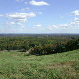
Campgaw Mountain