
– Lat/Long: 37.12° S 140.20° E
 Camel Back
Weather Forecast, AustraliaIssued: 2 pm Mon 03 Aug Local TimeUpdates in: hr min sUpdate imminent
Issued: 2 pm Mon 03 Aug Local Time
Updates in:
Update imminent hr min s

Issued: 2 pm Mon 03 Aug Local Time
Updates in:
Update imminent hr min s
Days 1–4 Weather SummarySome drizzle, heaviest during Thu morning. Freeze-thaw conditions (max 4°C on Wed night, min -2°C on Mon night). Winds decreasing (strong winds from the WSW on Mon afternoon, calm by Tue night). | Days 5–7 Weather SummaryMild with light rain (total 9mm) on Sat afternoon Becoming colder with a light covering of snow, mostly falling on Sat night. Freeze-thaw conditions (max 5°C on Fri night, min -2°C on Sun morning). Winds increasing (light winds from the WSW on Thu night, extremely windy from the NNW by Sat afternoon). | ||||||||||||||||
Mon 3 | Tuesday 4 | Wednesday 5 | Thursday 6 | Friday 7 | Saturday 8 | ||||||||||||
PM | night | AM | PM | night | AM | PM | night | AM | PM | night | AM | PM | night | AM | PM | night | |
cloudy | some clouds | cloudy | some clouds | clear | some clouds | cloudy | rain shwrs | rain shwrs | rain shwrs | clear | clear | clear | some clouds | cloudy | mod. rain | light snow | |
Cloud base (m) | 800 | 600 | 550 | 550 | 750 | 750 | 750 | 600 | 650 | 800 | 900 | 2550 | 550 | 50 | |||
km/h | |||||||||||||||||
 |  |  |  |  |  | ||||||||||||
— | — | — | — | — | — | — | — | — | — | — | — | — | — | — | — | 2 | |
mm | — | — | — | — | — | — | — | 0.4 | 0.8 | 0.1 | — | — | — | — | — | 6 | 3 |
max °C | -1 | -1 | -1 | 1 | 2 | 1 | 1 | 4 | 3 | 3 | 3 | 3 | 4 | 5 | 5 | 4 | 4 |
min °C | -1 | -2 | -1 | -1 | 0 | 1 | 0 | 2 | 2 | 3 | 2 | 2 | 4 | 5 | 2 | 2 | -1 |
chill °C | -9 | -10 | -7 | -7 | -5 | -4 | -5 | -4 | -2 | -2 | -3 | -2 | -1 | 0 | -7 | -8 | -10 |
Freezing level m | 1300 | 1250 | 1350 | 1350 | 1550 | 1750 | 1400 | 2000 | 2000 | 2150 | 2250 | 1950 | 2200 | 2200 | 2150 | 2300 | 2000 |
— | — | 7:05 | — | — | 7:03 | — | — | 7:03 | — | — | 7:01 | — | — | 7:01 | — | — | |
5:23 | — | — | 5:24 | — | — | 5:24 | — | — | 5:25 | — | — | 5:27 | — | — | 5:28 | — | |
Loading...
Camel Back Weather (Days 0-3):
The weather forecast for Camel Back is: Some drizzle, heaviest during Thu morning. Freeze-thaw conditions (max 4°C on Wed night, min -2°C on Mon night). Winds decreasing (strong winds from the WSW on Mon afternoon, calm by Tue night).
Camel Back Weather (Days 3-6):
Mild with light rain (total 9mm) on Sat afternoon Becoming colder with a light covering of snow, mostly falling on Sat night. Freeze-thaw conditions (max 5°C on Fri night, min -2°C on Sun morning). Winds increasing (light winds from the WSW on Thu night, extremely windy from the NNW by Sat afternoon).
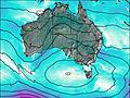
This table gives the weather forecast for Camel Back at the specific elevation of 1430 m. Our advanced weather models allow us to provide distinct weather forecasts for several elevations of Camel Back. To see the weather forecasts for the other elevations, use the tab navigation above the table. For a wider overview of the weather, consult the Weather Map of South-Australia.
| Weather Station | Temp. | Weather | Wind | Gusts | Cloud / Visibility |
|---|---|---|---|---|---|
Robe Airfield | |||||
Robe Comparison | |||||
Naracoorte Aerodrome | |||||
Padthaway South | |||||
Mount Gambier Aero | |||||
* NOTE: not all weather observatories update at the same frequency which is the reason why some locations may show data from stations that are further away than known closer ones.