– Lat/Long: 57.12° N 3.63° W
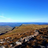
 Cairngorm
Weather Forecast, United KingdomIssued: 6 pm Sun 05 Jul Local TimeUpdates in: hr min sUpdate imminent
Issued: 6 pm Sun 05 Jul Local Time
Updates in:
Update imminent hr min s

Issued: 6 pm Sun 05 Jul Local Time
Updates in:
Update imminent hr min s
Days 1–4 Weather SummaryLight rain (total 5mm), mostly falling on Sun afternoon. Very mild (max 14°C on Wed morning, min 8°C on Sun afternoon). Winds decreasing (severe gales from the W on Mon afternoon, moderate winds from the W by Wed morning). | Days 5–7 Weather SummaryLight rain (total 4mm), mostly falling on Fri afternoon. Very mild (max 15°C on Thu afternoon, min 11°C on Fri night). Wind will be generally light. | ||||||||||||||||
Sun 5 | Monday 6 | Tuesday 7 | Wednesday 8 | Thursday 9 | Friday 10 | ||||||||||||
PM | night | AM | PM | night | AM | PM | night | AM | PM | night | AM | PM | night | AM | PM | night | |
light rain | light rain | light rain | some clouds | cloudy | light rain | light rain | rain shwrs | some clouds | clear | clear | clear | clear | some clouds | cloudy | rain shwrs | rain shwrs | |
km/h | |||||||||||||||||
 |  |  |  |  |  | ||||||||||||
— | — | — | — | — | — | — | — | — | — | — | — | — | — | — | — | — | |
mm | 3 | 0.8 | 0.1 | — | — | 0.4 | 0.3 | 0.1 | — | — | — | — | — | — | — | 2 | 1.8 |
max °C | 9 | 9 | 9 | 9 | 10 | 10 | 12 | 12 | 14 | 14 | 14 | 14 | 15 | 14 | 15 | 15 | 13 |
min °C | 8 | 9 | 8 | 9 | 9 | 10 | 11 | 12 | 13 | 14 | 12 | 13 | 14 | 14 | 14 | 14 | 11 |
chill °C | 3 | 4 | 2 | 3 | 3 | 6 | 7 | 8 | 11 | 13 | 9 | 11 | 13 | 13 | 12 | 14 | 9 |
Freezing level m | 3100 | 3300 | 3250 | 3450 | 3700 | 3400 | 3650 | 4000 | 4100 | 4000 | 4000 | 3800 | 3700 | 3500 | 3550 | 3500 | 3500 |
Cloud base (m) | 600 | 450 | 450 | 1650 | 600 | 550 | 500 | 550 | 700 | 5500 | 600 | ||||||
— | — | 4:28 | — | — | 4:28 | — | — | 4:31 | — | — | 4:31 | — | — | 4:33 | — | — | |
— | 10:08 | — | — | 10:08 | — | — | 10:07 | — | — | 10:07 | — | — | 10:06 | — | — | 10:05 | |
Loading...
Cairngorm Weather (Days 0-3):
The weather forecast for Cairngorm is: Light rain (total 5mm), mostly falling on Sun afternoon. Very mild (max 14°C on Wed morning, min 8°C on Sun afternoon). Winds decreasing (severe gales from the W on Mon afternoon, moderate winds from the W by Wed morning).
Cairngorm Weather (Days 3-6):
Light rain (total 4mm), mostly falling on Fri afternoon. Very mild (max 15°C on Thu afternoon, min 11°C on Fri night). Wind will be generally light.
This table gives the weather forecast for Cairngorm at the specific elevation of 1234 m. Our advanced weather models allow us to provide distinct weather forecasts for several elevations of Cairngorm. To see the weather forecasts for the other elevations, use the tab navigation above the table. For a wider overview of the weather, consult the Weather Map of United Kingdom.
* NOTE: not all weather observatories update at the same frequency which is the reason why some locations may show data from stations that are further away than known closer ones.