
– Lat/Long: 56.47° N 157.80° E
 Bolshoy-kekuknaysky
Weather Forecast, RussiaIssued: 11 pm Mon 03 Aug Local TimeUpdates in: hr min sUpdate imminent
Issued: 11 pm Mon 03 Aug Local Time
Updates in:
Update imminent hr min s

Issued: 11 pm Mon 03 Aug Local Time
Updates in:
Update imminent hr min s
Days 1–4 Weather SummaryModerate rain (total 11mm), heaviest on Wed night. Very mild (max 13°C on Tue night, min 6°C on Wed night). Winds decreasing (near gales from the SW on Tue night, light winds from the SSE by Wed night). | Days 5–7 Weather SummaryModerate rain (total 19mm), heaviest on Sat morning. Very mild (max 11°C on Fri night, min 2°C on Sat night). Winds increasing (light winds from the SE on Fri night, gales from the SW by Sat afternoon). | |||||||||||||||
Tuesday 4 | Wednesday 5 | Thursday 6 | Friday 7 | Saturday 8 | ||||||||||||
night | AM | PM | night | AM | PM | night | AM | PM | night | AM | PM | night | AM | PM | night | |
clear | clear | clear | some clouds | cloudy | light rain | mod. rain | light rain | light rain | rain shwrs | cloudy | light rain | light rain | mod. rain | mod. rain | rain shwrs | |
Cloud base (m) | 650 | 5100 | 1550 | 350 | 350 | 350 | 400 | 2300 | 1500 | 350 | 350 | 400 | ||||
km/h | ||||||||||||||||
 |  |  |  |  |  | |||||||||||
— | — | — | — | — | — | — | — | — | — | — | — | — | — | — | — | |
mm | — | — | — | — | — | 2 | 8 | 0.5 | 0.1 | 0.1 | — | 1.3 | 4 | 6 | 6 | 0.4 |
max °C | 12 | 12 | 12 | 13 | 11 | 9 | 8 | 8 | 8 | 9 | 9 | 10 | 11 | 10 | 7 | 4 |
min °C | 11 | 12 | 12 | 11 | 10 | 8 | 6 | 7 | 8 | 8 | 9 | 8 | 9 | 9 | 5 | 2 |
chill °C | 8 | 8 | 9 | 6 | 5 | 5 | 1 | 2 | 4 | 4 | 5 | 5 | 6 | 6 | -2 | -5 |
Freezing level m | 3600 | 3700 | 3700 | 3650 | 3550 | 3100 | 3500 | 3700 | 3750 | 3850 | 3750 | 3750 | 3800 | 3900 | 3300 | 2750 |
— | 5:35 | — | — | 5:37 | — | — | 5:37 | — | — | 5:39 | — | — | 5:41 | — | — | |
— | — | — | 9:32 | — | — | 9:30 | — | — | 9:29 | — | — | 9:25 | — | — | 9:23 | |
Loading...
Bolshoy-kekuknaysky Weather (Days 0-3):
The weather forecast for Bolshoy-kekuknaysky is: Moderate rain (total 11mm), heaviest on Wed night. Very mild (max 13°C on Tue night, min 6°C on Wed night). Winds decreasing (near gales from the SW on Tue night, light winds from the SSE by Wed night).
Bolshoy-kekuknaysky Weather (Days 3-6):
Moderate rain (total 19mm), heaviest on Sat morning. Very mild (max 11°C on Fri night, min 2°C on Sat night). Winds increasing (light winds from the SE on Fri night, gales from the SW by Sat afternoon).
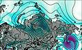
This table gives the weather forecast for Bolshoy-kekuknaysky at the specific elevation of 1401 m. Our advanced weather models allow us to provide distinct weather forecasts for several elevations of Bolshoy-kekuknaysky. To see the weather forecasts for the other elevations, use the tab navigation above the table. For a wider overview of the weather, consult the Weather Map of Russia.
| Weather Station | Temp. | Weather | Wind | Gusts | Cloud / Visibility |
|---|---|---|---|---|---|
Ust - Hajrjuzovo | |||||
Kljuchi | |||||
Sobolevo | |||||
Semyachik | |||||
Ozernoj (Mys) | |||||
Petropavlovsk (32580 -0) |
* NOTE: not all weather observatories update at the same frequency which is the reason why some locations may show data from stations that are further away than known closer ones.