– Lat/Long: 52.80° N 3.67° W
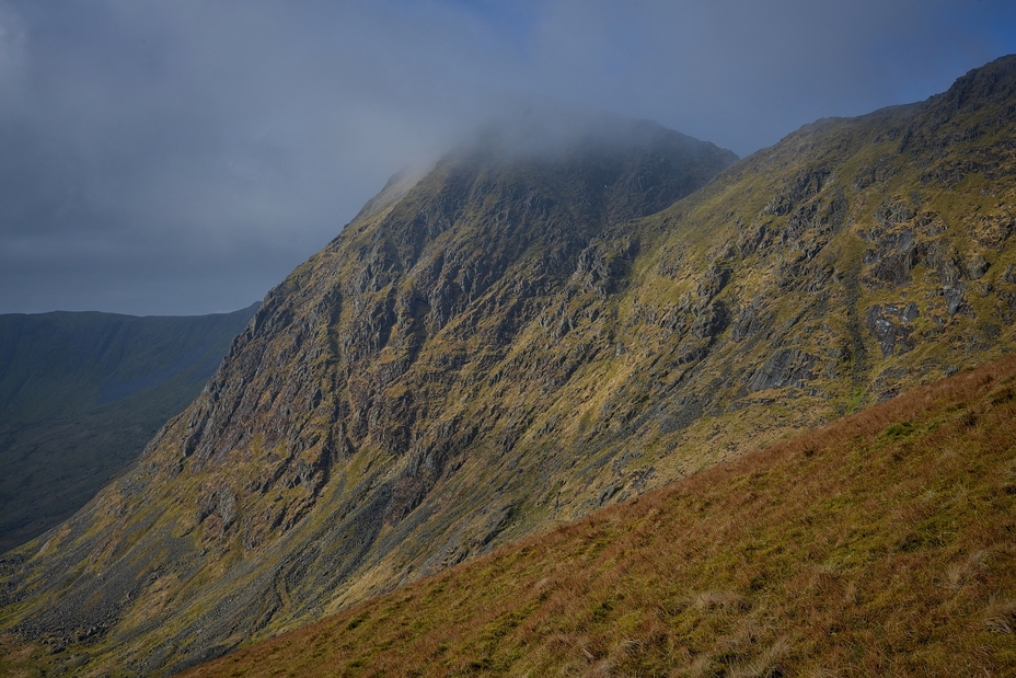
 Aran Fawddwy
Weather Forecast, United KingdomIssued: 6 am Mon 20 Jul Local TimeUpdates in: hr min sUpdate imminent
Issued: 6 am Mon 20 Jul Local Time
Updates in:
Update imminent hr min s

Issued: 6 am Mon 20 Jul Local Time
Updates in:
Update imminent hr min s
Days 1–3 Weather SummaryMostly dry. Very mild (max 17°C on Tue afternoon, min 10°C on Tue night). Wind will be generally light. | Days 4–6 Weather SummarySome drizzle, heaviest during Sat afternoon. Very mild (max 17°C on Thu afternoon, min 6°C on Sat night). Winds increasing (light winds from the NW on Thu morning, strong winds from the WSW by Sat morning). | |||||||||||||||||
Monday 20 | Tuesday 21 | Wednesday 22 | Thursday 23 | Friday 24 | Saturday 25 | |||||||||||||
AM | PM | night | AM | PM | night | AM | PM | night | AM | PM | night | AM | PM | night | AM | PM | night | |
clear | clear | clear | clear | clear | clear | clear | clear | clear | clear | clear | clear | clear | clear | rain shwrs | rain shwrs | rain shwrs | rain shwrs | |
Cloud base (m) | 2950 | 1800 | 8900 | 6300 | 9350 | 9500 | 9250 | 6600 | 2050 | 200 | 350 | |||||||
km/h | ||||||||||||||||||
 |  |  |  |  |  | |||||||||||||
— | — | — | — | — | — | — | — | — | — | — | — | — | — | — | — | — | — | |
mm | — | — | — | — | — | — | — | — | — | — | — | — | — | — | 0.1 | 0.2 | 0.7 | 0.2 |
max °C | 14 | 15 | 12 | 16 | 17 | 12 | 15 | 17 | 13 | 16 | 17 | 14 | 15 | 15 | 12 | 9 | 10 | 9 |
min °C | 13 | 15 | 11 | 15 | 16 | 10 | 14 | 16 | 11 | 15 | 16 | 12 | 15 | 15 | 9 | 9 | 9 | 6 |
chill °C | 12 | 15 | 11 | 15 | 16 | 8 | 14 | 16 | 10 | 14 | 16 | 10 | 14 | 14 | 5 | 5 | 6 | 1 |
Freezing level m | 3200 | 3400 | 3550 | 3700 | 3750 | 3700 | 3700 | 3600 | 3800 | 3700 | 3850 | 3950 | 3750 | 3650 | 3250 | 3100 | 3200 | 3050 |
5:13 | — | — | 5:15 | — | — | 5:16 | — | — | 5:18 | — | — | 5:18 | — | — | 5:20 | — | — | |
— | 9:25 | — | — | 9:24 | — | — | 9:23 | — | — | 9:22 | — | — | 9:21 | — | — | 9:19 | — | |
Loading...
Aran Fawddwy Weather (Days 0-3):
The weather forecast for Aran Fawddwy is: Mostly dry. Very mild (max 17°C on Tue afternoon, min 10°C on Tue night). Wind will be generally light.
Aran Fawddwy Weather (Days 3-6):
Some drizzle, heaviest during Sat afternoon. Very mild (max 17°C on Thu afternoon, min 6°C on Sat night). Winds increasing (light winds from the NW on Thu morning, strong winds from the WSW by Sat morning).
This table gives the weather forecast for Aran Fawddwy at the specific elevation of 911 m. Our advanced weather models allow us to provide distinct weather forecasts for several elevations of Aran Fawddwy. To see the weather forecasts for the other elevations, use the tab navigation above the table. For a wider overview of the weather, consult the Weather Map of United Kingdom.
| Weather Station | Temp. | Weather | Wind | Gusts | Cloud / Visibility |
|---|---|---|---|---|---|
Clatter | |||||
Llangollen | |||||
Caernarfon Airport | |||||
Long Mynd |
* NOTE: not all weather observatories update at the same frequency which is the reason why some locations may show data from stations that are further away than known closer ones.
Aran Fawddwy Photos
View all
Snowdonia photos (206) |
Cambrian Mountains photos (384) |
photos from mountains in United Kingdom (2125) |
all photos
 Upload new photo
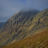
Aran Fawddwy
View from Aran Ridge
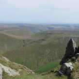
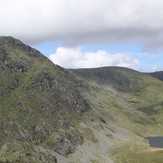
Aran Ridge with Creiglyn Dyfi below
Aran Fawddwy