– Lat/Long: 44.87° N 110.84° W
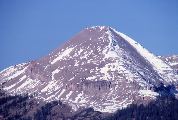
 Antler Peak
Weather Forecast, United StatesIssued: 11 am Sun 19 Jul Local TimeUpdates in: hr min sUpdate imminent
Issued: 11 am Sun 19 Jul Local Time
Updates in:
Update imminent hr min s

Issued: 11 am Sun 19 Jul Local Time
Updates in:
Update imminent hr min s
Days 1–3 Weather SummarySome drizzle, heaviest during Tue afternoon. Warm (max 20°C on Mon afternoon, min 14°C on Mon night). Winds decreasing (fresh winds from the W on Sun afternoon, calm by Tue night). | Days 4–6 Weather SummaryModerate rain (total 10mm), heaviest on Wed night. Warm (max 20°C on Fri afternoon, min 10°C on Wed night). Winds increasing (calm on Wed morning, strong winds from the SW by Fri afternoon). | |||||||||||||||||
Sunday 19 | Monday 20 | Tuesday 21 | Wednesday 22 | Thursday 23 | Friday 24 | |||||||||||||
AM | PM | night | AM | PM | night | AM | PM | night | AM | PM | night | AM | PM | night | AM | PM | night | |
clear | some clouds | some clouds | clear | some clouds | rain shwrs | some clouds | risk tstorm | rain shwrs | some clouds | some clouds | rain shwrs | rain shwrs | risk tstorm | clear | clear | some clouds | rain shwrs | |
Cloud base (m) | 5450 | 5550 | 6600 | 6400 | 5700 | 6050 | 5000 | 4550 | 9300 | 6450 | 2550 | 3050 | 4250 | 4450 | 5500 | 4800 | ||
km/h | ||||||||||||||||||
 |  |  |  |  |  | |||||||||||||
— | — | — | — | — | — | — | — | — | — | — | — | — | — | — | — | — | — | |
mm | — | — | — | — | — | 0.1 | — | 0.7 | 0.3 | — | — | 8 | 0.8 | 0.9 | — | — | — | 0.8 |
max °C | 17 | 19 | 18 | 17 | 20 | 16 | 16 | 18 | 14 | 16 | 18 | 11 | 12 | 15 | 15 | 17 | 20 | 16 |
min °C | 15 | 18 | 16 | 16 | 19 | 14 | 14 | 15 | 14 | 14 | 16 | 10 | 10 | 14 | 15 | 16 | 18 | 15 |
chill °C | 13 | 17 | 16 | 15 | 19 | 12 | 13 | 14 | 13 | 14 | 15 | 8 | 9 | 12 | 15 | 14 | 16 | 13 |
Freezing level m | 5200 | 5350 | 5300 | 5300 | 5600 | 5350 | 5250 | 5500 | 5300 | 5350 | 5500 | 5000 | 4900 | 5250 | 5350 | 5300 | 5600 | 5350 |
5:54 | — | — | 5:54 | — | — | 5:56 | — | — | 5:56 | — | — | 5:58 | — | — | 5:58 | — | — | |
— | — | 9:02 | — | — | 9:01 | — | — | 9:01 | — | — | 9:00 | — | — | 9:00 | — | 8:59 | — | |
Loading...
Antler Peak Weather (Days 0-3):
The weather forecast for Antler Peak is: Some drizzle, heaviest during Tue afternoon. Warm (max 20°C on Mon afternoon, min 14°C on Mon night). Winds decreasing (fresh winds from the W on Sun afternoon, calm by Tue night).
Antler Peak Weather (Days 3-6):
Moderate rain (total 10mm), heaviest on Wed night. Warm (max 20°C on Fri afternoon, min 10°C on Wed night). Winds increasing (calm on Wed morning, strong winds from the SW by Fri afternoon).
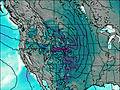
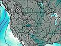
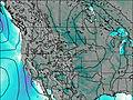
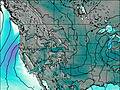
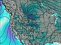
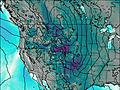
This table gives the weather forecast for Antler Peak at the specific elevation of 3067 m. Our advanced weather models allow us to provide distinct weather forecasts for several elevations of Antler Peak. To see the weather forecasts for the other elevations, use the tab navigation above the table. For a wider overview of the weather, consult the Weather Map of Wyoming.
| Weather Station | Temp. | Weather | Wind | Gusts | Cloud / Visibility |
|---|---|---|---|---|---|
Ennis Big Sky Airport (Montana) | |||||
Livingston Airport |
* NOTE: not all weather observatories update at the same frequency which is the reason why some locations may show data from stations that are further away than known closer ones.
Antler Peak Photos
View all
Rocky Mountains (USA) photos (298) |
photos from mountains in United States (3056) |
all photos
 Upload new photo
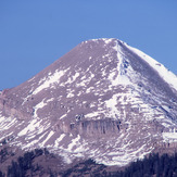
Antler Peak