– Lat/Long: 28.58° N 83.95° E
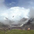
 Annapurna – Climbing, Hiking & Mountaineering information

Annapurna Guide
- Elevation: 8091
- Difficulty: Major Mountain Expedition
- Best months to climb: April, May
- Convenient center: Pokhara, Nepal
Annapurna climbers Notes
|


| Select a
mountain summit from the menu |
||
|
Select a Mountain Summit
|
||
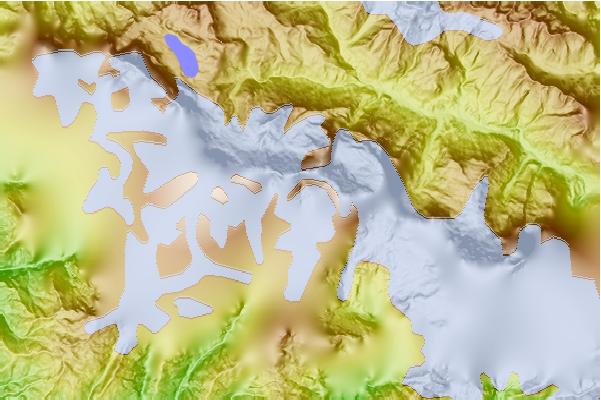

Use this relief map to navigate to mountain peaks in the area of Annapurna.
10 other mountain peaks closest to Annapurna:
| 1. | Gangapurna (7455 m) | 2.4 km |
| 2. | Singu Chuli (6501 m) | 4.9 km |
| 3. | Annapurna Sanctuary (4130 m) | 9.2 km |
| 4. | Machhapuchhare (7000 m) | 9.3 km |
| 5. | Machapuchare (6993 m) | 9.8 km |
| 6. | Hiunchuli (6441 m) | 9.9 km |
| 7. | Tilicho Peak (7134 m) | 18.1 km |
| 8. | Chulu Far East (6059 m) | 21.1 km |
| 9. | Nilgiri Himal (7061 m) | 23.5 km |
| 10. | Pisang Peak (6091 m) | 24.2 km |