
– Lat/Long: 56.70° N 159.65° E
 Alney-chashakondzha
Weather Forecast, RussiaIssued: 11 pm Wed 29 Jul Local TimeUpdates in: hr min sUpdate imminent
Issued: 11 pm Wed 29 Jul Local Time
Updates in:
Update imminent hr min s

Issued: 11 pm Wed 29 Jul Local Time
Updates in:
Update imminent hr min s
Days 1–4 Weather SummaryLight rain (total 4mm), mostly falling on Thu night. Mild temperatures (max 5°C on Fri afternoon, min 1°C on Thu night). Winds decreasing (fresh winds from the W on Thu night, calm by Sat morning). | Days 5–7 Weather SummarySome drizzle, heaviest during Mon afternoon. Mild temperatures (max 5°C on Sat night, min 3°C on Sun night). Wind will be generally light. | ||||||||||||||||||
Thursday 30 | Friday 31 | Saturday 1 | Sunday 2 | Monday 3 | Tuesday 4 | ||||||||||||||
night | AM | PM | night | AM | PM | night | AM | PM | night | AM | PM | night | AM | PM | night | AM | PM | night | |
light rain | rain shwrs | light rain | rain shwrs | rain shwrs | rain shwrs | rain shwrs | some clouds | rain shwrs | rain shwrs | some clouds | clear | clear | rain shwrs | rain shwrs | clear | some clouds | clear | clear | |
Cloud base (m) | 650 | 700 | 650 | 650 | 2200 | 1750 | 8600 | 1600 | 700 | 650 | 700 | 800 | 2900 | 1700 | 2300 | 9300 | 2650 | 1750 | |
km/h | |||||||||||||||||||
 |  |  |  |  |  |  | |||||||||||||
— | — | — | — | — | — | — | — | — | — | — | — | — | — | — | — | — | — | — | |
mm | 1.7 | 0.2 | 0.7 | 1.3 | 0.1 | 0.2 | 0.1 | — | 0.2 | 0.2 | — | — | — | 0.2 | 0.9 | — | — | — | — |
max °C | 3 | 3 | 2 | 3 | 4 | 5 | 5 | 5 | 5 | 5 | 4 | 4 | 4 | 3 | 4 | 4 | 4 | 5 | 5 |
min °C | 2 | 2 | 2 | 1 | 3 | 4 | 4 | 4 | 5 | 4 | 4 | 4 | 3 | 3 | 3 | 4 | 4 | 5 | 5 |
chill °C | -2 | -3 | -3 | -6 | -2 | 0 | 2 | 4 | 4 | 1 | 0 | 1 | 0 | 0 | -2 | -1 | 0 | 1 | 1 |
Freezing level m | 3100 | 3150 | 3100 | 2900 | 3250 | 3300 | 3400 | 3400 | 3550 | 3550 | 3400 | 3350 | 3350 | 3100 | 3100 | 3400 | 3350 | 3350 | 3450 |
— | 5:16 | — | — | 5:18 | — | — | 5:20 | — | — | 5:22 | — | — | 5:24 | — | — | 5:26 | — | — | |
— | — | — | 9:37 | — | — | 9:35 | — | — | 9:32 | — | — | 9:30 | — | — | 9:29 | — | — | 9:27 | |
Loading...
Alney-chashakondzha Weather (Days 0-3):
The weather forecast for Alney-chashakondzha is: Light rain (total 4mm), mostly falling on Thu night. Mild temperatures (max 5°C on Fri afternoon, min 1°C on Thu night). Winds decreasing (fresh winds from the W on Thu night, calm by Sat morning).
Alney-chashakondzha Weather (Days 3-6):
Some drizzle, heaviest during Mon afternoon. Mild temperatures (max 5°C on Sat night, min 3°C on Sun night). Wind will be generally light.
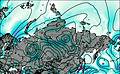
This table gives the weather forecast for Alney-chashakondzha at the specific elevation of 2598 m. Our advanced weather models allow us to provide distinct weather forecasts for several elevations of Alney-chashakondzha. To see the weather forecasts for the other elevations, use the tab navigation above the table. For a wider overview of the weather, consult the Weather Map of Russia.
| Weather Station | Temp. | Weather | Wind | Gusts | Cloud / Visibility |
|---|---|---|---|---|---|
Kljuchi | |||||
Ust - Hajrjuzovo | |||||
Ozernoj (Mys) | |||||
Semyachik | |||||
Sobolevo | |||||
Petropavlovsk (32580 -0) |
* NOTE: not all weather observatories update at the same frequency which is the reason why some locations may show data from stations that are further away than known closer ones.