
– Lat/Long: 45.94° N 7.30° E
 Aiguille du Croissant
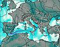
Weather Forecast, ItalyIssued: 7 am Mon 03 Aug Local TimeUpdates in: hr min sUpdate imminent
Issued: 7 am Mon 03 Aug Local Time
Updates in:
Update imminent hr min s

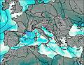
Issued: 7 am Mon 03 Aug Local Time
Updates in:
Update imminent hr min s
Days 1–3 Weather SummaryA light covering of new snow mostly falling on Mon night. Temperatures will be slightly above freezing (max 2°C on Mon morning, min 1°C on Mon night). Wind will be generally light. | Days 4–6 Weather SummaryA light covering of new snow mostly falling on Thu afternoon. Freeze-thaw conditions (max 2°C on Thu afternoon, min -1°C on Thu night). Wind will be generally light. | |||||||||||||||||
Monday 3 | Tuesday 4 | Wednesday 5 | Thursday 6 | Friday 7 | Saturday 8 | |||||||||||||
AM | PM | night | AM | PM | night | AM | PM | night | AM | PM | night | AM | PM | night | AM | PM | night | |
clear | risk tstorm | snow shwrs | clear | snow shwrs | snow shwrs | clear | snow shwrs | snow shwrs | clear | snow shwrs | snow shwrs | clear | clear | clear | clear | clear | clear | |
Cloud base (m) | 3550 | 9750 | 6600 | 3500 | 4900 | 3250 | 2400 | 2550 | 2350 | 2600 | 3450 | |||||||
km/h | ||||||||||||||||||
 |  |  |  |  |  | |||||||||||||
— | — | 2 | — | 2 | 2 | — | 1 | 1 | — | 3 | 3 | — | — | — | — | — | — | |
mm | — | 0.4 | — | — | — | — | — | — | — | — | — | — | — | — | — | — | — | — |
max °C | 2 | 2 | 2 | 1 | 2 | 1 | 1 | 2 | 1 | 1 | 2 | 0 | -1 | 0 | 0 | 0 | 1 | 1 |
min °C | 2 | 2 | 1 | 1 | 2 | 1 | 1 | 1 | 1 | 1 | 0 | -1 | -1 | 0 | 0 | 0 | 1 | 0 |
chill °C | -1 | -2 | -4 | -3 | -3 | -2 | 1 | 1 | -2 | -2 | -4 | -5 | -4 | -3 | -5 | -5 | -4 | -5 |
Freezing level m | 4500 | 4550 | 4450 | 4450 | 4550 | 4400 | 4400 | 4500 | 4450 | 4400 | 4250 | 4200 | 4200 | 4300 | 4300 | 4200 | 4400 | 4350 |
6:13 | — | — | 6:16 | — | — | 6:16 | — | — | 6:18 | — | — | 6:18 | — | — | 6:20 | — | — | |
— | — | 8:58 | — | — | 8:55 | — | — | 8:54 | — | — | 8:53 | — | — | 8:52 | — | — | 8:51 | |
Loading...
Aiguille du Croissant Weather (Days 0-3):
The weather forecast for Aiguille du Croissant is: A light covering of new snow mostly falling on Mon night. Temperatures will be slightly above freezing (max 2°C on Mon morning, min 1°C on Mon night). Wind will be generally light.
Aiguille du Croissant Weather (Days 3-6):
A light covering of new snow mostly falling on Thu afternoon. Freeze-thaw conditions (max 2°C on Thu afternoon, min -1°C on Thu night). Wind will be generally light.
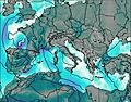
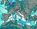
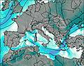
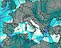
This table gives the weather forecast for Aiguille du Croissant at the specific elevation of 4260 m. Our advanced weather models allow us to provide distinct weather forecasts for several elevations of Aiguille du Croissant. To see the weather forecasts for the other elevations, use the tab navigation above the table. For a wider overview of the weather, consult the Weather Map of Italy.
| Weather Station | Temp. | Weather | Wind | Gusts | Cloud / Visibility |
|---|---|---|---|---|---|
Col DU Grand ST -Bernard | |||||
Montagnier- Bagnes | |||||
Som la Proz | |||||
Croix de Cœur | |||||
Les Attelas | |||||
Evolène Servacresse | |||||
Evolène | |||||
Evolene / Villa |
* NOTE: not all weather observatories update at the same frequency which is the reason why some locations may show data from stations that are further away than known closer ones.