
– Lat/Long: 32.65° S 70.01° W
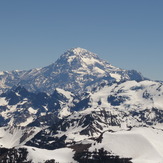
 Aconcagua
Weather Forecast, ArgentinaIssued: 7 am Mon 03 Aug Local TimeUpdates in: hr min sUpdate imminent
Issued: 7 am Mon 03 Aug Local Time
Updates in:
Update imminent hr min s

Issued: 7 am Mon 03 Aug Local Time
Updates in:
Update imminent hr min s
Days 1–3 Weather SummaryMild at first with light rain (total 4mm) on Mon afternoon followed by colder weather and light fall of snow, heaviest on Wed night. Freeze-thaw conditions (max 4°C on Tue morning, min -7°C on Wed night). Wind will be generally light. | Days 4–6 Weather SummaryA dusting of new snow. Temperatures will be below freezing (max -4°C on Thu afternoon, min -15°C on Sat night). Wind will be generally light. | |||||||||||||||||
Monday 3 | Tuesday 4 | Wednesday 5 | Thursday 6 | Friday 7 | Saturday 8 | |||||||||||||
AM | PM | night | AM | PM | night | AM | PM | night | AM | PM | night | AM | PM | night | AM | PM | night | |
light snow | light snow | snow shwrs | rain shwrs | light rain | some clouds | cloudy | cloudy | heavy snow | snow shwrs | clear | some clouds | clear | some clouds | cloudy | some clouds | some clouds | some clouds | |
Cloud base (m) | 4650 | 5050 | 6400 | 7250 | ||||||||||||||
km/h | ||||||||||||||||||
 |  |  |  |  |  | |||||||||||||
1 | 1 | 1 | — | — | — | — | — | 16 | 3 | — | — | — | — | — | — | — | — | |
mm | 1.2 | 1.9 | — | 0.6 | 0.1 | — | — | — | — | — | — | — | — | — | — | — | — | — |
max °C | 2 | 2 | 1 | 4 | 4 | 1 | 2 | 1 | -3 | -7 | -4 | -9 | -8 | -7 | -10 | -9 | -7 | -12 |
min °C | 0 | 2 | 1 | 2 | 3 | 0 | 0 | -2 | -7 | -12 | -7 | -12 | -12 | -9 | -11 | -12 | -9 | -15 |
chill °C | -4 | -1 | -1 | 0 | 1 | -3 | -2 | -7 | -13 | -18 | -12 | -19 | -18 | -16 | -18 | -20 | -16 | -23 |
Freezing level m | 3300 | 3300 | 3100 | 3600 | 3400 | 3050 | 3300 | 2750 | 2200 | 1950 | 1950 | 1650 | 1850 | 1650 | 1400 | 1550 | 1600 | 750 |
7:28 | — | — | 7:28 | — | — | 7:26 | — | — | 7:26 | — | — | 7:24 | — | — | 7:24 | — | — | |
— | 6:02 | — | — | 6:04 | — | — | 6:05 | — | — | 6:05 | — | — | 6:06 | — | — | 6:07 | — | |
Loading...
Aconcagua Weather (Days 0-3):
The weather forecast for Aconcagua is: Mild at first with light rain (total 4mm) on Mon afternoon followed by colder weather and light fall of snow, heaviest on Wed night. Freeze-thaw conditions (max 4°C on Tue morning, min -7°C on Wed night). Wind will be generally light.
Aconcagua Weather (Days 3-6):
A dusting of new snow. Temperatures will be below freezing (max -4°C on Thu afternoon, min -15°C on Sat night). Wind will be generally light.
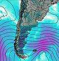
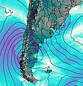
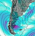
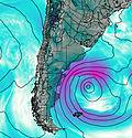
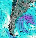
This table gives the weather forecast for Aconcagua at the specific elevation of 3000 m. Our advanced weather models allow us to provide distinct weather forecasts for several elevations of Aconcagua. To see the weather forecasts for the other elevations, use the tab navigation above the table. For a wider overview of the weather, consult the Weather Map of Argentina.
| Weather Station | Temp. | Weather | Wind | Gusts | Cloud / Visibility |
|---|---|---|---|---|---|
Llay Llay- Las Peñas | |||||
Lo Pinto | |||||
Quinta Normal |
* NOTE: not all weather observatories update at the same frequency which is the reason why some locations may show data from stations that are further away than known closer ones.
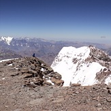
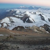
Aconcagua Photos
View all
Central Argentina-Chile photos (482) |
Andes photos (1029) |
photos from mountains in Argentina (251) |
all photos
 Upload new photo
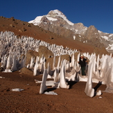


 See 25 more Aconcagua photos
Atardecer en el Monte Aconcagua
Aconcagua Polish Glacier
Summit
Aconcagua Polish route
Camp 3 Colera from the White Rocks.
Aconcagua
Monte Aconcagua