
– Lat/Long: 43.38° S 171.37° E
 A Frame Hut
Weather Forecast, New ZealandIssued: 11 am Wed 10 Sep Local TimeUpdates in: hr min sUpdate imminent
Issued: 11 am Wed 10 Sep Local Time
Updates in:
Update imminent hr min s

Issued: 11 am Wed 10 Sep Local Time
Updates in:
Update imminent hr min s
Days 1–3 Weather SummaryMild at first with light rain (total 3mm) on Wed afternoon followed by colder weather and light fall of snow, heaviest on Wed night. Freeze-thaw conditions (max 4°C on Fri morning, min -3°C on Wed night). Winds increasing (calm on Thu night, fresh winds from the NW by Fri night). | Days 4–6 Weather SummaryA dusting of snow turning to light rain (total 6mm) on Sat morning. Freeze-thaw conditions (max 6°C on Mon night, min 0°C on Sat night). Winds decreasing (strong winds from the NNW on Sat morning, light winds from the NW by Sun afternoon). | |||||||||||||||||
Wednesday 10 | Thursday 11 | Friday 12 | Saturday 13 | Sunday 14 | Monday 15 | |||||||||||||
AM | PM | night | AM | PM | night | AM | PM | night | AM | PM | night | AM | PM | night | AM | PM | night | |
snow shwrs | light snow | snow shwrs | clear | clear | some clouds | some clouds | clear | some clouds | snow shwrs | rain shwrs | some clouds | clear | rain shwrs | clear | some clouds | some clouds | rain shwrs | |
km/h | ||||||||||||||||||
 |  |  |  |  |  | |||||||||||||
2 | 2 | 9 | — | — | — | — | — | — | 1 | — | — | — | — | — | — | — | — | |
— | 3 | — | — | — | — | — | — | — | 6 | 0.1 | — | — | 0.2 | — | — | — | 0.3 | |
max°C | 2 | 2 | -2 | 0 | 1 | 1 | 4 | 4 | 1 | 3 | 3 | 2 | 4 | 5 | 4 | 5 | 5 | 6 |
min°C | 2 | 0 | -3 | -2 | 1 | 0 | 2 | 3 | 0 | 2 | 1 | 0 | 4 | 4 | 3 | 4 | 5 | 5 |
-3 | -2 | -7 | -6 | -3 | -4 | 2 | 3 | -2 | -5 | -3 | -5 | 1 | 2 | -2 | 0 | 1 | 1 | |
1350 | 1350 | 650 | 800 | 1200 | 950 | 1450 | 1800 | 1100 | 1350 | 1450 | 950 | 1650 | 1750 | 1800 | 1900 | 2100 | 2000 | |
Cloud base (m) | 700 | 1550 | 600 | 650 | 750 | 800 | 6550 | 550 | 600 | 600 | 1600 | 1750 | 1550 | 1700 | 900 | 1650 | ||
6:46 | — | — | 6:43 | — | — | 6:41 | — | — | 6:39 | — | — | 6:37 | — | — | 6:37 | — | — | |
— | 6:16 | — | — | 6:17 | — | — | 6:19 | — | — | 6:21 | — | — | 6:22 | — | — | 6:22 | — | |
Loading...
A Frame Hut Weather (Days 0-3):
The weather forecast for A Frame Hut is: Mild at first with light rain (total 3mm) on Wed afternoon followed by colder weather and light fall of snow, heaviest on Wed night. Freeze-thaw conditions (max 4°C on Fri morning, min -3°C on Wed night). Winds increasing (calm on Thu night, fresh winds from the NW by Fri night).
A Frame Hut Weather (Days 3-6):
A dusting of snow turning to light rain (total 6mm) on Sat morning. Freeze-thaw conditions (max 6°C on Mon night, min 0°C on Sat night). Winds decreasing (strong winds from the NNW on Sat morning, light winds from the NW by Sun afternoon).
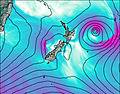
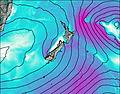
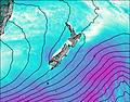
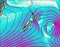
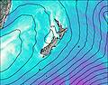
This table gives the weather forecast for A Frame Hut at the specific elevation of 1039 m. Our advanced weather models allow us to provide distinct weather forecasts for several elevations of A Frame Hut. To see the weather forecasts for the other elevations, use the tab navigation above the table. For a wider overview of the weather, consult the Weather Map of New Zealand.
* NOTE: not all weather observatories update at the same frequency which is the reason why some locations may show data from stations that are further away than known closer ones.