
– Lat/Long: 42.24° S 171.41° E
 Moonlight Tops Hut
Weather Forecast, New ZealandIssued: 5 am Wed 29 Jul Local TimeUpdates in: hr min sUpdate imminent
Issued: 5 am Wed 29 Jul Local Time
Updates in:
Update imminent hr min s

Issued: 5 am Wed 29 Jul Local Time
Updates in:
Update imminent hr min s
Days 1–3 Weather SummaryHeavy rain (total 32mm), heaviest during Thu afternoon. Later becoming colder with a dusting of snow on Fri morning. Freeze-thaw conditions (max 5°C on Wed afternoon, min -2°C on Fri night). Winds increasing (light winds from the WNW on Wed morning, gales from the W by Fri morning). | Days 4–6 Weather SummaryMostly dry. Freeze-thaw conditions (max 5°C on Sun afternoon, min -2°C on Sat morning). Mainly fresh winds. | |||||||||||||||||
Wednesday 29 | Thursday 30 | Friday 31 | Saturday 1 | Sunday 2 | Monday 3 | |||||||||||||
AM | PM | night | AM | PM | night | AM | PM | night | AM | PM | night | AM | PM | night | AM | PM | night | |
some clouds | rain shwrs | rain shwrs | rain shwrs | heavy rain | heavy rain | light snow | light snow | some clouds | clear | clear | clear | clear | clear | cloudy | light rain | light rain | rain shwrs | |
Cloud base (m) | 800 | 750 | 1650 | 600 | 350 | 400 | 200 | 200 | 550 | 1550 | 1750 | 900 | 6250 | 400 | 700 | 500 | ||
km/h | ||||||||||||||||||
 |  |  |  |  |  | |||||||||||||
— | — | — | — | — | — | 2 | 2 | — | — | — | — | — | — | — | — | — | — | |
mm | — | 0.1 | 0.1 | 0.3 | 16 | 14 | 1.6 | — | — | — | — | — | — | — | — | 0.2 | 0.2 | 0.1 |
max °C | 4 | 5 | 4 | 5 | 4 | 4 | 2 | 2 | 1 | -2 | -1 | 1 | 4 | 5 | 2 | 3 | 3 | 3 |
min °C | 3 | 4 | 4 | 4 | 4 | 2 | 1 | 1 | -2 | -2 | -2 | -2 | 2 | 3 | 1 | 2 | 3 | 1 |
chill °C | 1 | 2 | 1 | -1 | -3 | -6 | -8 | -7 | -10 | -10 | -4 | -5 | -1 | 1 | -5 | -4 | -2 | -2 |
Freezing level m | 1700 | 1750 | 1750 | 1700 | 1700 | 1450 | 1350 | 1200 | 1050 | 650 | 900 | 650 | 1650 | 1800 | 1350 | 1400 | 1400 | 1400 |
7:47 | — | — | 7:46 | — | — | 7:45 | — | — | 7:43 | — | — | 7:43 | — | — | 7:41 | — | — | |
— | 5:34 | — | — | 5:35 | — | — | 5:36 | — | — | 5:37 | — | — | 5:37 | — | — | 5:38 | — | |
Loading...
Moonlight Tops Hut Weather (Days 0-3):
The weather forecast for Moonlight Tops Hut is: Heavy rain (total 32mm), heaviest during Thu afternoon. Later becoming colder with a dusting of snow on Fri morning. Freeze-thaw conditions (max 5°C on Wed afternoon, min -2°C on Fri night). Winds increasing (light winds from the WNW on Wed morning, gales from the W by Fri morning).
Moonlight Tops Hut Weather (Days 3-6):
Mostly dry. Freeze-thaw conditions (max 5°C on Sun afternoon, min -2°C on Sat morning). Mainly fresh winds.
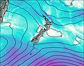
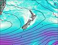
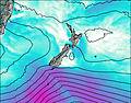
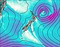
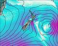
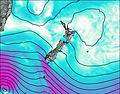
This table gives the weather forecast for Moonlight Tops Hut at the specific elevation of 1010 m. Our advanced weather models allow us to provide distinct weather forecasts for several elevations of Moonlight Tops Hut. To see the weather forecasts for the other elevations, use the tab navigation above the table. For a wider overview of the weather, consult the Weather Map of New Zealand.
| Weather Station | Temp. | Weather | Wind | Gusts | Cloud / Visibility |
|---|---|---|---|---|---|
Ratanui | |||||
Nelson Creek | |||||
Ahaura Rv at Gorge | |||||
Lake Brunner | |||||
Charleston | |||||
Powerhouse Rd | |||||
* NOTE: not all weather observatories update at the same frequency which is the reason why some locations may show data from stations that are further away than known closer ones.