
– Lat/Long: 58.99° N 6.61° E
 Langavatn
Weather Forecast, NorwayIssued: 1 am Sun 05 Jul Local TimeUpdates in: hr min sUpdate imminent
Issued: 1 am Sun 05 Jul Local Time
Updates in:
Update imminent hr min s

Issued: 1 am Sun 05 Jul Local Time
Updates in:
Update imminent hr min s
Days 1–3 Weather SummaryMostly dry. Mild temperatures (max 7°C on Tue night, min 2°C on Sun night). Mainly near gales. | Days 4–6 Weather SummaryMostly dry. Very mild (max 17°C on Fri afternoon, min 8°C on Wed morning). Winds decreasing (strong winds from the NW on Wed night, calm by Fri night). | |||||||||||||||||
Sunday 5 | Monday 6 | Tuesday 7 | Wednesday 8 | Thursday 9 | Friday 10 | |||||||||||||
AM | PM | night | AM | PM | night | AM | PM | night | AM | PM | night | AM | PM | night | AM | PM | night | |
rain shwrs | clear | some clouds | clear | clear | cloudy | some clouds | cloudy | some clouds | some clouds | some clouds | cloudy | cloudy | some clouds | some clouds | clear | clear | clear | |
km/h | ||||||||||||||||||
 |  |  |  |  |  | |||||||||||||
— | — | — | — | — | — | — | — | — | — | — | — | — | — | — | — | — | — | |
mm | 0.1 | — | — | — | — | — | — | — | — | — | — | — | — | — | — | — | — | — |
max °C | 5 | 5 | 4 | 5 | 6 | 6 | 4 | 5 | 7 | 8 | 9 | 9 | 10 | 12 | 13 | 15 | 17 | 17 |
min °C | 3 | 5 | 2 | 4 | 6 | 4 | 4 | 5 | 5 | 8 | 9 | 8 | 9 | 12 | 13 | 14 | 17 | 15 |
chill °C | -4 | -1 | -3 | 0 | 2 | 1 | 0 | -2 | 0 | 4 | 5 | 4 | 5 | 10 | 12 | 14 | 17 | 15 |
Freezing level m | 1700 | 1800 | 1400 | 1900 | 2300 | 2350 | 1700 | 2450 | 3000 | 2950 | 3450 | 3250 | 3600 | 3750 | 3700 | 3650 | 3650 | 3600 |
Cloud base (m) | 650 | 1500 | 750 | 1500 | 2300 | 550 | 1450 | 650 | 1800 | 5000 | 550 | 550 | 850 | 600 | 9350 | |||
4:31 | — | — | 4:31 | — | — | 4:33 | — | — | 4:35 | — | — | 4:35 | — | — | 4:37 | — | — | |
— | — | 10:44 | — | — | 10:43 | — | — | 10:42 | — | — | 10:40 | — | — | 10:39 | — | — | 10:37 | |
Loading...
Langavatn Weather (Days 0-3):
The weather forecast for Langavatn is: Mostly dry. Mild temperatures (max 7°C on Tue night, min 2°C on Sun night). Mainly near gales.
Langavatn Weather (Days 3-6):
Mostly dry. Very mild (max 17°C on Fri afternoon, min 8°C on Wed morning). Winds decreasing (strong winds from the NW on Wed night, calm by Fri night).
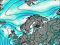
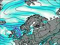
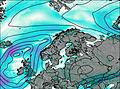
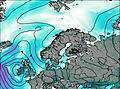
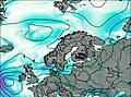
This table gives the weather forecast for Langavatn at the specific elevation of 1001 m. Our advanced weather models allow us to provide distinct weather forecasts for several elevations of Langavatn. To see the weather forecasts for the other elevations, use the tab navigation above the table. For a wider overview of the weather, consult the Weather Map of Norway.