
– Lat/Long: 42.72° S 171.90° E
 Harper Pass Bivvy
Weather Forecast, New ZealandIssued: 11 am Wed 01 Jul Local TimeUpdates in: hr min sUpdate imminent
Issued: 11 am Wed 01 Jul Local Time
Updates in:
Update imminent hr min s

Issued: 11 am Wed 01 Jul Local Time
Updates in:
Update imminent hr min s
Days 1–3 Weather SummarySome drizzle, heaviest during Thu night. Mild temperatures (max 6°C on Wed morning, min 3°C on Wed night). Winds increasing (calm on Wed morning, fresh winds from the NNW by Fri night). | Days 4–6 Weather SummaryHeavy rain (total 68mm) on Sat afternoon. Becoming colder with heavy fall of snow, heaviest during Mon night. Freeze-thaw conditions (max 6°C on Sat morning, min -1°C on Sun night). Winds increasing (calm on Sun afternoon, near gales from the SSE by Mon morning). | |||||||||||||||||
Wednesday 1 | Thursday 2 | Friday 3 | Saturday 4 | Sunday 5 | Monday 6 | |||||||||||||
AM | PM | night | AM | PM | night | AM | PM | night | AM | PM | night | AM | PM | night | AM | PM | night | |
some clouds | some clouds | some clouds | some clouds | clear | rain shwrs | rain shwrs | rain shwrs | rain shwrs | mod. rain | heavy rain | heavy rain | mod. rain | mod. rain | cloudy | light snow | mod. snow | heavy snow | |
km/h | ||||||||||||||||||
 |  |  |  |  |  | |||||||||||||
— | — | — | — | — | — | — | — | — | — | — | — | — | — | — | 5 | 10 | 22 | |
mm | — | — | — | — | — | 0.5 | 0.5 | 0.1 | 0.7 | 7 | 29 | 17 | 10 | 5 | — | — | — | — |
max °C | 6 | 6 | 4 | 5 | 6 | 4 | 5 | 5 | 6 | 6 | 6 | 5 | 3 | 3 | 1 | 1 | 1 | 2 |
min °C | 5 | 5 | 3 | 4 | 4 | 4 | 4 | 5 | 5 | 5 | 5 | 3 | 2 | 2 | -1 | 1 | 1 | 0 |
chill °C | 5 | 4 | 1 | 2 | 2 | 2 | 1 | 2 | 2 | 0 | -1 | -2 | 0 | 1 | -6 | -7 | -7 | -5 |
Freezing level m | 1600 | 1750 | 1750 | 1550 | 1550 | 2050 | 1900 | 1650 | 2000 | 1800 | 1800 | 1250 | 1300 | 1300 | 900 | 1000 | 1050 | 900 |
Cloud base (m) | 1000 | 1600 | 1000 | 950 | 1000 | 850 | 750 | 800 | 750 | 800 | 700 | 700 | 700 | 650 | 700 | 700 | 650 | 700 |
8:03 | — | — | 8:03 | — | — | 8:03 | — | — | 8:03 | — | — | 8:02 | — | — | 8:02 | — | — | |
— | 5:07 | — | — | 5:08 | — | — | 5:08 | — | — | 5:09 | — | — | 5:10 | — | — | 5:10 | — | |
Loading...
Harper Pass Bivvy Weather (Days 0-3):
The weather forecast for Harper Pass Bivvy is: Some drizzle, heaviest during Thu night. Mild temperatures (max 6°C on Wed morning, min 3°C on Wed night). Winds increasing (calm on Wed morning, fresh winds from the NNW by Fri night).
Harper Pass Bivvy Weather (Days 3-6):
Heavy rain (total 68mm) on Sat afternoon. Becoming colder with heavy fall of snow, heaviest during Mon night. Freeze-thaw conditions (max 6°C on Sat morning, min -1°C on Sun night). Winds increasing (calm on Sun afternoon, near gales from the SSE by Mon morning).
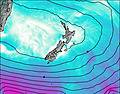
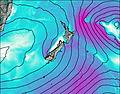
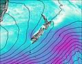
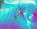
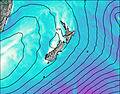
This table gives the weather forecast for Harper Pass Bivvy at the specific elevation of 840 m. Our advanced weather models allow us to provide distinct weather forecasts for several elevations of Harper Pass Bivvy. To see the weather forecasts for the other elevations, use the tab navigation above the table. For a wider overview of the weather, consult the Weather Map of New Zealand.