– Lat/Long: 37.90° N 81.11° W
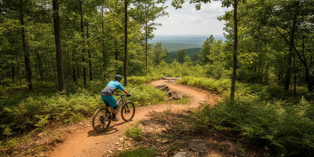
 The Summit Bechtel Reserve Bike Park
Weather Forecast, United StatesIssued: 7 pm Fri 31 Jul Local TimeUpdates in: hr min sUpdate imminent
Issued: 7 pm Fri 31 Jul Local Time
Updates in:
Update imminent hr min s

Issued: 7 pm Fri 31 Jul Local Time
Updates in:
Update imminent hr min s
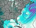
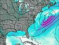
Days 1–4 Weather SummaryModerate rain (total 17mm), heaviest on Sun night. Warm (max 24°C on Sat afternoon, min 20°C on Fri night). Winds increasing (calm on Fri night, strong winds from the S by Sat night). | Days 5–7 Weather SummaryHeavy rain (total 25mm), heaviest during Tue afternoon. Warm (max 26°C on Thu afternoon, min 19°C on Tue night). Wind will be generally light. | ||||||||||||||||||
Saturday 1 | Sunday 2 | Monday 3 | Tuesday 4 | Wednesday 5 | Thursday 6 | ||||||||||||||
night | AM | PM | night | AM | PM | night | AM | PM | night | AM | PM | night | AM | PM | night | AM | PM | night | |
some clouds | some clouds | light rain | rain shwrs | rain shwrs | risk tstorm | risk tstorm | rain shwrs | risk tstorm | risk tstorm | rain shwrs | mod. rain | risk tstorm | rain shwrs | risk tstorm | risk tstorm | rain shwrs | some clouds | clear | |
Cloud base (m) | 6950 | 5300 | 2450 | 2800 | 550 | 1550 | 450 | 1550 | 6000 | 5650 | 2550 | 5500 | 4650 | 8350 | 2400 | 2850 | |||
km/h | |||||||||||||||||||
 |  |  |  |  |  |  | |||||||||||||
— | — | — | — | — | — | — | — | — | — | — | — | — | — | — | — | — | — | — | |
mm | — | — | 0.1 | 2 | 3 | 1.8 | 5 | 2 | 3 | 4 | 0.1 | 7 | 4 | 1.8 | 5 | 3 | 0.1 | — | — |
max °C | 22 | 23 | 24 | 23 | 21 | 23 | 22 | 21 | 23 | 22 | 23 | 24 | 22 | 22 | 23 | 22 | 25 | 26 | 25 |
min °C | 20 | 20 | 24 | 20 | 20 | 23 | 20 | 20 | 22 | 20 | 20 | 23 | 19 | 20 | 23 | 20 | 21 | 25 | 22 |
chill °C | 20 | 20 | 24 | 19 | 20 | 23 | 20 | 20 | 22 | 20 | 20 | 23 | 19 | 20 | 23 | 20 | 21 | 25 | 22 |
Freezing level m | 4850 | 4700 | 4750 | 4750 | 4550 | 4700 | 4550 | 4500 | 4500 | 4450 | 4400 | 4450 | 4550 | 4450 | 4550 | 4600 | 4550 | 4600 | 4750 |
— | 6:26 | — | — | 6:28 | — | — | 6:28 | — | — | 6:30 | — | — | 6:31 | — | — | 6:31 | — | — | |
— | — | — | 8:32 | — | — | 8:31 | — | — | 8:30 | — | — | 8:29 | — | — | 8:28 | — | — | 8:27 | |
Loading...
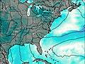
The Summit Bechtel Reserve Weather (Days 0-3):
The weather forecast for The Summit Bechtel Reserve is: Moderate rain (total 17mm), heaviest on Sun night. Warm (max 24°C on Sat afternoon, min 20°C on Fri night). Winds increasing (calm on Fri night, strong winds from the S by Sat night).
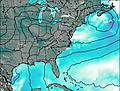
The Summit Bechtel Reserve Weather (Days 3-6):
Heavy rain (total 25mm), heaviest during Tue afternoon. Warm (max 26°C on Thu afternoon, min 19°C on Tue night). Wind will be generally light.
This table gives the weather forecast for The Summit Bechtel Reserve at the specific elevation of 804 m. Our advanced weather models allow us to provide distinct weather forecasts for several elevations of The Summit Bechtel Reserve. To see the weather forecasts for the other elevations, use the tab navigation above the table. For a wider overview of the weather, consult the Weather Map of Virginia.
| Weather Station | Temp. | Weather | Wind | Gusts | Cloud / Visibility |
|---|---|---|---|---|---|
Beckley Airport | |||||
Lewisbur / reenbrier Valley Airport | |||||
Bluefield Airport | |||||
Charleston Airport | |||||
Dubli / ew River Valley Airport | |||||
Sutto / raxton | |||||
Blacksbur / irginia Tech Montgomery Executive Airport | |||||
Richlands Airport |
* NOTE: not all weather observatories update at the same frequency which is the reason why some locations may show data from stations that are further away than known closer ones.