
– Lat/Long: 45.65° N 75.93° W
 Centre Vorlage Bike Park
Weather Forecast, CanadaIssued: 1 pm Thu 02 Jul Local TimeUpdates in: hr min sUpdate imminent
Issued: 1 pm Thu 02 Jul Local Time
Updates in:
Update imminent hr min s

Issued: 1 pm Thu 02 Jul Local Time
Updates in:
Update imminent hr min s
Days 1–4 Weather SummarySome drizzle, heaviest during Fri afternoon. Warm (max 32°C on Thu afternoon, min 15°C on Sat night). Wind will be generally light. | Days 5–7 Weather SummaryModerate rain (total 14mm), heaviest on Mon afternoon. Warm (max 25°C on Sun afternoon, min 14°C on Tue night). Wind will be generally light. | ||||||||||||||||
Thu 2 | Friday 3 | Saturday 4 | Sunday 5 | Monday 6 | Tuesday 7 | ||||||||||||
PM | night | AM | PM | night | AM | PM | night | AM | PM | night | AM | PM | night | AM | PM | night | |
rain shwrs | rain shwrs | some clouds | light rain | rain shwrs | clear | clear | some clouds | cloudy | cloudy | some clouds | light rain | mod. rain | light rain | light rain | some clouds | clear | |
km/h | |||||||||||||||||
 |  |  |  |  |  | ||||||||||||
— | — | — | — | — | — | — | — | — | — | — | — | — | — | — | — | — | |
mm | 0.3 | 0.1 | — | 0.5 | 0.3 | — | — | — | — | — | — | 0.5 | 9 | 4 | 0.1 | — | — |
max °C | 32 | 28 | 28 | 30 | 23 | 22 | 26 | 22 | 23 | 25 | 21 | 18 | 18 | 17 | 16 | 20 | 19 |
min °C | 30 | 20 | 24 | 25 | 17 | 17 | 25 | 15 | 18 | 24 | 16 | 18 | 17 | 15 | 15 | 18 | 14 |
chill °C | 30 | 20 | 24 | 25 | 17 | 17 | 25 | 15 | 18 | 24 | 16 | 18 | 17 | 14 | 14 | 18 | 14 |
Freezing level m | 4550 | 4550 | 4450 | 4350 | 4200 | 3950 | 3900 | 4100 | 4250 | 4150 | 4100 | 4000 | 4050 | 3850 | 3800 | 3900 | 4000 |
Cloud base (m) | 2050 | 4700 | 2850 | 9150 | 7300 | 6900 | 6650 | 6200 | 2150 | 200 | 200 | 600 | 600 | 200 | |||
— | — | 5:18 | — | — | 5:20 | — | — | 5:20 | — | — | 5:20 | — | — | 5:22 | — | — | |
— | 8:55 | — | — | 8:55 | — | — | 8:54 | — | — | 8:54 | — | — | 8:54 | — | — | 8:53 | |
Loading...
Centre Vorlage Weather (Days 0-3):
The weather forecast for Centre Vorlage is: Some drizzle, heaviest during Fri afternoon. Warm (max 32°C on Thu afternoon, min 15°C on Sat night). Wind will be generally light.
Centre Vorlage Weather (Days 3-6):
Moderate rain (total 14mm), heaviest on Mon afternoon. Warm (max 25°C on Sun afternoon, min 14°C on Tue night). Wind will be generally light.
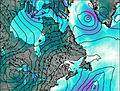
This table gives the weather forecast for Centre Vorlage at the specific elevation of 114 m. Our advanced weather models allow us to provide distinct weather forecasts for several elevations of Centre Vorlage. To see the weather forecasts for the other elevations, use the tab navigation above the table. For a wider overview of the weather, consult the Weather Map of Quebec.
| Weather Station | Temp. | Weather | Wind | Gusts | Cloud / Visibility |
|---|---|---|---|---|---|
Gatineau Airport | |||||
Ottawa Cda Rcs- Ont | |||||
Ottawa Macdonald -Cartier Int l A- Ont | |||||
Ottawa International Airport | |||||
Maniwaki Airport- Que | |||||
lightning 19km WSW of Carleton Place | |||||
Kemptville Airport | |||||
lightning 20km NW of Perth |
* NOTE: not all weather observatories update at the same frequency which is the reason why some locations may show data from stations that are further away than known closer ones.