
– Lat/Long: 11.73° N 85.82° W
 Zapatera
Weather Forecast, NicaraguaIssued: 5 pm Sun 02 Aug Local TimeUpdates in: hr min sUpdate imminent
Issued: 5 pm Sun 02 Aug Local Time
Updates in:
Update imminent hr min s

Issued: 5 pm Sun 02 Aug Local Time
Updates in:
Update imminent hr min s
Days 1–4 Weather SummaryModerate rain (total 18mm), heaviest on Sun night. Warm (max 31°C on Tue afternoon, min 26°C on Sun night). Mainly fresh winds. | Days 5–7 Weather SummaryHeavy rain (total 24mm), heaviest during Thu afternoon. Warm (max 31°C on Wed afternoon, min 25°C on Wed night). Mainly strong winds. | ||||||||||||||||
Sun 2 | Monday 3 | Tuesday 4 | Wednesday 5 | Thursday 6 | Friday 7 | ||||||||||||
PM | night | AM | PM | night | AM | PM | night | AM | PM | night | AM | PM | night | AM | PM | night | |
risk tstorm | risk tstorm | rain shwrs | risk tstorm | risk tstorm | rain shwrs | risk tstorm | risk tstorm | risk tstorm | risk tstorm | risk tstorm | risk tstorm | risk tstorm | risk tstorm | rain shwrs | risk tstorm | some clouds | |
Cloud base (m) | 700 | 850 | 800 | 5500 | 800 | 1550 | 6600 | 1800 | 350 | 800 | 2650 | 550 | 750 | 650 | |||
km/h | |||||||||||||||||
 |  |  |  |  |  | ||||||||||||
— | — | — | — | — | — | — | — | — | — | — | — | — | — | — | — | — | |
mm | 0.3 | 6 | 0.2 | 1.6 | 1.4 | 0.1 | 0.5 | 7 | 0.9 | 1.8 | 8 | 1.7 | 10 | 0.6 | 0.4 | 0.9 | — |
max °C | 30 | 27 | 29 | 30 | 27 | 30 | 31 | 28 | 30 | 31 | 27 | 29 | 28 | 26 | 28 | 27 | 26 |
min °C | 28 | 26 | 28 | 29 | 26 | 28 | 31 | 26 | 28 | 29 | 25 | 27 | 27 | 25 | 27 | 26 | 25 |
chill °C | 28 | 26 | 28 | 29 | 26 | 28 | 31 | 26 | 28 | 29 | 25 | 27 | 27 | 25 | 27 | 26 | 25 |
Freezing level m | 5150 | 5000 | 5000 | 5050 | 5150 | 5100 | 5000 | 4950 | 4900 | 4950 | 4900 | 4850 | 4800 | 4850 | 4950 | 4950 | 4900 |
— | — | 5:30 | — | — | 5:31 | — | — | 5:31 | — | — | 5:31 | — | — | 5:31 | — | — | |
6:07 | — | — | 6:07 | — | — | 6:07 | — | — | 6:07 | — | — | 6:06 | — | — | 6:06 | — | |
Loading...
Zapatera Weather (Days 0-3):
The weather forecast for Zapatera is: Moderate rain (total 18mm), heaviest on Sun night. Warm (max 31°C on Tue afternoon, min 26°C on Sun night). Mainly fresh winds.
Zapatera Weather (Days 3-6):
Heavy rain (total 24mm), heaviest during Thu afternoon. Warm (max 31°C on Wed afternoon, min 25°C on Wed night). Mainly strong winds.
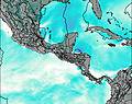
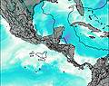
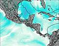
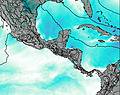
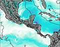
This table gives the weather forecast for Zapatera at the specific elevation of 103 m. Our advanced weather models allow us to provide distinct weather forecasts for several elevations of Zapatera. To see the weather forecasts for the other elevations, use the tab navigation above the table. For a wider overview of the weather, consult the Weather Map of Nicaragua.
| Weather Station | Temp. | Weather | Wind | Gusts | Cloud / Visibility |
|---|---|---|---|---|---|
Bluefields Airport | |||||
Liberi / omas Guardia Airport | |||||
Jinotega Airport | |||||
lightning 44km E of La Cruz de Rio Grande |
* NOTE: not all weather observatories update at the same frequency which is the reason why some locations may show data from stations that are further away than known closer ones.