JMK from UNITED STATES writes:
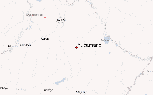
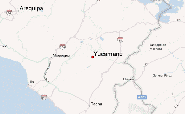
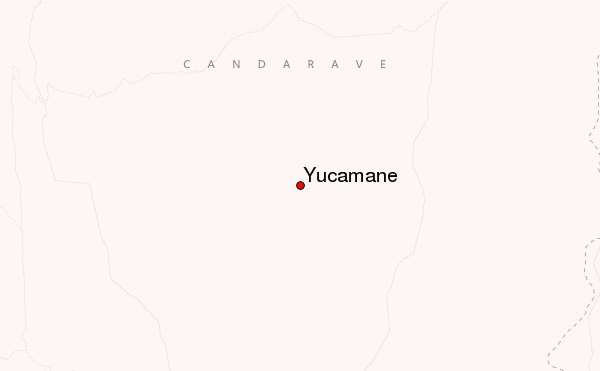
People who climb Yucamane (-17.182732, -70.1983260), or its sister volcano Tutupaca, can use the town of Candarave (-17.269573, -70.252617) as a base. There is bus service to and from Tacna. Candarave has a simple hotel and facilities. Inquire at the Town Hall for a guide to help you get to the proper trailhead (-17.248142, -70.229029). This is less than straightforward, since there are many small trails, and ravines, that impede a purely linear approach. However, the adventurous can simply walk the winding road that leaves Candarave at -17.267739, -70.248998 (next to the church), which zig-zags through a big ravine, passes through a small neighboring village. Turn left at the plaza (-17.259473, -70.233974), continue north 1km, turn right at -17.254738, -70.232653, follow the trail that traverses another ravine, turn left at -17.253731, -70.224974, then follow your nose. The trail will pass a water storage pond, then forks. Take the path to the right. The last (and tiny) human habitation is at -17.245023, -70.227264.
Since the 14km hike from Candarave to the trailhead can consume almost 4 hours, it might be best to camp near the trailhead, then start the climb the next morning. Alternatively, you might hire a mototaxi or combi in Candarave, and complete the climb in one day, but the drivers will expect double fare, and a tip of from 50 to 100 soles,, if you want someone to wait for you at the village. It would require an ATV, AWD, or dirt bike to reach the trailhead itself on wheels.
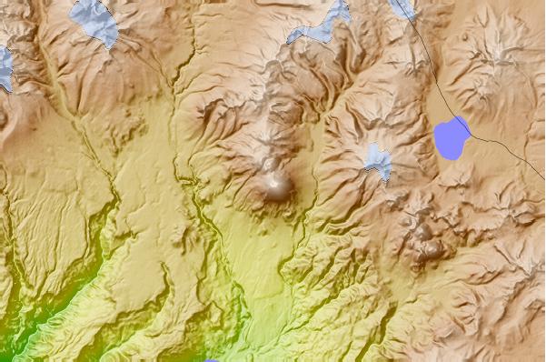
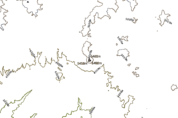
The ascent proper is rather simple, provided one is acclimatized, following a path of volcanic cinders. The path is all up and up. There are almost no switchbacks. The main hazard is to slip and fall onto loose and abrasive cinders, particularly during the descent. The weather tends to be clear in June and cloudy in Dec-Feb, with occasionally significant snowfall. The summit can be almost bare in June-Aug. But it will always feel chilly or downright cold. Excellent views.
2018-06-06 |
 Yucamane – Climbing, Hiking & Mountaineering information