– Lat/Long: 62.18° N 10.69° E
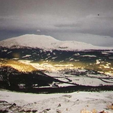
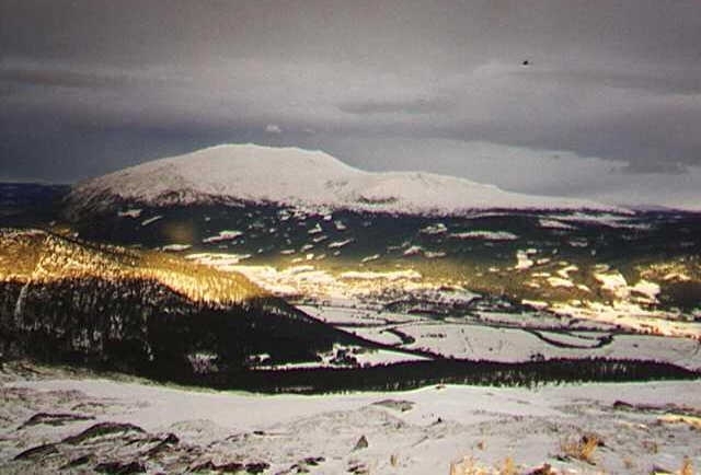
 Tronfjell
Weather Forecast, NorwayIssued: 1 am Mon 03 Aug Local TimeUpdates in: hr min sUpdate imminent
Issued: 1 am Mon 03 Aug Local Time
Updates in:
Update imminent hr min s

Issued: 1 am Mon 03 Aug Local Time
Updates in:
Update imminent hr min s
Days 1–3 Weather SummaryLight rain (total 6mm), mostly falling on Wed night. Mild temperatures (max 7°C on Tue night, min 2°C on Mon morning). Wind will be generally light. | Days 4–6 Weather SummaryHeavy rain (total 30mm), heaviest during Thu afternoon. Later becoming colder with a dusting of snow on Fri night. Mild temperatures (max 6°C on Thu morning, min 2°C on Fri morning). Winds increasing (calm on Fri afternoon, strong winds from the S by Sat afternoon). | |||||||||||||||||
Monday 3 | Tuesday 4 | Wednesday 5 | Thursday 6 | Friday 7 | Saturday 8 | |||||||||||||
AM | PM | night | AM | PM | night | AM | PM | night | AM | PM | night | AM | PM | night | AM | PM | night | |
some clouds | some clouds | some clouds | some clouds | cloudy | light rain | light rain | light rain | light rain | light rain | heavy rain | rain shwrs | clear | some clouds | light snow | light rain | light rain | mod. rain | |
Cloud base (m) | 2600 | 2450 | 2250 | 1850 | 2100 | 1700 | 500 | 500 | 500 | 450 | 500 | 850 | 850 | 2250 | 800 | 600 | 1350 | 450 |
km/h | ||||||||||||||||||
 |  |  |  |  |  | |||||||||||||
— | — | — | — | — | — | — | — | — | — | — | — | — | — | 1 | — | — | — | |
mm | — | — | — | — | — | 2 | 0.2 | 0.6 | 3 | 4 | 14 | 2 | — | — | 3 | 0.1 | 0.7 | 6 |
max °C | 3 | 5 | 4 | 3 | 6 | 7 | 5 | 6 | 7 | 6 | 6 | 5 | 3 | 6 | 5 | 2 | 4 | 3 |
min °C | 2 | 4 | 2 | 2 | 5 | 4 | 4 | 5 | 6 | 6 | 6 | 3 | 2 | 5 | 2 | 2 | 3 | 2 |
chill °C | -2 | -1 | 0 | 0 | 3 | 0 | 1 | 2 | 3 | 5 | 3 | -3 | -3 | 3 | 0 | -1 | -4 | -3 |
Freezing level m | 2050 | 2200 | 2000 | 2250 | 2550 | 2600 | 3050 | 3050 | 3100 | 2850 | 2650 | 2250 | 2250 | 2400 | 2200 | 2150 | 2250 | 2050 |
4:45 | — | — | 4:48 | — | — | 4:50 | — | — | 4:52 | — | — | 4:56 | — | — | 4:58 | — | — | |
— | — | 9:59 | — | — | 9:55 | — | — | 9:52 | — | — | 9:50 | — | — | 9:46 | — | — | 9:44 | |
Loading...
Tronfjell Weather (Days 0-3):
The weather forecast for Tronfjell is: Light rain (total 6mm), mostly falling on Wed night. Mild temperatures (max 7°C on Tue night, min 2°C on Mon morning). Wind will be generally light.
Tronfjell Weather (Days 3-6):
Heavy rain (total 30mm), heaviest during Thu afternoon. Later becoming colder with a dusting of snow on Fri night. Mild temperatures (max 6°C on Thu morning, min 2°C on Fri morning). Winds increasing (calm on Fri afternoon, strong winds from the S by Sat afternoon).
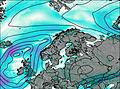
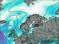
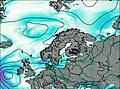
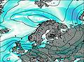
This table gives the weather forecast for Tronfjell at the specific elevation of 1666 m. Our advanced weather models allow us to provide distinct weather forecasts for several elevations of Tronfjell. To see the weather forecasts for the other elevations, use the tab navigation above the table. For a wider overview of the weather, consult the Weather Map of Norway.